Category:Upton, Linkinhorne
village in United Kingdom  | |||||
| Upload media | |||||
| Instance of | |||||
|---|---|---|---|---|---|
| Location | Linkinhorne, Cornwall, South West England, England | ||||
| Elevation above sea level |
| ||||
 | |||||
English: Upton is a hamlet in east Cornwall, England, UK. It is situated at north of Upton Cross 5 miles (8 kilometres) north-west of Callington.
Subcategories
This category has the following 4 subcategories, out of 4 total.
C
- The Caradon Inn, Upton (2 F)
P
Media in category "Upton, Linkinhorne"
The following 75 files are in this category, out of 75 total.
-
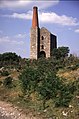
 Bellingham's Shaft Engine House - geograph.org.uk - 629295.jpg 640 × 425; 87 KB
-
 Bowdanoddon Wood-Hawk's Wood - geograph.org.uk - 715852.jpg 640 × 480; 154 KB
-
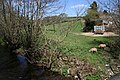
 Bridge over Lynher Tributary - geograph.org.uk - 532347.jpg 640 × 480; 201 KB
-
 Entrance to Upton Cross - geograph.org.uk - 3403808.jpg 640 × 455; 103 KB
-
 Flowering Bushes in Upton Cross - geograph.org.uk - 4533699.jpg 1,600 × 1,149; 354 KB
-

-
 Houseman's Shaft, South Phoenix Mine - geograph.org.uk - 628097.jpg 441 × 640; 97 KB
-
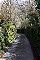
 Lane to Upton Cross - geograph.org.uk - 690137.jpg 640 × 420; 58 KB
-
 Linkinhorne, the Lynher at Rilla Mill - geograph.org.uk - 49058.jpg 640 × 435; 186 KB
-
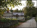
 Little Upton in the hamlet of Upton - geograph.org.uk - 2899731.jpg 3,040 × 2,288; 2.84 MB
-
 Lynher Dairy the home of Cornish Yarg - geograph.org.uk - 38651.jpg 640 × 427; 98 KB
-
 Lynher tributary - looking downstream - geograph.org.uk - 532350.jpg 480 × 640; 201 KB
-
 Old and later roads, Upton Cross - geograph.org.uk - 4447184.jpg 1,920 × 1,395; 751 KB
-
 Old road, Upton Cross - geograph.org.uk - 4447505.jpg 1,920 × 1,440; 1.1 MB
-
 On the Gonamena Incline - geograph.org.uk - 549718.jpg 640 × 427; 121 KB
-
 Prince of Wales Shaft engine house - geograph.org.uk - 629281.jpg 424 × 640; 95 KB
-

-
 Sheep at Owl's Roost - geograph.org.uk - 589042.jpg 640 × 372; 68 KB
-
 Side of Caradon Hill - geograph.org.uk - 222271.jpg 640 × 480; 66 KB
-

-
 Sunday School, Upton Cross - geograph.org.uk - 4447720.jpg 1,920 × 1,376; 655 KB
-
 Terrace of houses at Upton Cross - geograph.org.uk - 3381092.jpg 1,024 × 768; 137 KB
-
 The northern slope of Caradon Hill - geograph.org.uk - 547059.jpg 640 × 427; 95 KB
-
 The River Lynher by Plushabridge - geograph.org.uk - 410666.jpg 640 × 426; 168 KB
-
 Upton Cross - geograph.org.uk - 4447560.jpg 1,920 × 1,018; 337 KB
-
 Upton Cross Primary School - geograph.org.uk - 3698795.jpg 640 × 480; 53 KB
-
 Upton Cross, Cornwall - geograph.org.uk - 4102261.jpg 1,600 × 953; 244 KB
-
 A Horizontal Fence - geograph.org.uk - 524639.jpg 640 × 427; 126 KB
-
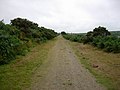
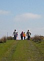 A walk on the moor - geograph.org.uk - 1511067.jpg 463 × 640; 61 KB
-
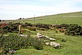
 Access to the access land - geograph.org.uk - 1083756.jpg 640 × 480; 200 KB
-
 Caradon Town sentinel - geograph.org.uk - 466264.jpg 640 × 427; 150 KB
-
 Converted Methodist Chapel in Minions - geograph.org.uk - 525582.jpg 640 × 427; 87 KB
-
 Cream Teas at Minions - geograph.org.uk - 522314.jpg 640 × 427; 97 KB
-
 Damaged Hedge - geograph.org.uk - 376381.jpg 640 × 427; 121 KB
-
 Disused Cottages near Minions - geograph.org.uk - 549749.jpg 640 × 427; 101 KB
-
 Farm Buildings near Gonamena - geograph.org.uk - 549733.jpg 640 × 427; 107 KB
-
 Footpath, Road, Pasture, Woodland - geograph.org.uk - 375676.jpg 640 × 427; 100 KB
-
 Forestry Tractor in Caradon Wood - geograph.org.uk - 404976.jpg 640 × 427; 153 KB
-
 Gateposts, Trebartha - geograph.org.uk - 589170.jpg 640 × 480; 147 KB
-
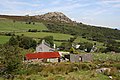
 Hillside Grazing by Wardbrook Farm - geograph.org.uk - 524347.jpg 640 × 427; 105 KB
-
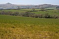
 Hilltop pasture north of Caradon Town - geograph.org.uk - 377022.jpg 640 × 427; 106 KB
-
 Holman's Shaft Pumping Engine House - geograph.org.uk - 549374.jpg 427 × 640; 110 KB
-

-
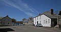
 Houses along the road - geograph.org.uk - 410604.jpg 640 × 427; 131 KB
-
 Kitto's Shaft, South Caradon Mine - geograph.org.uk - 548780.jpg 640 × 427; 109 KB
-
 Lane from Rilla Mill to North Darley - geograph.org.uk - 532340.jpg 640 × 480; 200 KB
-
 Lane to Bathpool - geograph.org.uk - 530658.jpg 640 × 477; 199 KB
-
 Ley Mill - geograph.org.uk - 376996.jpg 640 × 427; 115 KB
-
 Little Upton - geograph.org.uk - 375718.jpg 640 × 427; 99 KB
-
 Looking out from Plushabridge - geograph.org.uk - 410612.jpg 640 × 427; 137 KB
-
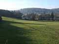
 Looking over the Lynher Valley - geograph.org.uk - 410683.jpg 640 × 427; 121 KB
-
 Lynher valley at Trebartha - geograph.org.uk - 638506.jpg 640 × 480; 68 KB
-
 Mining Waste near Kitto's Shaft - geograph.org.uk - 549159.jpg 640 × 427; 106 KB
-
 Minions Heritage Centre - geograph.org.uk - 525574.jpg 427 × 640; 87 KB
-
 Narrow Lane to Ley Mill - geograph.org.uk - 376979.jpg 427 × 640; 144 KB
-
 Near Plushabridge - geograph.org.uk - 404968.jpg 640 × 427; 118 KB
-
 Near Trebartha - geograph.org.uk - 589028.jpg 640 × 483; 139 KB
-
 North Darley , Lane to Rilla Mill - geograph.org.uk - 531559.jpg 640 × 425; 192 KB
-
 Old railway line - geograph.org.uk - 222274.jpg 640 × 480; 47 KB
-
 Pasture Fields - geograph.org.uk - 376966.jpg 640 × 427; 102 KB
-
 Pearce's Shaft Pumping Engine House - geograph.org.uk - 549540.jpg 640 × 427; 72 KB
-
 Ploughed field at Trefursdon - geograph.org.uk - 589051.jpg 640 × 480; 116 KB
-
 Ruined Farmstead - geograph.org.uk - 396364.jpg 640 × 480; 113 KB
-
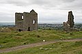 Rule's and Holman's Engine Houses - geograph.org.uk - 549356.jpg 640 × 426; 79 KB
-
 Rule's Shaft Winding Engine House - geograph.org.uk - 549363.jpg 640 × 427; 98 KB
-
 Sharptor - geograph.org.uk - 524431.jpg 640 × 427; 100 KB
-
 Sump Shaft Pumping Engine House - geograph.org.uk - 549551.jpg 640 × 427; 84 KB
-
 Taylor's Wood - geograph.org.uk - 376389.jpg 640 × 427; 106 KB
-
 The Seaton Valley below Gonamena - geograph.org.uk - 547050.jpg 640 × 427; 90 KB
-
-
 Tin mining - geograph.org.uk - 396332.jpg 640 × 480; 82 KB
-
 Upton Cross - geograph.org.uk - 376892.jpg 640 × 425; 85 KB
-
 Upton Cross School - geograph.org.uk - 375707.jpg 640 × 426; 76 KB
-
 Vegetation fenced and open - geograph.org.uk - 396306.jpg 480 × 640; 68 KB
-
 Wall at Witheybrook Marsh - geograph.org.uk - 396340.jpg 480 × 640; 76 KB


