Category:Urbanisation maps of Creil (Oise)
Media in category "Urbanisation maps of Creil (Oise)"
The following 4 files are in this category, out of 4 total.
-
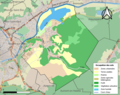
 60175-Creil-Sols.png 3,270 × 2,598; 4.48 MB
-
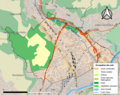
 60414-Montataire-Sols.png 3,270 × 2,598; 3.34 MB
-
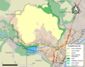
 60463-Nogent-sur-Oise-Sols.png 3,270 × 2,598; 4.73 MB
-
 60670-Verneuil-en-Halatte-Sols.png 3,270 × 2,598; 3.32 MB


