Category:Ursulinenkloster Fritzlar
| Object location | | View all coordinates using: OpenStreetMap |
|---|
 | |||||
| Upload media | |||||
| Instance of | |||||
|---|---|---|---|---|---|
| Location | Fritzlar, Schwalm-Eder-Kreis, Kassel Government Region, Hesse, Germany | ||||
 | |||||
Media in category "Ursulinenkloster Fritzlar"
The following 9 files are in this category, out of 9 total.
-
 Fritzlar Katharinenkirche Ursulinen.jpg 4,608 × 3,456; 2.96 MB
-
 Fritzlar Katharinenkirche von Südost.jpg 4,608 × 3,456; 2.91 MB
-
 Fritzlar Katharinenkirche.jpg 4,608 × 3,456; 3.15 MB
-
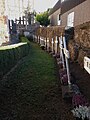 Fritzlar Ursulinengräber.jpg 3,456 × 4,608; 3.46 MB
-
 Fritzlar Ursulinenkloster.jpg 4,608 × 3,456; 2.97 MB
-
 Fritzlar, Blick zum ehemaligen Ursulinenkloster.jpg 2,551 × 1,647; 934 KB
-
 Fritzlar, ehem. Ursulinenkloster.JPG 4,608 × 3,456; 2.95 MB
-
 Fritzlar, Ursulinen Klosterkirche.jpg 1,760 × 2,000; 697 KB
-
 Fritzlar, Ursulinenkloster.JPG 4,608 × 3,456; 2.92 MB


