Category:Utah County, Utah
Counties of Utah: Beaver · Box Elder · Cache · Carbon · Daggett · Davis · Duchesne · Emery · Garfield · Grand · Iron · Juab · Kane · Millard · Morgan · Piute · Rich · Salt Lake · San Juan · Sanpete · Sevier · Summit · Tooele · Uintah · Utah · Wasatch · Washington · Wayne · Weber
county in north-central Utah, United States _at_Historic_Utah_County_Courthouse,_Jul_15.jpg)  | |||||
| Upload media | |||||
| Instance of | |||||
|---|---|---|---|---|---|
| Named after | |||||
| Location | Utah | ||||
| Capital | |||||
| Inception |
| ||||
| Highest point | |||||
| Population |
| ||||
| Area |
| ||||
| official website | |||||
 | |||||
English: Media related to Utah County, Utah, a county along the Wasatch Front in northern Utah, United States.
Subcategories
This category has the following 19 subcategories, out of 19 total.
Media in category "Utah County, Utah"
The following 73 files are in this category, out of 73 total.
-
 Flag of Utah County, Utah.svg 512 × 307; 10 KB
-

-

-

-
-
-

-
 4700 TB Lava Tubes.jpg 2,448 × 3,264; 1.23 MB
-
 Bombus appositus 19389525.jpg 2,048 × 1,520; 937 KB
-
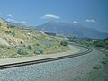
 DRGW 5771 July 1974 East at GillulyRPx (8476946110).jpg 1,011 × 656; 760 KB
-
 East on N 2100 W in Utah County, Utah, Oct 16.jpg 2,592 × 1,944; 2.34 MB
-
 East on SR-164 in Utah County, Utah, Jun 16.jpg 2,592 × 1,944; 2.32 MB
-
 Exotic Flocked Tree - panoramio.jpg 3,264 × 2,448; 1.97 MB
-
 Fire hydrant in Spanish Fork Canyon, Mar 17.jpg 2,592 × 1,944; 2.19 MB
-
 Given Family Massacre historical marker, Mar 17.jpg 2,592 × 1,944; 2.17 MB
-
 Grand Row of Fog-Flocked Trees - panoramio.jpg 3,264 × 2,448; 2.31 MB
-
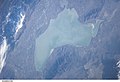 ISS006-E-7263 - View of Utah.jpg 3,032 × 2,064; 898 KB
-
 Leaving Jordan Narrows on southbound FrontRunner, Jul 16.jpg 2,592 × 1,944; 2.35 MB
-
 Logo of KHQN-AM.png 221 × 101; 22 KB
-
 Moses Mountain dyeclan.com - panoramio.jpg 3,664 × 2,748; 2.37 MB
-
 Mountain meadow near Pumphouse Hill, July 16.jpg 2,592 × 1,944; 2.4 MB
-
 Māori Woman at Utah Lake.jpg 3,168 × 4,752; 439 KB
-
 NO sign on Dividend Fork Road, May 16.jpg 2,592 × 1,944; 2.36 MB
-
 North & down from Right Fork Hobble Creek Rd, Jul 16.jpg 2,592 × 1,944; 2.13 MB
-
 North (close) at SR-68 & SR-194 in Utah County, Utah, Oct 16.jpg 2,592 × 1,944; 2.29 MB
-
 North across Spanish Fork River Bottoms, Jul 15.jpg 2,816 × 2,112; 2.4 MB
-
 North at SR-68 & SR-194 in Utah County, Utah, Oct 16.jpg 2,592 × 1,944; 2.35 MB
-
 North on SR-96 at Utah County line, Dec 16.jpg 2,592 × 1,944; 2.35 MB
-
 North on US-6 in at Utah-Carbon county line, Dec 16.jpg 2,592 × 1,944; 2.4 MB
-
 North-northwest across Spanish Fork River Bottoms, Jul 15.jpg 2,816 × 2,112; 2.32 MB
-
 North-nortwest along UP tracks at S 2400 East in Utah County, Utah, May 16.jpg 2,592 × 1,944; 2.45 MB
-
 Northeast at US-6 & Dividend Rd west junction, May 16.jpg 2,592 × 1,944; 2.4 MB
-
 Northeast on Tintic Branch Line from Bamburger Rd, Utah County, Utah, Jun 16.jpg 2,592 × 1,944; 2.32 MB
-
 Northwest across hay field in Spanish Fork River Bottoms, Jul 15.jpg 2,816 × 2,112; 2.83 MB
-
 Northwest across Spanish Fork River Bottoms, Jul 15.jpg 2,816 × 2,112; 2.5 MB
-
 Northwest on US-6 on westbound at Utah-Wasatch Utah county line, Dec 16.jpg 2,592 × 1,944; 2.29 MB
-
 NRCSUT97004 - Utah (6483)(NRCS Photo Gallery).jpg 2,100 × 1,500; 6.18 MB
-
 NRCSUT97004 - Utah (6483)(NRCS Photo Gallery).tif 2,100 × 1,500; 10.33 MB
-
 NRCSUT97005 - Utah (6485)(NRCS Photo Gallery).jpg 2,100 × 1,500; 5.18 MB
-
 NRCSUT97005 - Utah (6485)(NRCS Photo Gallery).tif 2,100 × 1,500; 9.09 MB
-
 NRCSUT97007 - Utah (6489)(NRCS Photo Gallery).jpg 2,100 × 1,500; 5.15 MB
-
 NRCSUT97007 - Utah (6489)(NRCS Photo Gallery).tif 2,100 × 1,500; 9.08 MB
-
 NRCSUT97016 - Utah (6507)(NRCS Photo Gallery).jpg 2,100 × 1,500; 5.97 MB
-
 NRCSUT97016 - Utah (6507)(NRCS Photo Gallery).tif 2,100 × 1,500; 10.31 MB
-
 NRCSUT97023 - Utah (6521)(NRCS Photo Gallery).jpg 2,100 × 1,500; 5.47 MB
-
 NRCSUT97023 - Utah (6521)(NRCS Photo Gallery).tif 2,100 × 1,500; 9.54 MB
-
 Old silo along Spanish Fork River Trail, Jul 15.jpg 2,816 × 2,112; 2.57 MB
-
 Open Field Near Provo River - 1 - panoramio.jpg 3,264 × 2,448; 2.09 MB
-
 Radio Unica 1480 AM.jpg 378 × 263; 14 KB
-
 Reflections of the Spanish Fork, Jul 15.jpg 2,816 × 2,112; 2.7 MB
-
 Scipio Africanus Kenner.jpg 1,290 × 1,284; 955 KB
-
 Scofield State Park from SR-96, Dec 16.jpg 2,592 × 1,944; 2.31 MB
-
 Side road on Forest Rd 058, Utah County, Utah, Jul 16.jpg 2,592 × 1,944; 2.37 MB
-
 South at SR-68 & SR-194 in Utah County, Utah, Oct 16.jpg 2,592 × 1,944; 2.34 MB
-
 South on SR-96 at Carbon County line, Dec 16.jpg 2,592 × 1,944; 2.35 MB
-
 South on US-6 in at Utah-Carbon county line, Dec 16.jpg 2,592 × 1,944; 2.33 MB
-
 South-southeast along UP tracks at S 2400 East in Utah County, Utah, May 16.jpg 2,592 × 1,944; 2.4 MB
-
 Southeast on eastbound US-6 at Wasatch-Utah county line, Dec 16.jpg 2,592 × 1,944; 2.32 MB
-
 Southwest at Spanish Fork River Trail from the trail, Jul 15.jpg 2,816 × 2,112; 2.61 MB
-
 Spanish Fork river from Spanish Fork River Trail 1, Jul 15.jpg 2,816 × 2,112; 2.56 MB
-
 Spanish Fork river from Spanish Fork River Trail 2, Jul 15.jpg 2,816 × 2,112; 2.7 MB
-
 Spanish Fork river from Spanish Fork River Trail 3, Jul 15.jpg 2,816 × 2,112; 2.64 MB
-
 Sunset along Right Fork Hobble Creek Rd, Jul 16.jpg 2,592 × 1,944; 2.25 MB
-
 USA Utah County, Utah age pyramid.svg 520 × 600; 8 KB
-
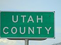 Utah County, Utah sign on US-6 at Eureka city limit, May 16.jpg 2,592 × 1,944; 2.26 MB
-
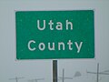 Utah County, Utah sign on US-6 east of Soldier Summit, Dec 16.jpg 2,592 × 1,944; 2.68 MB
-
 Utah Lake, United States (Unsplash).jpg 4,688 × 3,125; 5.52 MB
-
 Utah Valley seen from Traverse Ridge.jpg 1,280 × 960; 211 KB
-
 View from Forest Rd 058, Utah County, Utah, Jul 16.jpg 2,592 × 1,944; 2.37 MB
-
 West across hay field in Spanish Fork River Bottoms, Jul 15.jpg 2,816 × 2,112; 2.63 MB
-
 West along SR-164 at I-15 & SR-164 interchange in Utah County, Utah, Jun 16.jpg 2,592 × 1,944; 2.39 MB
-
 West on N 2100 W in Utah County, Utah, Oct 16.jpg 2,592 × 1,944; 2.3 MB
-
 Winter Scene - panoramio - planetary nebula.jpg 3,264 × 2,448; 1.72 MB


.jpg)


_at_SR-68_%26_SR-194_in_Utah_County,_Utah,_Oct_16.jpg)


(NRCS_Photo_Gallery).jpg)
(NRCS_Photo_Gallery).jpg)
(NRCS_Photo_Gallery).jpg)
(NRCS_Photo_Gallery).jpg)
(NRCS_Photo_Gallery).jpg)


.jpg)


