Category:Vöhl
municipality in Landkreis Waldeck-Frankenberg in Hesse, Germany     | |||||
| Upload media | |||||
| Instance of |
| ||||
|---|---|---|---|---|---|
| Location | Waldeck-Frankenberg, Kassel Government Region, Hesse, Germany | ||||
| Population |
| ||||
| Area |
| ||||
| Elevation above sea level |
| ||||
| official website | |||||
 | |||||
Subcategories
This category has the following 11 subcategories, out of 11 total.
Media in category "Vöhl"
The following 31 files are in this category, out of 31 total.
-
 Aseler Gedenkstein im Winter - Asel memorial in winter - panoramio.jpg 3,888 × 2,592; 2.35 MB
-
 Beech trees in the sunrise - Buchen im Sonnenlicht. - panoramio.jpg 800 × 1,200; 197 KB
-
 Buchenberg-Friedhof-2022.jpg 6,240 × 4,160; 6.28 MB
-
 Cycle path along the Edersee - panoramio.jpg 2,560 × 1,920; 1.27 MB
-
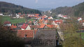 Dorfitter dorfansicht.jpg 4,000 × 2,248; 1.18 MB
-
 Edertal bei Vollmond - Eder valley at full moon´s light - panoramio.jpg 3,888 × 2,592; 1.27 MB
-
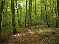
 Im Mombecktal - In the Mombeck valley - panoramio.jpg 3,264 × 2,448; 3.73 MB
-
 Inoperative Railtrack near Herzhausen - panoramio.jpg 1,529 × 1,020; 562 KB
-
 Kellerwald - Fungi - 001.jpg 3,888 × 2,592; 4.03 MB
-
 Kellerwald - Fungi - 005.jpg 3,888 × 2,592; 4.12 MB
-
 Kellerwald - Gustav-Herbold-Quelle (001).JPG 5,184 × 3,456; 9.78 MB
-
 Kellerwald 001.jpg 1,944 × 2,592; 3.15 MB
-
 Kellerwald 002.jpg 2,592 × 1,944; 2.89 MB
-
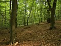 Kellerwald 003.jpg 2,592 × 1,944; 2.84 MB
-
 Kellerwald 010.jpg 2,592 × 1,944; 3.09 MB
-
 Kurve - panoramio.jpg 2,592 × 1,944; 2.08 MB
-
 Mohn - panoramio - Helfmann.jpg 2,592 × 1,944; 3.36 MB
-
 Mückenburg Burghügel Abschnittsgraben.jpg 1,312 × 751; 1.26 MB
-

-
 Radweg Aseler Straße K 31 Vöhl Asel.JPG 3,264 × 2,448; 3.33 MB
-
 Radweg Dalwigker Holz K 25 K 29.JPG 3,264 × 2,448; 2.42 MB
-
 Radweg Edersee Asel-Süd Bringhausen.JPG 3,264 × 2,448; 1.89 MB
-
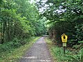 Radweg Nationalpark Kellerwald-Edersee Asel-Süd Bringhausen.JPG 3,264 × 2,448; 3.94 MB
-
 Radweg Obernburger Straße K 25 K 29 Marienhagen.JPG 3,264 × 2,448; 2.1 MB
-
 Shadowed meadow in the afternoon - Beschattete Wiese am Nachmittag - panoramio.jpg 3,888 × 2,592; 5.85 MB
-
 Steuerburg-ausschnitt günther.png 350 × 310; 201 KB
-
 Sunset over flooded cycle track besides Schmittlotheim - panoramio.jpg 1,306 × 979; 317 KB
-
 Unused railway - Stillgelegte Gleise - panoramio.jpg 2,592 × 3,888; 2.01 MB
-
 Weg am Fahrentriesch im Nationalpark Kellerwald - panoramio.jpg 3,264 × 2,448; 4.33 MB
-
 Weisenstein bei obernburg Grundriss.png 1,459 × 1,061; 1.56 MB
-
 White framed Eder river 2005 - Weiss umrandete Eder 2005 - panoramio.jpg 3,888 × 2,592; 1.95 MB


.JPG)


