Category:Valleys of Lincolnshire
Wikimedia category | |||||
| Upload media | |||||
| Instance of | |||||
|---|---|---|---|---|---|
| |||||
Media in category "Valleys of Lincolnshire"
The following 37 files are in this category, out of 37 total.
-
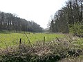 An opening - geograph.org.uk - 390074.jpg 640 × 480; 118 KB
-
 Farmland near Swayfield - geograph.org.uk - 629030.jpg 640 × 427; 82 KB
-
 Hubbard's Hills - geograph.org.uk - 1317174.jpg 640 × 427; 444 KB
-
 Hubbards Hills, Louth (1) - geograph.org.uk - 417155.jpg 640 × 480; 152 KB
-
 Hubbards Hills, Louth (3) - geograph.org.uk - 417178.jpg 640 × 466; 97 KB
-
 Hubbards Hills, Louth (5) - geograph.org.uk - 417216.jpg 640 × 480; 142 KB
-
 Hubbards Hills, Louth - geograph.org.uk - 417008.jpg 640 × 480; 164 KB
-
 Laughton Manor Farm - geograph.org.uk - 277948.jpg 640 × 480; 79 KB
-
 Narrow valley - geograph.org.uk - 430504.jpg 640 × 480; 107 KB
-
 River Welland from Uffington Bridge - geograph.org.uk - 608129.jpg 640 × 480; 99 KB
-
 Sow Dale, Old Bolingbroke - geograph.org.uk - 583805.jpg 640 × 480; 131 KB
-
 Stoke Rochford view - geograph.org.uk - 164852.jpg 640 × 427; 81 KB
-
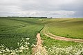 Bridleway to Thoresway - geograph.org.uk - 452375.jpg 640 × 427; 72 KB
-
 Thoresway - geograph.org.uk - 451331.jpg 640 × 427; 68 KB
-
 Upper Bain Valley - geograph.org.uk - 44359.jpg 640 × 480; 94 KB
-
 Valley of the West Glen River - geograph.org.uk - 289556.jpg 640 × 480; 76 KB
-
 Vanishing Point - geograph.org.uk - 753133.jpg 640 × 480; 61 KB
-
 Westward valley view - geograph.org.uk - 461564.jpg 640 × 480; 98 KB
-
 Whiting Mill Bottom - geograph.org.uk - 302949.jpg 640 × 480; 119 KB
-
 Winter play at Hubbard's Hills, Louth - geograph.org.uk - 70634.jpg 640 × 425; 113 KB
-
 Wolds Bridleway - geograph.org.uk - 368862.jpg 640 × 558; 171 KB
-
 Across the valley - geograph.org.uk - 723649.jpg 640 × 359; 67 KB
-
 Between the Pylons - geograph.org.uk - 432418.jpg 640 × 477; 65 KB
-
 Climbing out of the valley - geograph.org.uk - 430509.jpg 640 × 480; 107 KB
-
 Oxcombe Valley - geograph.org.uk - 244354.jpg 640 × 427; 96 KB
-
 Ravendale - geograph.org.uk - 171348.jpg 640 × 427; 125 KB
-
 Ravendale - geograph.org.uk - 171516.jpg 640 × 427; 98 KB
-

-

-
 River Welland from the A15 bridge - geograph.org.uk - 623631.jpg 640 × 480; 60 KB
-
 River Witham - geograph.org.uk - 457319.jpg 640 × 480; 82 KB
-
 Sow Dale, Old Bolingbroke - geograph.org.uk - 107159.jpg 640 × 480; 136 KB
-
 Sow Dale, Old Bolingbroke - geograph.org.uk - 583801.jpg 640 × 480; 122 KB
-
 Sow Dale, Old Bolingbroke - geograph.org.uk - 583808.jpg 640 × 480; 147 KB
-
 Sow Dale, Old Bolingbroke - geograph.org.uk - 583811.jpg 640 × 480; 110 KB
-
 Valley to the north of Fulletby village - geograph.org.uk - 44684.jpg 640 × 480; 106 KB
-
 View to Gunby Dale - geograph.org.uk - 423765.jpg 640 × 480; 82 KB


_-_geograph.org.uk_-_417155.jpg)
_-_geograph.org.uk_-_417178.jpg)
_-_geograph.org.uk_-_417216.jpg)


