Category:Vechtoever, Maarssen
| Object location | | View all coordinates using: OpenStreetMap |
|---|
 | |||||
| Upload media | |||||
| Instance of |
| ||||
|---|---|---|---|---|---|
| Location | Maarssen, Utrecht, Netherlands | ||||
| Has part(s) | |||||
| Heritage designation |
| ||||
 | |||||
Nederlands: Vechtoever (ook wel Vegt-oever) is een buitenplaats langs de rivier de Vecht in het Nederlandse dorp Maarssen.
|
This is a category about rijksmonumentcomplex number 508165
|
Landhuis
|
This is a category about rijksmonument number 508164
|
Historische aanleg
|
This is a category about rijksmonument number 508166
|
Vier borstbeelden
|
This is a category about rijksmonument number 508168
|
Hekwerk
|
This is a category about rijksmonument number 508169
|
Koetshuis
|
This is a category about rijksmonument number 508170
|
Oranjerie
|
This is a category about rijksmonument number 508171
|
Schuur
|
This is a category about rijksmonument number 508172
|
Koude bak
|
This is a category about rijksmonument number 508173
|
Tuinkoepel
|
This is a category about rijksmonument number 508174
|
Bakstenen dam
|
This is a category about rijksmonument number 508175
|
| Address |
|
Subcategories
This category has the following 4 subcategories, out of 4 total.
H
- Houten brug, Vechtoever (3 F)
O
- Oranjerie, Vechtoever (2 F)
T
- Theekoepel, Vechtoever (9 F)
- Toegangshek, Vechtoever (8 F)
Media in category "Vechtoever, Maarssen"
The following 62 files are in this category, out of 62 total.
-
 Binnenzijde van deur - Maarssen - 20350333 - RCE.jpg 1,200 × 1,197; 309 KB
-
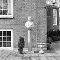
 Borstbeeld (Trojaanse prins Paris) - Maarssen - 20341503 - RCE.jpg 1,200 × 1,200; 374 KB
-
 Borstbeeld (Trojaanse prins Paris) - Maarssen - 20341504 - RCE.jpg 1,197 × 1,200; 417 KB
-
 Borstbeeld - Maarssen - 20341505 - RCE.jpg 1,197 × 1,200; 423 KB
-
 Borstbeeld - Maarssen - 20341507 - RCE.jpg 1,197 × 1,200; 434 KB
-
 Borstbeeld - Maarssen - 20341508 - RCE.jpg 1,200 × 1,200; 447 KB
-
 Buitenplaats Vechtoever langs de Vecht in Maarssen hoofdgebouw frontaal.jpg 3,264 × 2,448; 3.6 MB
-
 Buitenplaats Vechtoever langs de Vecht in Maarssen hoofdgebouw schuin.jpg 3,264 × 2,448; 3.77 MB
-
 Exterieur HUIS, VOORGEVEL - Maarssen - 20276578 - RCE.jpg 1,193 × 1,200; 411 KB
-
 Exterieur KOETSHUIS, VOORGEVEL - Maarssen - 20276577 - RCE.jpg 1,197 × 1,200; 464 KB
-
 Exterieur KOETSHUIS, VOORGEVEL, RECHTER ZIJGEVEL - Maarssen - 20276575 - RCE.jpg 1,192 × 1,200; 395 KB
-
 Gedeelte van balustrade - Maarssen - 20350332 - RCE.jpg 1,200 × 1,197; 295 KB
-
 Huis Vechtoever, reproductie van foto - Maarssen - 20143566 - RCE.jpg 1,200 × 932; 280 KB
-
 Huize Vechtoever, reproductie van oude foto - Maarssen - 20143567 - RCE.jpg 940 × 1,200; 269 KB
-
 Huize Vechtoever, reproductie van oude foto - Maarssen - 20143568 - RCE.jpg 1,200 × 941; 305 KB
-
 Interieur - Maarssen - 20350342 - RCE.jpg 1,190 × 1,200; 165 KB
-
 Interieur - Maarssen - 20350343 - RCE.jpg 1,200 × 1,200; 225 KB
-
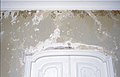
 INTERIEUR, GANG, BESCHILDERING BOVEN DEUR - Maarssen - 20276582 - RCE.jpg 1,200 × 1,199; 186 KB
-
 INTERIEUR, GANG, BESCHILDERING, DETAIL - Maarssen - 20276580 - RCE.jpg 1,183 × 1,200; 180 KB
-
 INTERIEUR, GANG, BESCHILDERING, DETAIL - Maarssen - 20276581 - RCE.jpg 1,200 × 1,191; 236 KB
-
 INTERIEUR, MUURSCHILDERING, DETAIL - Maarssen - 20263549 - RCE.jpg 1,200 × 775; 136 KB
-
 INTERIEUR, MUURSCHILDERING, DETAIL - Maarssen - 20263552 - RCE.jpg 1,200 × 775; 128 KB
-
 INTERIEUR, MUURSCHILDERING, DETAIL - Maarssen - 20263554 - RCE.jpg 1,200 × 775; 150 KB
-
 INTERIEUR, MUURSCHILDERING, DETAIL - Maarssen - 20263555 - RCE.jpg 1,200 × 775; 149 KB
-
 INTERIEUR, MUURSCHILDERING, DETAIL - Maarssen - 20263556 - RCE.jpg 1,200 × 775; 173 KB
-
 INTERIEUR, MUURSCHILDERING, DETAIL - Maarssen - 20263557 - RCE.jpg 1,200 × 775; 184 KB
-
 INTERIEUR, OVERZICHT GANG - Maarssen - 20276583 - RCE.jpg 1,199 × 1,200; 200 KB
-
 INTERIEUR, OVERZICHT MUURSCHILDERINGEN - Maarssen - 20263553 - RCE.jpg 1,200 × 775; 136 KB
-

-
 Interieur, schilderstuk boven deur - Maarssen - 20350348 - RCE.jpg 1,200 × 1,197; 199 KB
-
 Interieur, schilderstuk boven deur - Maarssen - 20350350 - RCE.jpg 1,200 × 1,197; 187 KB
-
 Interieur, stucplafond - Maarssen - 20350344 - RCE.jpg 1,186 × 1,200; 241 KB
-
 Interieur, stucplafond - Maarssen - 20350345 - RCE.jpg 1,188 × 1,200; 187 KB
-
 Interieur, stucplafond - Maarssen - 20350346 - RCE.jpg 1,200 × 1,200; 160 KB
-
 INTERIEUR, TRAPOPGANG, BESCHILDERING - Maarssen - 20276584 - RCE.jpg 1,200 × 1,198; 190 KB
-

-
 Keldervenster - Maarssen - 20350335 - RCE.jpg 1,190 × 1,200; 388 KB
-
 Metselverband - Maarssen - 20350336 - RCE.jpg 1,197 × 1,200; 451 KB
-
 Metselverband, detail - Maarssen - 20350337 - RCE.jpg 1,190 × 1,200; 396 KB
-
 Metselverband, detail - Maarssen - 20350339 - RCE.jpg 1,200 × 1,197; 429 KB
-
 Metselverband, detail - Maarssen - 20350340 - RCE.jpg 1,200 × 1,197; 497 KB
-
 Metselverband, detail - Maarssen - 20350341 - RCE.jpg 1,200 × 1,190; 434 KB
-
 Metselverband, detail - Maarssen - 20358138 - RCE.jpg 1,200 × 1,192; 309 KB
-
 Overzicht ingangshek achter het huis - Maarssen - 20341471 - RCE.jpg 1,200 × 1,190; 524 KB
-
 Overzicht landgoed - Maarssen - 20341444 - RCE.jpg 1,195 × 1,200; 339 KB
-
 Overzicht parkaanleg, zicht vanuit weiland - Maarssen - 20341445 - RCE.jpg 1,200 × 1,136; 262 KB
-
 Overzicht vanaf de Vecht op het huis - Maarssen - 20341462 - RCE.jpg 1,190 × 1,200; 487 KB
-
 Overzicht vijver, op de achtergrond zicht op het huis - Maarssen - 20341468 - RCE.jpg 1,183 × 1,200; 525 KB
-
 Overzicht vijver, op de achtergrond zicht op het huis - Maarssen - 20358140 - RCE.jpg 1,200 × 1,196; 455 KB
-
 Overzicht voorgevel - Maarssen - 20341463 - RCE.jpg 1,188 × 1,200; 476 KB
-
 Parkaanleg met overzicht op waterpartij - Maarssen - 20341448 - RCE.jpg 1,192 × 1,200; 394 KB
-
 Parkaanleg, zicht vanuit park over weiland - Maarssen - 20341446 - RCE.jpg 1,195 × 1,200; 297 KB
-
 Rijksmonument-508164-Vechtoever.jpg 2,592 × 1,936; 1.59 MB
-
 Schoorsteen - Maarssen - 20341576 - RCE.jpg 1,195 × 1,200; 380 KB
-
 Schuur met opslagplaats voor hout - Maarssen - 20341481 - RCE.jpg 1,195 × 1,200; 414 KB
-
 Schuur, gedeelte van dak met makelaar - Maarssen - 20341517 - RCE.jpg 1,200 × 1,200; 233 KB
-
 Stenen brug met onderste gedeelte van toegangshek - Maarssen - 20341489 - RCE.jpg 1,192 × 1,200; 381 KB
-
 Vechtoever, aanzicht - Maarssen - 20143569 - RCE.jpg 1,200 × 804; 280 KB
-
 Vechtoever, aanzicht - Maarssen - 20143570 - RCE.jpg 1,200 × 804; 268 KB
-
 Vechtoever, overzicht bomenlaan 7 - Maarssen - 20143572 - RCE.jpg 1,200 × 1,200; 455 KB
-
 Venster met blinden - Maarssen - 20350334 - RCE.jpg 1,197 × 1,200; 419 KB
-
 Zicht op waterpartij - Maarssen - 20341447 - RCE.jpg 1,195 × 1,200; 472 KB

_-_Maarssen_-_20341503_-_RCE.jpg)
_-_Maarssen_-_20341504_-_RCE.jpg)


