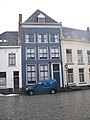
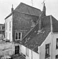
Category:Veerpoortstraat 11, Doesburg
| Object location | | View all coordinates using: OpenStreetMap |
|---|
building in Doesburg, Netherlands  | |||||
| Upload media | |||||
| Instance of | |||||
|---|---|---|---|---|---|
| Location | Doesburg, Gelderland, Netherlands | ||||
| Street address |
| ||||
| Located on street | |||||
| Heritage designation |
| ||||
 | |||||
|
This is a category about rijksmonument number 13065
|
| Address |
|
Media in category "Veerpoortstraat 11, Doesburg"
The following 7 files are in this category, out of 7 total.
-
 Achter en zijgevel - Doesburg - 20058375 - RCE.jpg 1,197 × 1,200; 305 KB
-
 Doesburg, Netherlands - panoramio (29).jpg 2,048 × 1,375; 375 KB
-
 Doesburg, Netherlands - panoramio (70).jpg 4,896 × 3,264; 2.13 MB
-
 Doesburg, Veerpoortstraat 11.jpg 1,536 × 2,048; 790 KB
-
 Linkerzijgevel - Doesburg - 20058374 - RCE.jpg 1,183 × 1,200; 321 KB
-
 Overzicht voorgevels - Doesburg - 20058369 - RCE.jpg 1,200 × 1,195; 324 KB
-
 Voorgevel - Doesburg - 20058373 - RCE.jpg 807 × 1,200; 160 KB

.jpg)
.jpg)


