Category:Veldzicht, Westerlee
| Object location | | View all coordinates using: OpenStreetMap |
|---|
 | |||||
| Upload media | |||||
| Instance of | |||||
|---|---|---|---|---|---|
| Part of | |||||
| Location | Westerlee, Groningen, Netherlands | ||||
| Heritage designation |
| ||||
 | |||||
|
This is a category about rijksmonumentcomplex number 522080
|
Boerderij:
|
This is a category about rijksmonument number 522081
|
Stookhok:
|
This is a category about rijksmonument number 522082
|
Koetshuis:
|
This is a category about rijksmonument number 522083
|
| Address |
|
Media in category "Veldzicht, Westerlee"
The following 171 files are in this category, out of 171 total.
-

-

-

-
-
-

-

-

-

-

-

-

-

-

-

-

-

-
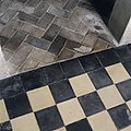
 Interieur, detail van de tegelvloer van de keuken - Westerlee - 20399064 - RCE.jpg 1,200 × 1,200; 585 KB
-

-

-

-
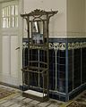
 Interieur, detail van tegelwand in de serre - Westerlee - 20399059 - RCE.jpg 1,200 × 1,200; 277 KB
-

-

-

-
-

-

-
 Interieur, diverse dakpannen - Westerlee - 20399075 - RCE.jpg 1,200 × 960; 158 KB
-

-

-

-

-

-

-

-

-

-

-

-

-

-

-

-
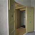
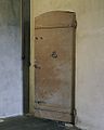
 Interieur, overzicht van de kelderdeur - Westerlee - 20399026 - RCE.jpg 960 × 1,200; 143 KB
-

-
 Interieur, overzicht van de keuken met tegelvloer - Westerlee - 20399062 - RCE.jpg 1,200 × 1,200; 198 KB
-

-

-

-

-

-

-

-

-
 Interieur, overzicht van de paardenstal - Westerlee - 20399024 - RCE.jpg 1,200 × 1,200; 354 KB
-
 Interieur, overzicht van de paardenstal - Westerlee - 20399025 - RCE.jpg 1,200 × 1,200; 235 KB
-

-
-

-

-

-

-

-

-

-

-

-
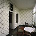 Interieur, overzicht van de serre met tegelwanden - Westerlee - 20399060 - RCE.jpg 1,200 × 1,200; 283 KB
-

-
 Interieur, overzicht van de voordeur van het voorhuis - Westerlee - 20399038 - RCE.jpg 1,200 × 1,200; 277 KB
-

-

-

-

-
-

-

-

-

-

-

-

-

-

-

-

-

-

-

-

-

-

-

-

-
-

-
-
 Interieur, tegellambrisering in de hal van het voorhuis - Westerlee - 20399041 - RCE.jpg 1,200 × 1,200; 253 KB
-

-
-

-

-
-

-

-

-

-

-

-

-

-

-

-

-
-

-

-
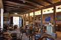
 Overzicht van het koetshuis - Westerlee - 20398992 - RCE.jpg 1,200 × 960; 241 KB
-
 Overzicht van het koetshuis - Westerlee - 20398997 - RCE.jpg 1,200 × 960; 203 KB
-
 Paraplubak en tegellambrisering - Westerlee - 20399034 - RCE.jpg 960 × 1,200; 192 KB
-
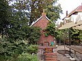
 Rechterzijgevel met de voorzijde van de stookhut - Westerlee - 20398986 - RCE.jpg 1,200 × 1,200; 393 KB
-

-

-

-

-

-
 Veldzicht Westerlee - oude boerderij nu hotel - 1910 - 1.jpg 3,648 × 2,736; 2.76 MB
-
 Veldzicht Westerlee - oude boerderij nu hotel - 1910 - 10.jpg 3,648 × 2,736; 2.23 MB
-
 Veldzicht Westerlee - oude boerderij nu hotel - 1910 - 11.jpg 3,648 × 2,736; 2.38 MB
-
 Veldzicht Westerlee - oude boerderij nu hotel - 1910 - 12.jpg 3,648 × 2,736; 2.21 MB
-
 Veldzicht Westerlee - oude boerderij nu hotel - 1910 - 13.jpg 3,648 × 2,736; 2.35 MB
-
 Veldzicht Westerlee - oude boerderij nu hotel - 1910 - 14.jpg 3,648 × 2,736; 2.06 MB
-
 Veldzicht Westerlee - oude boerderij nu hotel - 1910 - 15.jpg 2,736 × 3,648; 2.14 MB
-
 Veldzicht Westerlee - oude boerderij nu hotel - 1910 - 16.jpg 3,648 × 2,736; 2.41 MB
-
 Veldzicht Westerlee - oude boerderij nu hotel - 1910 - 17.jpg 3,648 × 2,736; 2.22 MB
-
 Veldzicht Westerlee - oude boerderij nu hotel - 1910 - 18.jpg 3,648 × 2,736; 2.1 MB
-
 Veldzicht Westerlee - oude boerderij nu hotel - 1910 - 19.jpg 3,648 × 2,736; 2.38 MB
-
 Veldzicht Westerlee - oude boerderij nu hotel - 1910 - 2.jpg 3,648 × 2,736; 2.19 MB
-
 Veldzicht Westerlee - oude boerderij nu hotel - 1910 - 20.jpg 3,648 × 2,736; 2.56 MB
-
 Veldzicht Westerlee - oude boerderij nu hotel - 1910 - 21.jpg 3,648 × 2,736; 2.36 MB
-
 Veldzicht Westerlee - oude boerderij nu hotel - 1910 - 22.jpg 3,648 × 2,736; 2.15 MB
-
 Veldzicht Westerlee - oude boerderij nu hotel - 1910 - 23.jpg 3,648 × 2,736; 2.08 MB
-
 Veldzicht Westerlee - oude boerderij nu hotel - 1910 - 3.jpg 3,648 × 2,736; 2.23 MB
-
 Veldzicht Westerlee - oude boerderij nu hotel - 1910 - 4.jpg 3,648 × 2,736; 2.5 MB
-
 Veldzicht Westerlee - oude boerderij nu hotel - 1910 - 5.jpg 3,648 × 2,736; 2.22 MB
-
 Veldzicht Westerlee - oude boerderij nu hotel - 1910 - 6.jpg 3,648 × 2,736; 2.36 MB
-
 Veldzicht Westerlee - oude boerderij nu hotel - 1910 - 7.jpg 3,648 × 2,736; 2.38 MB
-
 Veldzicht Westerlee - oude boerderij nu hotel - 1910 - 8.jpg 3,648 × 2,736; 2.21 MB
-
 Veldzicht Westerlee - oude boerderij nu hotel - 1910 - 9.jpg 3,648 × 2,736; 2.31 MB
-
 Veldzicht, koetshuis Westerlee 1.jpg 2,736 × 3,648; 2.32 MB
-
 Veldzicht, koetshuis Westerlee 10.jpg 3,648 × 2,736; 2.24 MB
-
 Veldzicht, koetshuis Westerlee 11.jpg 3,648 × 2,736; 2.43 MB
-
 Veldzicht, koetshuis Westerlee 2.jpg 3,648 × 2,736; 2.43 MB
-
 Veldzicht, koetshuis Westerlee 3.jpg 2,736 × 3,648; 2.35 MB
-
 Veldzicht, koetshuis Westerlee 4.jpg 3,648 × 2,736; 2.29 MB
-
 Veldzicht, koetshuis Westerlee 5.jpg 3,648 × 2,736; 2.35 MB
-
 Veldzicht, koetshuis Westerlee 6.jpg 2,736 × 3,648; 2.2 MB
-
 Veldzicht, koetshuis Westerlee 7.jpg 3,648 × 2,736; 2.23 MB
-
 Veldzicht, koetshuis Westerlee 8.jpg 3,648 × 2,736; 2.13 MB
-
 Veldzicht, koetshuis Westerlee 9.jpg 2,736 × 3,648; 2.19 MB
-
 Veldzicht, stookhut Westerlee - 1.jpg 3,648 × 2,736; 2.24 MB
-
 Veldzicht, stookhut Westerlee - 2.jpg 3,648 × 2,736; 2.14 MB
-
 Veldzicht, stookhut Westerlee - 3.jpg 3,648 × 2,736; 2.39 MB
-
 Veldzicht, stookhut Westerlee - 4.jpg 2,736 × 3,648; 2.35 MB
-
 Voerbak aan de muur - Westerlee - 20534148 - RCE.jpg 1,200 × 799; 155 KB
-

-

-
 Zwarte tegelvloer - Westerlee - 20399028 - RCE.jpg 1,200 × 1,200; 205 KB
-
 Zwarte tegelvloer - Westerlee - 20399031 - RCE.jpg 960 × 1,200; 174 KB
-
 Zwarte tegelvloer naar klinkers - Westerlee - 20399030 - RCE.jpg 1,200 × 1,200; 286 KB


