Category:Veresaevo
| Object location | | View all coordinates using: OpenStreetMap |
|---|
Беларуская: be:Вэрэсаевэ
Qırımtatarca: crh:Quruvlı Kenegez
Հայերեն: hy:Վերեսաևո
Română: ro:Veresaieve (Veresaieve), Sakî
Русский: ru:Вересаево
Українська: uk:Вересаєве
human settlement in Saky Raion, Autonomous Republic of Crimea, Ukraine  | |||||
| Upload media | |||||
| Instance of | |||||
|---|---|---|---|---|---|
| Named after | |||||
| Location |
| ||||
| Inception |
| ||||
| Population |
| ||||
 | |||||
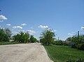
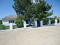
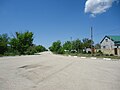
Media in category "Veresaevo"
The following 20 files are in this category, out of 20 total.
-
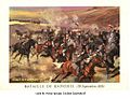 60Neustadt voeux2.jpg 501 × 385; 62 KB
-
 Veresaevo 1.jpg 3,334 × 2,362; 793 KB
-
 Veresaevo 10.jpg 3,648 × 2,736; 3.35 MB
-
 Veresaevo 11.jpg 3,246 × 2,339; 897 KB
-
 Veresaevo 12.jpg 3,356 × 2,280; 740 KB
-
 Veresaevo 13.jpg 3,168 × 2,362; 753 KB
-
 Veresaevo 14.jpg 3,080 × 2,389; 800 KB
-
 Veresaevo 15.jpg 3,648 × 2,736; 3.84 MB
-
 Veresaevo 16.jpg 3,648 × 2,736; 3.96 MB
-
 Veresaevo 17.jpg 3,648 × 2,736; 3.48 MB
-
 Veresaevo 18.jpg 3,648 × 2,736; 3.14 MB
-
 Veresaevo 19.jpg 3,648 × 2,736; 3.59 MB
-
 Veresaevo 2.jpg 3,648 × 2,736; 3.48 MB
-
 Veresaevo 3.jpg 3,648 × 2,736; 3.66 MB
-
 Veresaevo 4.jpg 3,444 × 2,439; 719 KB
-
 Veresaevo 5.jpg 3,648 × 2,736; 3.74 MB
-
 Veresaevo 6.jpg 3,648 × 2,736; 3.42 MB
-
 Veresaevo 7.jpg 3,474 × 2,473; 862 KB
-
 Veresaevo 8.jpg 3,431 × 2,376; 1.07 MB
-
 Veresaevo 9.jpg 3,648 × 2,736; 3.82 MB


