Category:Veturmapoj Esperante
English: Travel maps in Esperanto
Nederlands: Reiskaarten in Esperanto
Media in category "Veturmapoj Esperante"
The following 27 files are in this category, out of 27 total.
-
 1voyageJacquesCartier.jpg 608 × 636; 81 KB
-
 Central Europe Regions (eo).png 2,137 × 1,784; 603 KB
-
 Europe regions minimal cities (eo).png 1,500 × 1,307; 528 KB
-
 Europe regions minimal cities hi.svg 1,500 × 1,307; 1.5 MB
-
 Map of Asia (eo 1).png 974 × 797; 216 KB
-
 Map of Asia (eo 2).png 974 × 797; 221 KB
-
 Map of Asia (eo 3).png 974 × 797; 210 KB
-
 Map of Asia (eo 4).png 974 × 797; 214 KB
-
 Map of Asia (eo 5).png 974 × 797; 212 KB
-
 Map of Asia (eo 6).png 974 × 797; 218 KB
-
 Map of Asia (eo).png 974 × 797; 281 KB
-
 Map of Central America (eo 2).png 848 × 605; 98 KB
-
 Map of Central America (eo).png 848 × 605; 113 KB
-
 Map of North America (eo 2).png 1,000 × 651; 129 KB
-
 Map of North America (eo).png 1,000 × 651; 130 KB
-
 Map of South America (eo).png 493 × 600; 75 KB
-
 Map of the Caribbean (eo).png 1,252 × 881; 186 KB
-
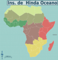
 Map-Africa-Regions (eo 1).png 991 × 1,030; 231 KB
-
 Map-Africa-Regions (eo 2).png 991 × 1,030; 232 KB
-
 Map-Africa-Regions (eo 3).png 991 × 1,030; 237 KB
-
 Map-Africa-Regions (eo 4).png 991 × 1,030; 234 KB
-
 Map-Africa-Regions (eo 5).png 991 × 1,030; 220 KB
-
 Map-Africa-Regions (eo 6).png 991 × 1,030; 226 KB
-
 Map-Africa-Regions (eo 7).png 991 × 1,030; 220 KB
-
 Map-Africa-Regions (eo).png 991 × 1,030; 291 KB
-
 MapoSanktaBriego.jpg 1,000 × 879; 1.28 MB
-
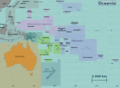 Oceania regions map (eo).png 2,987 × 2,190; 1.25 MB

.png)
.png)

.png)
.png)
.png)
.png)
.png)
.png)
.png)
.png)
.png)
.png)
.png)
.png)
.png)
.png)
.png)
.png)
.png)
.png)
.png)
.png)
.png)

.png)