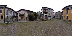
Category:Via dei Monti Lariani
|
Via dei Monti Lariani has an entry on OpenStreetMap (show). |
mountain hiking trail along the western bank of Como Lake | |||||
| Upload media | |||||
| Instance of |
| ||||
|---|---|---|---|---|---|
| Location | Lombardy, Italy | ||||
| Has part(s) | |||||
| Start point |
| ||||
| Destination point |
| ||||
| Length |
| ||||
| Mountain range |
| ||||
 | |||||
Subcategories
This category has the following 7 subcategories, out of 7 total.
A
G
V
Pages in category "Via dei Monti Lariani"
This category contains only the following page.
Media in category "Via dei Monti Lariani"
This category contains only the following file.
-
Information board on VML in Nessa (Stazzona).jpg 1,099 × 1,308; 554 KB


