Category:Views of villages in the United Kingdom
Countries of Europe: Austria · France‡ · Germany · Italy · Slovenia · Switzerland · Ukraine · United Kingdom
Wikimedia category | |||||
| Upload media | |||||
| Instance of | |||||
|---|---|---|---|---|---|
| Category combines topics | |||||
| Category:Villages in the United Kingdom | |||||
Wikimedia category | |||||
| Instance of | |||||
| Category combines topics | |||||
| |||||
Media in category "Views of villages in the United Kingdom"
The following 45 files are in this category, out of 45 total.
-
 A View towards Haworth - geograph.org.uk - 6136294.jpg 5,184 × 3,456; 5.45 MB
-
 Ardersier 2019.jpg 5,184 × 3,456; 6.84 MB
-
 Armitage Bridge, Huddersfield, West Yorkshire.jpg 960 × 540; 128 KB
-
 Booth - geograph.org.uk - 6071474.jpg 5,184 × 3,456; 5.94 MB
-
 Booth Village - geograph.org.uk - 1540244.jpg 640 × 480; 107 KB
-
 Booth, from Stocks Lane (5922513607).jpg 3,696 × 2,464; 5.73 MB
-
 Bradley Lane - geograph.org.uk - 3811161.jpg 2,048 × 1,536; 1 MB
-

-
 Brookfoot from Brookfoot Lane, Southowram - geograph.org.uk - 397993.jpg 640 × 473; 122 KB
-
 Carr Green primary school, Rastrick - geograph.org.uk - 4412585.jpg 1,024 × 768; 231 KB
-
 Chelsfield 2019.jpg 3,586 × 2,513; 3.88 MB
-
 Elland Footpath 38 - geograph.org.uk - 3681517.jpg 2,000 × 1,500; 1.3 MB
-
 Fairburn Village viewed from Fryston Woods - geograph.org.uk - 3305811.jpg 3,144 × 1,971; 1.23 MB
-
 Footpath to the right - geograph.org.uk - 1432313.jpg 640 × 427; 70 KB
-
 Footpath towards Stainland - geograph.org.uk - 2562987.jpg 640 × 480; 156 KB
-
 Hawksworth village - geograph.org.uk - 6019845.jpg 1,024 × 768; 65 KB
-
 Hawksworth village from below - geograph.org.uk - 5731460.jpg 1,024 × 768; 141 KB
-
 Haworth View - geograph.org.uk - 5964325.jpg 800 × 520; 156 KB
-
 Healey , from south side of valley - geograph.org.uk - 1223183.jpg 640 × 480; 76 KB
-
 Kirkthorpe Village - geograph.org.uk - 356329.jpg 640 × 480; 118 KB
-

-
 Linthwaite - geograph.org.uk - 3126960.jpg 1,445 × 686; 466 KB
-
 Linthwaite - geograph.org.uk - 4641524.jpg 640 × 426; 51 KB
-
 Looking down on Luddenden village from New Road - geograph.org.uk - 4045740.jpg 2,000 × 1,471; 1.38 MB
-
-
 Looking towards Luddington - geograph.org.uk - 308890.jpg 640 × 302; 87 KB
-
 Low Bradley - geograph.org.uk - 879882.jpg 640 × 372; 83 KB
-
 Luddenden - geograph.org.uk - 4949801.jpg 5,183 × 2,920; 1.5 MB
-
 Mill Bank - geograph.org.uk - 2914677.jpg 2,000 × 1,500; 870 KB
-
 Millbrook Lake Nov2015.jpg 1,789 × 1,180; 1.29 MB
-
 Oakworth Village - geograph.org.uk - 40342.jpg 640 × 480; 93 KB
-
 On Calderdale Way - view N to Mill Bank near Ripponden - geograph.org.uk - 6006965.jpg 5,184 × 2,920; 5.23 MB
-
 Outlane - a linear village - geograph.org.uk - 33028.jpg 640 × 478; 104 KB
-
 Rowhedge Essex UK - View from River Bank Opposite in Wivenhoe.jpg 3,995 × 1,107; 2.11 MB
-
 Suspension tester - geograph.org.uk - 1055923.jpg 640 × 480; 202 KB
-
-
 View from Old Riding Lane, Luddenden (5937889094).jpg 3,000 × 4,000; 7.04 MB
-
-

-
 View of the fishing village Staithes, Yorkshire, England.jpg 3,642 × 2,428; 5.63 MB
-
 View towards Fagley - geograph.org.uk - 4772455.jpg 1,024 × 768; 190 KB
-
 Wentbridge Village - geograph.org.uk - 1253325.jpg 640 × 287; 56 KB
-
 Wike from Tarn Lane, Scarcroft - geograph.org.uk - 140139.jpg 640 × 480; 76 KB
-
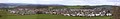 Wilsden Panorama.jpg 2,000 × 315; 125 KB
-
 Yarwell, England.jpg 8,560 × 6,160; 37.63 MB


.jpg)


.jpg)


