Category:Volksschule Unterwart
| Object location | | View all coordinates using: OpenStreetMap |
|---|
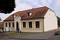
school building in Unterwart, Austria  | |||||
| Upload media | |||||
| Instance of | |||||
|---|---|---|---|---|---|
| Location | Unterwart, Oberwart District, Burgenland, Austria | ||||
| Street address |
| ||||
| Heritage designation | |||||
 | |||||
Media in category "Volksschule Unterwart"
The following 4 files are in this category, out of 4 total.
-
 20210821 WTSB Unterwart 5002.jpg 5,379 × 3,586; 12.68 MB
-
 20210821 WTSB Unterwart 5003.jpg 2,942 × 4,413; 10.46 MB
-
 Unterwart - ehemalige Volksschule.jpg 3,000 × 2,000; 838 KB
-
 Unterwart ehem. Volksschule.jpg 4,000 × 6,000; 14.03 MB


