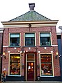
Category:Voorstraat 88, Kollum
| Object location | | View all coordinates using: OpenStreetMap |
|---|
building in Kollumerland en Nieuwkruisland, Netherlands  | |||||
| Upload media | |||||
| Instance of | |||||
|---|---|---|---|---|---|
| Location | Kollum, Noardeast-Fryslân, Friesland, Netherlands | ||||
| Street address |
| ||||
| Located on street |
| ||||
| Heritage designation |
| ||||
 | |||||
|
This is a category about rijksmonument number 23738
|
| Address |
|
Media in category "Voorstraat 88, Kollum"
The following 4 files are in this category, out of 4 total.
-
 Exterieur VOORGEVEL - Kollum - 20292027 - RCE.jpg 773 × 1,200; 206 KB
-
 Kollum - Voorstraat 88.jpg 2,356 × 3,141; 3.05 MB
-
 Voorgevel - Kollum - 20126639 - RCE.jpg 804 × 1,200; 177 KB
-
 Voorstraat 88, Kollum.JPG 3,456 × 4,608; 3.34 MB


