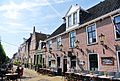
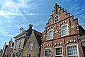
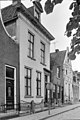
Category:Voorstreek 118 (Sloten, Friesland)
| Object location | | View all coordinates using: OpenStreetMap |
|---|
 | |||||
| Upload media | |||||
| Instance of |
| ||||
|---|---|---|---|---|---|
| Location | Sloten, De Fryske Marren, Friesland, Netherlands | ||||
| Street address |
| ||||
| Located on street | |||||
| Heritage designation |
| ||||
 | |||||
Nederlands: Voorstreek 118, Sloten, Friesland
|
This is a category about rijksmonument number 33878
|
| Address |
|
Media in category "Voorstreek 118 (Sloten, Friesland)"
The following 7 files are in this category, out of 7 total.
-
 8556 Sloten, Netherlands - panoramio (11).jpg 2,048 × 1,375; 738 KB
-
 8556 Sloten, Netherlands - panoramio (17).jpg 2,048 × 1,375; 497 KB
-
 Sloten Friesland imp 079.JPG 3,264 × 2,448; 2.31 MB
-
 Sloten Friesland Voorstreek 118.JPG 2,448 × 3,264; 2.09 MB
-
 Voorgevels - Sloten - 20201218 - RCE.jpg 802 × 1,200; 200 KB
-
 Voorgevels - Sloten - 20201232 - RCE.jpg 802 × 1,200; 208 KB
-
 Voorstreek118 Sloten.jpg 2,736 × 3,648; 803 KB
.jpg)
.jpg)


