<nowiki>Vrijhoeve-Capelle; Vrijhoeve-Capelle; Vrijhoeve-Capelle; Vrijhoeve-Capelle; Vrijhoeve-Capelle; Vrijhoeve-Capelle; Vrijhoeve-Capelle; Vrijhoeve-Capelle; Vrijhoeve-Capelle; Vrijhoeve-Capelle; Vrijhoeve-Capelle; ڤريچهويڤى كاپيلى; Vrijhoeve-Capelle; Hollanda'da belediye; localité de la commune de Waalwijk; Uertschaft an der Gemeng Waalwijk; муніципалітет у Нідерландах; voormalige gemeente en dorp in de Brabantse gemeente Waalwijk, Nederland; fshat në Hollandë; Gemeinde in den Niederlanden; village in Waalwijk, the Netherlands; farm village in the Netherlands; farm village in the Netherlands; قرية في هولندا; conceyu de los Países Baxos</nowiki>


 Vrijhoeve-Capelle wapen HRvA.svg 400 × 449; 141 KB
 Vrijhoeve-Capelle wapen.svg 461 × 521; 114 KB
 1865 VrijhoevenCapelle.png 1,264 × 1,593; 148 KB
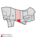 Map - NL - Waalwijk - Wijk 03 Vrijhoeve - Buurt 00 Vrijhoeve.svg 375 × 375; 27 KB
