Category:Wüstheuterode
Part of the municipality of Uder in Germany    | |||||
| Upload media | |||||
| Instance of |
| ||||
|---|---|---|---|---|---|
| Location | Uder, Eichsfeld, Thuringia, Germany | ||||
| Population |
| ||||
| Area |
| ||||
| Elevation above sea level |
| ||||
| official website | |||||
 | |||||
Subcategories
This category has the following 6 subcategories, out of 6 total.
Media in category "Wüstheuterode"
The following 27 files are in this category, out of 27 total.
-
 2.Auflage Karte von Mühlausen u. Umgebung LB.jpg 814 × 948; 455 KB
-

-
 Eiche auf dem Hirtenhöfchen zu Wüstheuterode im Eichsfeld, Thüringen.jpg 3,882 × 1,813; 3.98 MB
-
 Kartenausschnitt FFH-Gebiet Meißner und Meißner Vorland - Iberg.png 599 × 332; 354 KB
-
 Kreis Heiligenstadt 1840 (34).jpg 1,728 × 1,561; 1.81 MB
-
 Kriegerdenkmal zu Wüstheuterode im Eichsfeld.jpg 3,849 × 2,887; 3.59 MB
-
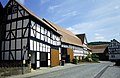
 Ortsansichten in Wüstheuterode (20).jpg 2,551 × 1,986; 1.59 MB
-
 Wappen Wuestheuterode.png 162 × 194; 32 KB
-
 Wegweiser W.JPG 3,240 × 4,320; 4.77 MB
-
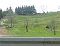
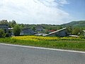
 Wüstheuterode (45).jpg 3,648 × 2,794; 3.19 MB
-
 Wüstheuterode 09.JPG 3,742 × 2,707; 1.4 MB
-
 Wüstheuterode 1996-05-31 01.jpg 4,476 × 2,904; 2.68 MB
-
 Wüstheuterode 1996-05-31 02.jpg 4,410 × 2,892; 2.59 MB
-
 Wüstheuterode 1996-05-31 03.jpg 4,414 × 2,883; 2.94 MB
-
 Wüstheuterode 1996-05-31 05.jpg 4,446 × 2,874; 2.39 MB
-
 Wüstheuterode 1996-05-31 06.jpg 4,452 × 2,910; 2.78 MB
-
 Wüstheuterode 1996-05-31 07.jpg 4,419 × 2,899; 2.76 MB
-
 Wüstheuterode 1996-05-31 08.jpg 4,038 × 2,886; 2.25 MB
-
 Wüstheuterode Dorfansichten (25d).jpg 4,498 × 3,088; 6.18 MB
-
 Wüstheuterode Dorfansichten (26).jpg 4,242 × 3,134; 6.03 MB
-
 Wüstheuterode Dorfansichten (27a).jpg 4,270 × 3,172; 4.47 MB
-
 Wüstheuterode Dorfansichten (27b).jpg 4,320 × 3,240; 4.77 MB
-
 Wüstheuterode Dorfansichten (28).jpg 4,320 × 3,240; 5.09 MB
-
 Wüstheuterode Dorfansichten (30).jpg 4,308 × 3,224; 4.07 MB
-
 Wüstheuterode in EIC.svg 1,149 × 1,140; 578 KB
-
 Wüstheuterode St. Bonifatius 02.jpg 5,376 × 2,336; 2.93 MB
-
 Wüstheuterode St. Bonifatius 03.jpg 3,648 × 2,736; 2.13 MB


.jpg)

.jpg)

.jpg)


.jpg)
.jpg)
.jpg)
.jpg)
.jpg)
.jpg)

