Category:Wagnershöhe bei Gößweinstein
 | |||||
| Upload media | |||||
| Instance of | |||||
|---|---|---|---|---|---|
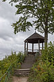
| Location | Gößweinstein, Forchheim, Upper Franconia, Bavaria, Germany | ||||
| Heritage designation | |||||
| Width |
| ||||
| Length |
| ||||
| Area |
| ||||
| Elevation above sea level |
| ||||
| official website | |||||
 | |||||
Deutsch: Die Wagnershöhe bei Gößweinstein ist eine Felswand in Gößweinstein im Landkreis Forchheim in Bayern. Sie ist als Geotop (474R049) und Naturdenkmal (ND-04493) ausgewiesen.
Media in category "Wagnershöhe bei Gößweinstein"
The following 2 files are in this category, out of 2 total.
-
 PavillonWagnershoeheGoessweinstein.jpg 1,437 × 1,290; 2.29 MB
-
 Wagnershöhe 01.jpg 3,456 × 5,184; 4.71 MB
