Category:Waikato District
district in New Zealand's Waikato region   | |||||
| Upload media | |||||
| Instance of | |||||
|---|---|---|---|---|---|
| Location | Waikato, New Zealand | ||||
| Population |
| ||||
| Area |
| ||||
| Different from | |||||
 | |||||
Subcategories
This category has the following 37 subcategories, out of 37 total.
E
- Eureka, New Zealand (4 F)
G
- Glen Massey (8 F)
- Gordonton (5 F)
H
- Hakarimata Range (12 F)
- Horsham Downs (1 F)
J
- Jacqui Church (3 F)
L
- Lichfield, New Zealand (1 F)
M
- Mangatangi (2 F)
- Mangatāwhiri (3 F)
- Maramarua (10 F)
- Mercer, New Zealand (9 F)
N
O
- Onewhero (2 F)
P
- Pakoka River (10 F)
- Port Waikato (7 F)
- Pukekawa (4 F)
R
T
- Tawatahi River (1 F)
- Te Kauwhata (7 F)
- Te Kowhai (2 F)
- Te Mata, Waikato District (19 F)
- Te Rangihaeata (20 F)
- Te Uku (16 F)
W
- Waerenga (17 F)
- Waikaretu (8 F)
- Wairēinga / Bridal Veil Falls (16 F)
Media in category "Waikato District"
The following 53 files are in this category, out of 53 total.
-
 1907 train between Wairangi and Whangamarino.jpg 1,000 × 558; 128 KB
-
 1914 Whangamarino crash.jpg 1,000 × 451; 165 KB
-
 1915 advert for Ngaruawahia-Waingaro Landing-Raglan route.jpg 2,294 × 3,679; 999 KB
-
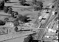
 1940 Ohinewai.jpg 2,122 × 1,351; 889 KB
-
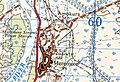
 1942 Whangamarino railway station N52 one inch map.jpg 1,370 × 1,046; 192 KB
-
 1951 RCC map.jpg 1,080 × 1,722; 468 KB
-
 1959 Horotiu railway station.jpg 1,514 × 1,082; 485 KB
-
 1959 Horotiu station.jpg 1,532 × 1,202; 640 KB
-
 1961 Amokura railway station on Sheet N52 one inch map.jpg 910 × 624; 50 KB
-
 1963 Horotiu Bridge.jpg 730 × 403; 83 KB
-
 2005 Horotiu landfill.jpg 1,490 × 945; 607 KB
-
 At The End of a Rainbow is a Shark Gong (15249146959).jpg 3,237 × 2,428; 1.68 MB
-
 Auckland and Waikato GNS 1 to 250,000 sheets.jpg 1,790 × 1,356; 1.02 MB
-
 Bert McIndoe at Wairangi Railway Station, about 1900.jpg 1,632 × 1,108; 823 KB
-
 Chart of Glen Afton railway station ticket sales 1926-1950.jpg 693 × 390; 46 KB
-
 Chart of Mercer railway station passengers 1881-1950.jpg 693 × 390; 51 KB
-
 Extract of Auckland 1 to 250,000 geology map.png 1,256 × 1,546; 4.38 MB
-
 Glen Massey extract from 1925 Geological map of Newcastle survey district.jpg 1,008 × 1,213; 332 KB
-
 Glen Massey geological map.jpg 982 × 991; 598 KB
-
 Glen Murray landing, Opuatia Stream.jpg 1,000 × 728; 138 KB
-
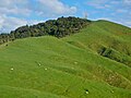 Hapuakohe Track to Maungakawa.jpg 2,560 × 1,920; 1.29 MB
-
 Horotiu bridge 2001.jpg 4,000 × 3,000; 3.57 MB
-
 Horotiu bridge hinge 1921.jpg 3,000 × 4,000; 3.22 MB
-
 Horotiu geological map.jpg 642 × 458; 199 KB
-
 Horotiu works in 1916.jpg 948 × 1,433; 564 KB
-
 ISS019-E-20134 - View of the North Island of New Zealand.jpg 4,256 × 2,832; 1.16 MB
-
 Kerikeri Stream waterfall beside Ruakiwi Rd.JPG 2,048 × 1,536; 2.07 MB
-
 Lake Kimihia.jpg 4,032 × 3,024; 3.1 MB
-
 Mangatawhiri River.jpg 4,032 × 3,024; 6.16 MB
-
 Map of Whangarata railway station in 1920s.jpg 269 × 165; 95 KB
-
 Massed balloons (3419425927).jpg 1,800 × 1,200; 243 KB
-
 Meremere power station.jpg 4,032 × 3,024; 2.57 MB
-
 Migratory Bird Refuge Center - panoramio.jpg 5,184 × 3,456; 3.08 MB
-
 Mount William and Walkway sign.jpg 2,835 × 2,154; 1.65 MB
-
 Mt Karioi from Maungakawa.jpg 4,211 × 1,875; 2.27 MB
-
Nzwars-meremere.ogv 19 s, 720 × 576; 18.63 MB
-
 Path to bird hide - panoramio.jpg 4,288 × 2,848; 1.62 MB
-
 Rangiriri railway station on one inch map.jpg 1,616 × 710; 87 KB
-
 Signpost at the former centre of State Highway 22.jpg 4,000 × 3,000; 3.74 MB
-
 SN1397 Whangarata railway station in 1961.jpg 908 × 789; 538 KB
-
-
 Stalactites and stalagmites in Elgood Limestone cave at Adventure Waikato.jpg 4,000 × 3,000; 3.12 MB
-
 Te Kauwhata railway station passenger use 1923-1950.jpg 1,152 × 710; 96 KB
-
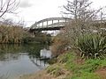
 Te Rehu O Waikato Bridge.jpg 4,000 × 3,000; 2.7 MB
-
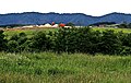
 Waerenga Government Farm, circa 1910s (21662290206).jpg 6,423 × 4,709; 3.61 MB
-
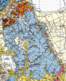
 Waikato DC.PNG 251 × 376; 26 KB
-
 Waikato District Council 2023 0015.jpg 2,207 × 1,471; 1.25 MB
-
 Waikato District Council chamber.jpg 2,793 × 2,117; 981 KB
-
 Waikato District council chamber.jpg 5,945 × 2,673; 2.06 MB
-
 Waikato District Council truck.jpg 3,279 × 3,363; 3.1 MB
-
 Waikato Territorial Authority.png 246 × 352; 5 KB
-
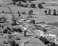
 Waipa Collieries and Township.jpg 926 × 650; 252 KB
-
 Whatawhata from the bus stop.jpg 1,885 × 1,289; 625 KB


.jpg)


.jpg)


.jpg)


