Category:Waldkapelle (Schloßborn)
| Object location | | View all coordinates using: OpenStreetMap |
|---|
This is the category of the Hessian Kulturdenkmal (cultural monument) with the ID 100196 (Wikidata)
|
church building in Schloßborn  | |||||
| Upload media | |||||
| Instance of | |||||
|---|---|---|---|---|---|
| Location | Schloßborn, Glashütten, Hochtaunuskreis, Darmstadt Government Region, Hesse, Germany | ||||
| Heritage designation | |||||
 | |||||
Media in category "Waldkapelle (Schloßborn)"
The following 9 files are in this category, out of 9 total.
-
 Ostkreuz-Butznickel-JR-E-4272-2020-05-21.jpg 3,069 × 4,679; 6.8 MB
-
 Ostkreuz-Butznickel-JR-E-4303-2020-05-21.jpg 813 × 4,762; 1.21 MB
-
 Schlossborn, Waldkapelle (1).JPG 3,264 × 4,928; 8.36 MB
-
 Schlossborn, Waldkapelle, Ostkreuz.JPG 3,264 × 4,928; 7.66 MB
-
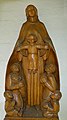 Schlossborn, Waldkapelle, Schutzmantelmadonna.jpg 3,488 × 6,256; 18.95 MB
-
 Schlossborn, Waldkapelle.JPG 3,256 × 4,906; 11.11 MB
-
 Waldkapelle-Butznickel-JR-E-4264-2020-05-21.jpg 4,762 × 3,169; 8.86 MB
-
 Waldkapelle-Butznickel-JR-E-4355-2020-06-01.jpg 4,458 × 3,489; 8.72 MB
-
 Waldkapelle-Butznickel-JR-E-4364-2020-06-01.jpg 4,562 × 3,113; 8.9 MB

.JPG)


