Category:Walgett Shire
Deutsch: Walgett Shire ist ein lokales Verwaltungsgebiet (LGA) im australischen Bundesstaat New South Wales. Das Gebiet ist 22.336 km² groß und hat etwa 7.000 Einwohner. (→Walgett Shire)
English: Walgett Shire is a local government area in the Orana region of New South Wales, Australia. The northern boundary of the Shire is located adjacent to the border between New South Wales and Queensland. The town of Walgett is located at the junction of the Barwon River and the Namoi River, and at the junction of the Kamilaroi Highway and the Castlereagh Highway. (→Walgett Shire)
Français : Le comté de Walgett est une zone d'administration locale dans le nord de la Nouvelle-Galles du Sud en Australie. (→Comté de Walgett)
Italiano: La Contea di Walgett è una Local Government Area che si trova nel Nuovo Galles del Sud. Essa si estende su di una superficie di 22.336 chilometri quadrati ed ha una popolazione di 7.235 abitanti. La sede del consiglio si trova a Walgett. (→Contea di Walgett)
Nederlands: Walgett Shire Council is een Local Government Area (LGA) in de Australische deelstaat Nieuw-Zuid-Wales. (→Walgett Shire Council)
local government area in New South Wales  | |||||
| Upload media | |||||
| Instance of | |||||
|---|---|---|---|---|---|
| Location | New South Wales, AUS | ||||
| Capital | |||||
| Inception |
| ||||
| Population |
| ||||
| Area |
| ||||
| Elevation above sea level |
| ||||
| official website | |||||
 | |||||
Subcategories
This category has the following 8 subcategories, out of 8 total.
Media in category "Walgett Shire"
The following 5 files are in this category, out of 5 total.
-
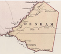 Denham County 1876 map.png 473 × 417; 245 KB
-
 Map of Cowper county in 1876.png 558 × 437; 5 KB
-
 Pilliga Narrabri Shire Walgett Shire Municipal Boundary Sign.JPG 5,632 × 3,740; 8.07 MB
-
 Walgett LGA NSW.png 400 × 337; 33 KB
-
 Walgett Shire Council Offices.jpg 2,592 × 1,944; 2.3 MB


