Category:Wallfahrtskirche Maria Fatima, Droß
| Object location | | View all coordinates using: OpenStreetMap |
|---|
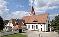
church building in Droß, Austria  Südostansicht der Pfarrkirche in Droß | |||||
| Upload media | |||||
| Instance of | |||||
|---|---|---|---|---|---|
| Location | Droß, Krems District, Lower Austria, Austria | ||||
| Street address |
| ||||
| Heritage designation | |||||
 | |||||
Deutsch: Die Kirche Maria Fatima in Droß
Media in category "Wallfahrtskirche Maria Fatima, Droß"
The following 6 files are in this category, out of 6 total.
-
 Droß - Kirche.JPG 4,441 × 2,795; 9.91 MB
-
 Droß Kirche01.jpg 3,000 × 4,000; 4.03 MB
-
 Droß4.jpg 2,560 × 1,920; 1.71 MB
-
 Wallfahrtskirche Maria Fatima in Droß 01 2015-08.jpg 4,800 × 3,200; 4.78 MB
-
 Wallfahrtskirche Maria Fatima in Droß 02 2015-08.jpg 4,800 × 3,200; 5.35 MB
-
 Wallfahrtskirche Maria Fatima in Droß 03 2015-08.jpg 4,800 × 3,200; 4.84 MB


