Category:Wallington Demesne
civil parish in Northumberland, England  | |||||
| Upload media | |||||
| Instance of | |||||
|---|---|---|---|---|---|
| Location | Northumberland, North East England, England | ||||
 | |||||
Subcategories
This category has the following 8 subcategories, out of 8 total.
C
H
- Hartburn Grange (3 F)
- Highlaws, Northumberland (4 F)
M
- Middleton, Wallington Demesne (32 F)
S
W
- West Grange Hall (1 F)
Media in category "Wallington Demesne"
The following 200 files are in this category, out of 292 total.
(previous page) (next page)-
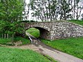
 'The Arches', Wallington - geograph.org.uk - 3417073.jpg 1,824 × 1,368; 435 KB
-
 A Douglas Fir - geograph.org.uk - 3417727.jpg 1,368 × 1,824; 1 MB
-
 A flotilla of duck and ducklings - geograph.org.uk - 5016023.jpg 1,600 × 1,121; 322 KB
-
 A lone Canada Goose on the Garden Pond - geograph.org.uk - 3416335.jpg 1,824 × 1,368; 1,004 KB
-
 A monumental urn - geograph.org.uk - 3417908.jpg 1,368 × 1,824; 984 KB
-
 A potting shed in the dell - geograph.org.uk - 3416972.jpg 1,824 × 1,368; 921 KB
-
 A rill from the outflow of the Garden Pond - geograph.org.uk - 3416976.jpg 1,368 × 1,824; 1.13 MB
-
 A tree with Witch's Broom infestation - geograph.org.uk - 3417900.jpg 1,824 × 1,368; 816 KB
-
 A view along the terrace path from its western end - geograph.org.uk - 3416794.jpg 1,824 × 1,368; 1.12 MB
-
 A696 towards Jedburgh - geograph.org.uk - 4606707.jpg 640 × 480; 89 KB
-
 A696 towards Jedburgh - geograph.org.uk - 4611306.jpg 640 × 480; 74 KB
-
 Abandoned railway line - geograph.org.uk - 3509633.jpg 960 × 1,280; 463 KB
-
 Access to the House Entrance - geograph.org.uk - 3415381.jpg 1,824 × 1,368; 626 KB
-
 Access to Wallington House - geograph.org.uk - 3417861.jpg 1,824 × 1,368; 776 KB
-
 An odd sign approaching a ford^ - geograph.org.uk - 5015982.jpg 1,600 × 1,212; 540 KB
-
 Angerton Lake - geograph.org.uk - 5016309.jpg 1,600 × 1,200; 225 KB
-
 Another bridge on the defunct 'Wannie Line' - geograph.org.uk - 5016032.jpg 1,600 × 1,200; 514 KB
-

-
 Approach to Wallington Bridge - geograph.org.uk - 5245217.jpg 1,280 × 895; 393 KB
-
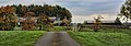
 Approaching Middleton village - geograph.org.uk - 2759363.jpg 640 × 480; 124 KB
-
 Autumn Acers in East Wood, Wallington - geograph.org.uk - 5598078.jpg 1,024 × 769; 410 KB
-
 B6342 heading north - geograph.org.uk - 3187679.jpg 640 × 480; 93 KB
-
 B6342 heading north - geograph.org.uk - 3187689.jpg 640 × 480; 77 KB
-
 B6342 near Cambo - geograph.org.uk - 3509630.jpg 1,280 × 960; 261 KB
-
 B6342 north of Cambo - geograph.org.uk - 2759168.jpg 640 × 480; 75 KB
-
 B6342, Wallington - geograph.org.uk - 4988212.jpg 1,024 × 768; 547 KB
-
 B6343 heading east - geograph.org.uk - 3187730.jpg 640 × 480; 97 KB
-
 B6343 heading east towards Morpeth - geograph.org.uk - 3187734.jpg 640 × 480; 69 KB
-
 Barley, Middleton - geograph.org.uk - 4988265.jpg 1,024 × 768; 297 KB
-
 Beech trees in winter - geograph.org.uk - 2759306.jpg 640 × 480; 127 KB
-
 Blue Bike at Blue door - geograph.org.uk - 5755020.jpg 640 × 480; 155 KB
-
 Blue Door - geograph.org.uk - 3986082.jpg 2,456 × 1,772; 2.87 MB
-
 Boat in Boat Shed - geograph.org.uk - 4501773.jpg 426 × 640; 82 KB
-
 Borders at Wallington - geograph.org.uk - 5060013.jpg 640 × 427; 175 KB
-
 Bridge on Rothbury Railway over Hart Burn - geograph.org.uk - 4024836.jpg 1,024 × 768; 326 KB
-
 Bridge on Wannie Line south of Chesters - geograph.org.uk - 4027944.jpg 1,024 × 768; 400 KB
-
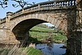
 Bridge over River Wansbeck - geograph.org.uk - 3522261.jpg 1,600 × 1,055; 425 KB
-
 Bridge over the former 'Wannie Line' - geograph.org.uk - 5013683.jpg 1,600 × 1,193; 457 KB
-
 Bridge over the River Wansbeck near Wallington House - geograph.org.uk - 3414152.jpg 1,824 × 1,368; 952 KB
-
 Bridge under trackbed of former railway - geograph.org.uk - 5013260.jpg 1,600 × 1,200; 305 KB
-
 Bridge, Wannie Line - geograph.org.uk - 4988126.jpg 1,024 × 768; 442 KB
-
 Broom House - geograph.org.uk - 5013233.jpg 1,600 × 1,182; 309 KB
-
 Broom House Farm - geograph.org.uk - 2759138.jpg 640 × 480; 106 KB
-
 Broomhouse Farm - geograph.org.uk - 5798637.jpg 1,024 × 768; 226 KB
-
 Byway north of Highlaws - geograph.org.uk - 4449394.jpg 1,600 × 1,209; 491 KB
-
 Byway open to all traffic - geograph.org.uk - 5015980.jpg 1,600 × 1,200; 436 KB
-
 China Pond, Wallington - geograph.org.uk - 5597477.jpg 1,024 × 768; 387 KB
-
 China Pond, Wallington - geograph.org.uk - 5598072.jpg 1,024 × 768; 288 KB
-
 Close Houses - geograph.org.uk - 2958423.jpg 640 × 480; 81 KB
-
 Comfrey along Wannie Line - geograph.org.uk - 4028238.jpg 1,024 × 768; 439 KB
-
 Contented bull - geograph.org.uk - 4497037.jpg 640 × 480; 445 KB
-
 Copse at Middleton Bank Top - geograph.org.uk - 4365867.jpg 480 × 640; 296 KB
-
 Cottages, Wallington - geograph.org.uk - 2523894.jpg 2,816 × 1,880; 2.72 MB
-
 Courtyard quarters at Wallington - geograph.org.uk - 3415309.jpg 1,749 × 1,187; 680 KB
-

-
 Crags beside the Hart Burn - geograph.org.uk - 5016312.jpg 1,600 × 1,200; 423 KB
-
 Cycle path, Comb Hill - geograph.org.uk - 5800944.jpg 1,024 × 768; 348 KB
-
 Cycle path, Lower Black Bell - geograph.org.uk - 5800911.jpg 1,024 × 768; 357 KB
-
 Cycle path, Upper Black Bell - geograph.org.uk - 5800904.jpg 1,024 × 768; 218 KB
-
 Dismantled bridge abutment, Wannie Line - geograph.org.uk - 4024761.jpg 1,024 × 768; 351 KB
-
 Dismantled railway junction, Wannie Line - geograph.org.uk - 4024773.jpg 1,024 × 768; 349 KB
-

-
 Disused Wannie Line railway from road bridge - geograph.org.uk - 4028213.jpg 1,024 × 768; 362 KB
-
-
 Double bend - geograph.org.uk - 3417736.jpg 1,824 × 1,368; 887 KB
-
 Dragons' heads at Wallington House - geograph.org.uk - 3522289.jpg 1,600 × 1,106; 415 KB
-
 Dried up pond near Wallington - geograph.org.uk - 2958422.jpg 640 × 480; 137 KB
-
 Driveway to Bickerton - geograph.org.uk - 4365910.jpg 640 × 480; 253 KB
-
 Driveway to Saugh House - geograph.org.uk - 5015496.jpg 1,600 × 1,159; 504 KB
-
 Dying Gunnera at Garden Pond, Wallington - geograph.org.uk - 5598065.jpg 1,024 × 768; 392 KB
-
 East Wood, Wallington - geograph.org.uk - 5598084.jpg 1,024 × 768; 351 KB
-
 Elf Hills - geograph.org.uk - 4987676.jpg 1,024 × 768; 256 KB
-
 Elf Hills woodland - geograph.org.uk - 4987667.jpg 1,024 × 768; 416 KB
-
 Embankment on the "Wannie Line" - geograph.org.uk - 2759142.jpg 640 × 480; 78 KB
-
 Embankment on the "Wannie Line" - geograph.org.uk - 2759143.jpg 640 × 480; 95 KB
-
 Entering the Walled Garden at Wallington - geograph.org.uk - 6232527.jpg 1,024 × 576; 263 KB
-
 Farm road to Middleton South - geograph.org.uk - 4365870.jpg 480 × 640; 241 KB
-
 Farmland and woodland near Holy Burn - geograph.org.uk - 3187676.jpg 640 × 480; 121 KB
-
 Farmland between disused railway lines - geograph.org.uk - 4028251.jpg 1,024 × 768; 281 KB
-

-
 Farmland east of Rothbury Railway - geograph.org.uk - 4024819.jpg 1,024 × 768; 319 KB
-
 Farmland near Chesters - geograph.org.uk - 3187666.jpg 640 × 480; 77 KB
-
 Farmland near Scot's Gap - geograph.org.uk - 3187727.jpg 640 × 480; 56 KB
-
-
 Fawns from Comb Hill - geograph.org.uk - 5800951.jpg 1,024 × 768; 285 KB
-

-
 Fences and fields near Hartburn - geograph.org.uk - 2759474.jpg 640 × 480; 92 KB
-
 Field beside the Wansbeck - geograph.org.uk - 4988220.jpg 1,024 × 768; 327 KB
-
 Field boundary near Holy Burn - geograph.org.uk - 2759147.jpg 640 × 480; 82 KB
-
 Field boundary near Middleton - geograph.org.uk - 2759472.jpg 640 × 480; 84 KB
-
 Field boundary, Broom House Farm - geograph.org.uk - 2958417.jpg 640 × 480; 100 KB
-
 Field boundary, Broom House Farm - geograph.org.uk - 2958419.jpg 480 × 640; 156 KB
-
 Field near Prior Hall Farm - geograph.org.uk - 2958433.jpg 640 × 480; 82 KB
-
 Field with trees and sheep - geograph.org.uk - 2958430.jpg 640 × 480; 105 KB
-
 Field, Chesters - geograph.org.uk - 4988118.jpg 1,024 × 768; 265 KB
-
 Field, Middleton - geograph.org.uk - 4988232.jpg 1,024 × 768; 250 KB
-
 Field, Wallington - geograph.org.uk - 4988161.jpg 1,024 × 768; 345 KB
-
 Fields between Middleton ^ Scot's Gap - geograph.org.uk - 1940894.jpg 1,024 × 768; 177 KB
-
 Fields, Middleton Mill - geograph.org.uk - 4988229.jpg 1,024 × 768; 213 KB
-
 Floodplain of the River Wansbeck - geograph.org.uk - 4365901.jpg 640 × 480; 275 KB
-
 Floodplain of the River Wansbeck - geograph.org.uk - 4366271.jpg 640 × 480; 241 KB
-
 Footbridge over the River Wansbeck - geograph.org.uk - 4365896.jpg 640 × 480; 258 KB
-
 Footbridge over the River Wansbeck in Wallington Dean - geograph.org.uk - 5234084.jpg 5,312 × 2,988; 7.12 MB
-
 Footpath in the grounds of Wallington Hall - geograph.org.uk - 5234105.jpg 5,312 × 2,988; 6.34 MB
-
 Footpath next to River Wansbeck in Wallington Hall grounds - geograph.org.uk - 5234087.jpg 5,312 × 2,988; 5.93 MB
-
 Footpath on Broomhouse Farm - geograph.org.uk - 5800919.jpg 1,024 × 768; 213 KB
-
 Footpath on Broomhouse Farm - geograph.org.uk - 5800925.jpg 1,024 × 770; 332 KB
-
 Footpath on Broomhouse Farm - geograph.org.uk - 5800933.jpg 1,024 × 768; 326 KB
-
 Ford across the Hart Burn - geograph.org.uk - 5015990.jpg 1,600 × 1,200; 586 KB
-
 Ford and footbridge over River Wansbeck - geograph.org.uk - 4449386.jpg 1,600 × 1,180; 358 KB
-
 Ford at Hartburn Grange - geograph.org.uk - 3977776.jpg 3,872 × 2,592; 4.81 MB
-
 Ford on the River Wansbeck - geograph.org.uk - 5195136.jpg 3,000 × 2,000; 5.54 MB
-
 Ford over the River Wansbeck - geograph.org.uk - 4366259.jpg 640 × 480; 287 KB
-
 Four dragons at Wallington - geograph.org.uk - 2962944.jpg 640 × 371; 72 KB
-
 Garden at Wallington Hall - geograph.org.uk - 2453803.jpg 1,500 × 1,125; 1.8 MB
-
 Gated access to Wallington House - geograph.org.uk - 3417870.jpg 1,613 × 1,095; 707 KB
-
 Gated crossing over the B6342 road - geograph.org.uk - 3417876.jpg 1,685 × 1,253; 848 KB
-
 Gated road south of Broomhouse Farm - geograph.org.uk - 5798642.jpg 1,024 × 767; 291 KB
-
 Gated road to Chesters - geograph.org.uk - 5013239.jpg 1,600 × 1,292; 295 KB
-
 Grangemoor Farm - geograph.org.uk - 2759344.jpg 640 × 480; 79 KB
-
 Grass, sheep and reeds - geograph.org.uk - 5013272.jpg 1,600 × 1,200; 259 KB
-
 Grassland near Middleton South - geograph.org.uk - 5022873.jpg 1,600 × 1,184; 287 KB
-
 Grazing near Mirlaw House - geograph.org.uk - 4606706.jpg 640 × 480; 73 KB
-
 Grazing near Scot's Gap - geograph.org.uk - 3187721.jpg 640 × 480; 90 KB
-
 Grazing south of the B6343 - geograph.org.uk - 3187732.jpg 640 × 480; 73 KB
-

-
 Ha-ha at Wallington House - geograph.org.uk - 3522302.jpg 1,600 × 1,200; 494 KB
-
 Hart Burn - geograph.org.uk - 1548847.jpg 640 × 317; 68 KB
-
 Hart Burn east of Rothbury Railway - geograph.org.uk - 4024827.jpg 1,024 × 768; 392 KB
-
 Hart Burn west of Rothbury Railway - geograph.org.uk - 4024832.jpg 1,024 × 768; 355 KB
-
 Hawthorn, Elf Hills - geograph.org.uk - 4987679.jpg 1,024 × 768; 289 KB
-
 He's got the key of the door^ - geograph.org.uk - 3416360.jpg 1,368 × 1,824; 676 KB
-
 Heading towards the B6342 - geograph.org.uk - 3187672.jpg 640 × 480; 101 KB
-
 Holy Burn - geograph.org.uk - 1548846.jpg 640 × 399; 132 KB
-
 Holy Well near Rugley Walls - geograph.org.uk - 4028175.jpg 1,024 × 768; 394 KB
-
 Holyburn Plantation - geograph.org.uk - 4988139.jpg 1,024 × 768; 503 KB
-
 Imposing bridge on the old 'Wannie Line' - geograph.org.uk - 5013262.jpg 1,600 × 1,200; 517 KB
-
 Jubilee Stone above Hallion's Rock - geograph.org.uk - 4227711.jpg 1,024 × 768; 291 KB
-
 Junction at Prior Hall - geograph.org.uk - 2958438.jpg 480 × 640; 133 KB
-
 Junction of Morpeth road with the B6342 - geograph.org.uk - 3414157.jpg 1,824 × 1,368; 595 KB
-
 Long Byres - geograph.org.uk - 4227724.jpg 1,024 × 768; 286 KB
-
 Long Byres, Shaftoe Crags - geograph.org.uk - 4381619.jpg 640 × 480; 250 KB
-

-

-
 Looking south from the Portico, Wallington - geograph.org.uk - 5139512.jpg 1,600 × 1,064; 547 KB
-
 Looking south from the Portico, Wallington - geograph.org.uk - 5139514.jpg 1,600 × 1,064; 568 KB
-
 Meadow Cranesbill in Wannie Line grassland - geograph.org.uk - 4024781.jpg 1,024 × 769; 315 KB
-
 Meeting of Vicarage Burn and River Wansbeck, Wallington - geograph.org.uk - 5234092.jpg 5,312 × 2,988; 6.14 MB
-
 Mid morning break - geograph.org.uk - 2958415.jpg 640 × 480; 104 KB
-
 Middleton Bank Top Farm - geograph.org.uk - 4365868.jpg 640 × 480; 266 KB
-
 Middleton Bank Top Farm - geograph.org.uk - 4365869.jpg 640 × 480; 242 KB
-
 Middleton Burn - geograph.org.uk - 5013730.jpg 1,600 × 1,200; 380 KB
-
 Middleton Burn and Fox Covert - geograph.org.uk - 2759321.jpg 640 × 480; 69 KB
-
 Middleton Matters^ - geograph.org.uk - 4396092.jpg 640 × 480; 218 KB
-
 Middleton Mill Farm - geograph.org.uk - 4365871.jpg 640 × 480; 219 KB
-
 Minor road from Chesters Farm - geograph.org.uk - 4028131.jpg 1,024 × 768; 323 KB
-
 Minor road near Broom House - geograph.org.uk - 5798632.jpg 1,024 × 769; 263 KB
-
 Minor road to Knowesgate - geograph.org.uk - 4028166.jpg 1,024 × 768; 343 KB
-
 Minor road, Wallington - geograph.org.uk - 4988217.jpg 1,024 × 768; 319 KB
-
 Monument at Saugh House - geograph.org.uk - 2958435.jpg 640 × 480; 179 KB
-
 Monument at Saugh House - geograph.org.uk - 2958436.jpg 480 × 640; 142 KB
-
 Neptune's Gate - geograph.org.uk - 3416344.jpg 1,368 × 1,824; 664 KB
-
 New Deanham - geograph.org.uk - 5013663.jpg 1,600 × 1,359; 362 KB
-
 Newbiggen House - geograph.org.uk - 1548836.jpg 640 × 224; 60 KB
-
 Newbiggen House - geograph.org.uk - 2725989.jpg 3,301 × 1,374; 825 KB
-
 North Plantation, Bolam West Houses - geograph.org.uk - 4988272.jpg 1,024 × 768; 437 KB
-

-
 Northern end of Shaftoe Crags - geograph.org.uk - 4497026.jpg 640 × 480; 405 KB
-
 Oak tree near Prior Hall Farm - geograph.org.uk - 2958440.jpg 480 × 640; 110 KB
-
 Orchid on south bank of Wannie Line cutting - geograph.org.uk - 4028151.jpg 767 × 1,024; 216 KB
-
 Ordnance Survey 1GL Bolt - geograph.org.uk - 4697964.jpg 480 × 640; 108 KB
-
 Ordnance Survey Cut Mark - geograph.org.uk - 4710600.jpg 480 × 640; 120 KB
-
 Our Flossy^ - geograph.org.uk - 3416701.jpg 1,368 × 1,824; 566 KB
-
 Pack Horse bridge - geograph.org.uk - 2337924.jpg 4,000 × 3,000; 5.85 MB
-
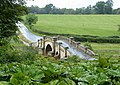
 Paine's Bridge - geograph.org.uk - 2523928.jpg 2,816 × 1,880; 2.77 MB
-
 Paine's Bridge over the River Wansbeck - geograph.org.uk - 3071080.jpg 1,024 × 768; 491 KB
-
 Paines Bridge - geograph.org.uk - 4120100.jpg 2,167 × 1,529; 1.8 MB
-
 Parkland at Wallington - geograph.org.uk - 3417947.jpg 1,368 × 1,824; 676 KB
-
 Parkland at Wallington - geograph.org.uk - 5060015.jpg 640 × 427; 90 KB
-

-
 Perseus with the head of Medusa - geograph.org.uk - 3416693.jpg 1,368 × 1,824; 688 KB
-
 Ploughed field near Broom House - geograph.org.uk - 5798628.jpg 1,024 × 768; 187 KB
-
 Portico House pathway through East Wood - geograph.org.uk - 3417021.jpg 1,824 × 1,368; 1.12 MB
-
-
 Public footpath to Cambo and Prior Hall - geograph.org.uk - 5015498.jpg 1,600 × 1,200; 510 KB
-
 Railway bridge on the "Wannie" line - geograph.org.uk - 2759368.jpg 640 × 480; 137 KB
-

-
 Remains of lineside hut, Wannie Line - geograph.org.uk - 4028156.jpg 1,024 × 768; 393 KB
-
 River Wansbeck - geograph.org.uk - 2523935.jpg 2,816 × 1,880; 3.58 MB
-
 River Wansbeck - geograph.org.uk - 4366202.jpg 640 × 480; 274 KB
-
 River Wansbeck - geograph.org.uk - 4988224.jpg 1,024 × 768; 271 KB
-
 River Wansbeck - geograph.org.uk - 5013802.jpg 1,600 × 1,191; 377 KB
-
 River Wansbeck downstream of the ornamental bridge - geograph.org.uk - 5141331.jpg 1,600 × 1,064; 631 KB
-
 River Wansbeck downstream of the ornamental bridge - geograph.org.uk - 5141332.jpg 1,600 × 1,064; 745 KB
-
 River Wansbeck near Barn Flatt - geograph.org.uk - 5597471.jpg 767 × 1,024; 298 KB
-
 River Wansbeck south of Wallington Hall - geograph.org.uk - 5139866.jpg 1,600 × 1,064; 551 KB
-
 River Wansbeck south of Wallington Hall - geograph.org.uk - 5146895.jpg 1,600 × 1,064; 636 KB
-
 Road junction - geograph.org.uk - 4503915.jpg 1,600 × 1,089; 387 KB
-
 Road to Chesters - geograph.org.uk - 4988112.jpg 1,024 × 768; 258 KB
-
 Road to Chesters - geograph.org.uk - 4988130.jpg 1,024 × 768; 307 KB


