Category:Walmsgate
English: Walmsgate is a settlement and civil parish in the East Lindsey district, in the county of Lincolnshire, England.
human settlement in Lincolnshire, UK  | |||||
| Upload media | |||||
| Instance of | |||||
|---|---|---|---|---|---|
| Location | East Lindsey, Lincolnshire, East Midlands, England | ||||
| Population |
| ||||
 | |||||
Media in category "Walmsgate"
The following 48 files are in this category, out of 48 total.
-
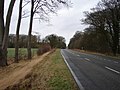 A16 Approaching Walmsgate - geograph.org.uk - 657541.jpg 640 × 480; 87 KB
-
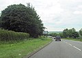
 A16 at Walmsgate - geograph.org.uk - 657517.jpg 640 × 480; 70 KB
-
 A16 beside Roadside Plantation - geograph.org.uk - 6685629.jpg 640 × 415; 103 KB
-
 A16 near Walmsgate - geograph.org.uk - 3558324.jpg 2,256 × 1,504; 1.67 MB
-
 A16, Walmsgate - geograph.org.uk - 6685627.jpg 800 × 490; 86 KB
-

-

-

-

-
 Burwell, aerial 2016 - geograph.org.uk - 4913853.jpg 450 × 640; 53 KB
-
 Clump of Trees at A16 Near Walmsgate - geograph.org.uk - 657550.jpg 480 × 640; 143 KB
-
 Dry valley in the Wolds - geograph.org.uk - 1019318.jpg 640 × 480; 54 KB
-

-
 Entrance to Walmsgate, A16 - geograph.org.uk - 4132245.jpg 640 × 448; 64 KB
-

-

-
 Ford near Manor Farm Walmsgate - geograph.org.uk - 1858412.jpg 3,872 × 2,592; 2.66 MB
-

-
 Junction for Ketsby from A16 south - geograph.org.uk - 3004234.jpg 640 × 454; 70 KB
-

-
 Lay-by on A16 near White Pit - geograph.org.uk - 4071167.jpg 1,024 × 768; 182 KB
-
 Lone ash tree in the hedgeline - geograph.org.uk - 3825668.jpg 640 × 427; 56 KB
-
 Looking Across the Fields - geograph.org.uk - 657537.jpg 640 × 480; 81 KB
-

-

-
 Old and new - geograph.org.uk - 2256782.jpg 640 × 427; 91 KB
-

-
 Padley's Piece Plantation - geograph.org.uk - 1019321.jpg 640 × 480; 82 KB
-
 Shades of green - geograph.org.uk - 1019324.jpg 640 × 480; 98 KB
-

-

-

-

-

-
 Start of Cowdyke Lane, Walmsgate - geograph.org.uk - 657512.jpg 640 × 480; 87 KB
-
-
 Swaby, aerial 2017 - geograph.org.uk - 5391049.jpg 640 × 427; 64 KB
-
 The drive from Low Farm to the A16 - geograph.org.uk - 3825670.jpg 640 × 427; 104 KB
-
 The drive to Low Farm - geograph.org.uk - 3825667.jpg 640 × 427; 100 KB
-
 The drive to Low Farm - geograph.org.uk - 3825669.jpg 640 × 427; 98 KB
-
 The edge of Ruckland Gate Plantation - geograph.org.uk - 1919231.jpg 1,600 × 1,200; 530 KB
-
 Track in the Wolds - geograph.org.uk - 1019317.jpg 640 × 480; 95 KB
-

-

-
 Walmsgate farmland - geograph.org.uk - 2256779.jpg 640 × 427; 104 KB
-

-
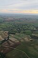
 Walmsgate, aerial 2016 - geograph.org.uk - 5194780.jpg 640 × 427; 40 KB
-


