Category:Wantsum Walk

The Wantsum Walk runs from Herne Bay, Kent to Birchington
Media in category "Wantsum Walk"
The following 18 files are in this category, out of 18 total.
-
 Reservoir at Belle Isle - geograph.org.uk - 1000026.jpg 640 × 481; 78 KB
-
 Stream by the Wantsum Walk by Shuart - geograph.org.uk - 631160.jpg 640 × 480; 124 KB
-

-
 The Wantsum Walk - geograph.org.uk - 489294.jpg 640 × 480; 95 KB
-
 The Wantsum Walk - geograph.org.uk - 489300.jpg 640 × 480; 67 KB
-
 The Wantsum Walk, Chislet Marshes - geograph.org.uk - 487656.jpg 640 × 480; 84 KB
-
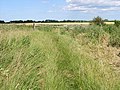
 View along the Wantsum Walk - geograph.org.uk - 487649.jpg 640 × 480; 73 KB
-

-
 View along Wantsum Walk - geograph.org.uk - 489273.jpg 640 × 480; 55 KB
-

-
 Wantsum Walk near Reculver - geograph.org.uk - 647620.jpg 640 × 480; 88 KB
-
 Wantsum Walk, Minnis Bay - geograph.org.uk - 1471423.jpg 640 × 430; 121 KB
-
 Entrance to Snake Drove - geograph.org.uk - 492238.jpg 640 × 480; 51 KB
-
 Equestrian centre by the Wantsum Walk - geograph.org.uk - 631163.jpg 640 × 480; 63 KB
-
 Looking N along the North Stream - geograph.org.uk - 492233.jpg 640 × 480; 65 KB
-
 Looking NE along the Wantsum Walk - geograph.org.uk - 489295.jpg 640 × 480; 76 KB
-

-
 Part of the Wantsum Walk near Chitty - geograph.org.uk - 369396.jpg 640 × 480; 81 KB


