Category:War memorial of Saint-Genis-Pouilly
| Object location | | View all coordinates using: OpenStreetMap |
|---|
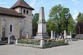
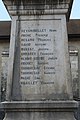
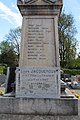
war memorial located in Ain department, France  | |||||
| Upload media | |||||
| Instance of | |||||
|---|---|---|---|---|---|
| Location | Saint-Genis-Pouilly, Ain, Auvergne-Rhône-Alpes, Metropolitan France, France | ||||
| Inception |
| ||||
 | |||||
Media in category "War memorial of Saint-Genis-Pouilly"
The following 11 files are in this category, out of 11 total.
-
 Monument morts St Genis Pouilly 1.jpg 3,456 × 5,184; 6.89 MB
-
 Monument morts St Genis Pouilly 10.jpg 5,184 × 3,456; 8.45 MB
-
 Monument morts St Genis Pouilly 11.jpg 3,456 × 5,184; 7.22 MB
-
 Monument morts St Genis Pouilly 2.jpg 5,184 × 3,456; 7.77 MB
-
 Monument morts St Genis Pouilly 3.jpg 5,184 × 3,456; 7.59 MB
-
 Monument morts St Genis Pouilly 4.jpg 3,456 × 5,184; 6.62 MB
-
 Monument morts St Genis Pouilly 5.jpg 5,184 × 3,456; 6.09 MB
-
 Monument morts St Genis Pouilly 6.jpg 3,456 × 5,184; 6.71 MB
-
 Monument morts St Genis Pouilly 7.jpg 3,456 × 5,184; 6.42 MB
-
 Monument morts St Genis Pouilly 8.jpg 3,456 × 5,184; 7.4 MB
-
 Monument morts St Genis Pouilly 9.jpg 3,456 × 5,184; 7.65 MB


