Category:Warborough
village and civil parish in South Oxfordshire, England  | |||||
| Upload media | |||||
| Instance of | |||||
|---|---|---|---|---|---|
| Location | South Oxfordshire, Oxfordshire, South East England, England | ||||
| official website | |||||
 | |||||
Subcategories
This category has the following 10 subcategories, out of 10 total.
C
- The Cricketers, Warborough (6 F)
H
M
- The Manor House, Warborough (3 F)
- Warborough Methodist Chapel (2 F)
S
- Six Bells, Warborough (5 F)
V
W
- Warborough War Memorial (5 F)
Media in category "Warborough"
The following 200 files are in this category, out of 295 total.
(previous page) (next page)-
 43 Wallingford Road - geograph.org.uk - 5199151.jpg 1,844 × 2,460; 932 KB
-
 A bend in the Thames Path at Shillingford Bridge - geograph.org.uk - 3759445.jpg 1,024 × 683; 273 KB
-
 A cereal field in Warborough - geograph.org.uk - 2370361.jpg 1,500 × 1,000; 183 KB
-
 A ditch by the bridleway - geograph.org.uk - 2370359.jpg 1,000 × 1,500; 206 KB
-
 A Generous Margin - geograph.org.uk - 4179747.jpg 4,000 × 3,000; 4.09 MB
-
 A large house by the Thames - geograph.org.uk - 2382729.jpg 1,500 × 1,000; 233 KB
-
 A Vanished Tributary^ - geograph.org.uk - 6443199.jpg 3,334 × 3,240; 2.87 MB
-
 A wet day on Shillingford Bridge - geograph.org.uk - 4690263.jpg 2,592 × 1,944; 1.46 MB
-
 A329 at Upper Hill Farm entrance - geograph.org.uk - 3672642.jpg 640 × 320; 46 KB
-
 A329 enters Warborough - geograph.org.uk - 2830806.jpg 3,428 × 2,367; 1.34 MB
-
 A329 New Road, Shillingford - geograph.org.uk - 6191102.jpg 1,024 × 684; 335 KB
-
 A329 passes through Warborough - geograph.org.uk - 2831296.jpg 3,644 × 2,659; 1.79 MB
-
 A329 Thame Road - geograph.org.uk - 6191194.jpg 1,024 × 684; 386 KB
-
 A4074 towards Shillingford - geograph.org.uk - 6236504.jpg 1,024 × 684; 354 KB
-
 All cleaned up - geograph.org.uk - 1279783.jpg 400 × 600; 69 KB
-
 Arable fields at Warborough - geograph.org.uk - 2370348.jpg 1,500 × 1,000; 137 KB
-
 Autumnal view south along Shillingford Bridge - geograph.org.uk - 3759469.jpg 1,024 × 683; 231 KB
-
 Back of the hall - geograph.org.uk - 1726762.jpg 1,024 × 683; 127 KB
-
 Barge moored at Shillingford - geograph.org.uk - 2536399.jpg 1,024 × 680; 207 KB
-
 Behind the hedge - geograph.org.uk - 1104437.jpg 640 × 480; 88 KB
-
 Benchmark on barn conversion at ^235 Thame Road - geograph.org.uk - 3761129.jpg 683 × 1,024; 264 KB
-
 Benchmark on Court Farm house - geograph.org.uk - 3761482.jpg 683 × 1,024; 289 KB
-
 Benchmark on culvert near Lower Grange - geograph.org.uk - 4336292.jpg 683 × 1,024; 203 KB
-
 Benchmark on footpath wall at Shillingford Court - geograph.org.uk - 3759696.jpg 683 × 1,024; 273 KB
-
 Benchmark on pill box beside A4074 - geograph.org.uk - 5191045.jpg 683 × 1,024; 324 KB
-
 Benchmark on The Cottage, NE side of A4074 - geograph.org.uk - 2440043.jpg 683 × 1,024; 268 KB
-
 Benchmark on wall pier outside ^63-71 Oatlands - geograph.org.uk - 3761472.jpg 683 × 1,024; 181 KB
-
 Benchmark on ^2a Warborough Road - geograph.org.uk - 3759942.jpg 1,024 × 683; 226 KB
-
 Bend in the distance - geograph.org.uk - 1727278.jpg 1,024 × 683; 150 KB
-
 Bend on New Road at Shillingford - geograph.org.uk - 3672619.jpg 640 × 392; 35 KB
-
 Best kept Village - geograph.org.uk - 1727288.jpg 533 × 800; 94 KB
-
 Between Benson ^ Shillingford - geograph.org.uk - 3043645.jpg 800 × 422; 83 KB
-
 Blue plaque on the wall - geograph.org.uk - 1727314.jpg 1,024 × 683; 199 KB
-
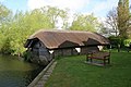 Boathouse at the wharf - geograph.org.uk - 1275280.jpg 640 × 426; 75 KB
-
 Boathouse by the River Thames - geograph.org.uk - 2382718.jpg 1,500 × 1,000; 308 KB
-
 Boathouse by the River Thames at Shillingford - geograph.org.uk - 3030706.jpg 3,872 × 2,592; 4.13 MB
-
 Boathouses on the River Thames - geograph.org.uk - 2382727.jpg 1,500 × 1,000; 252 KB
-
 Bridge and Tree - geograph.org.uk - 1878566.jpg 2,048 × 1,536; 485 KB
-
 Bridge House - geograph.org.uk - 5199135.jpg 2,560 × 1,920; 1.23 MB
-
 Bridleway to Lower Grane - geograph.org.uk - 1607333.jpg 640 × 480; 104 KB
-
 Bridleway to Warborough - geograph.org.uk - 1607323.jpg 640 × 480; 105 KB
-
 Bridleway towards Ladybrook Copse - geograph.org.uk - 3766211.jpg 1,024 × 683; 185 KB
-
 Bridleway, Warborough - geograph.org.uk - 6157998.jpg 1,024 × 768; 237 KB
-
 Buttresses on the wall - geograph.org.uk - 1726766.jpg 533 × 800; 127 KB
-
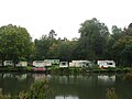 Caravan Park by the River Thames - geograph.org.uk - 4690255.jpg 2,592 × 1,944; 955 KB
-
 Caravan park near Shillingford - geograph.org.uk - 2535173.jpg 1,024 × 680; 261 KB
-
 Cherry Tree by the Bridleway - geograph.org.uk - 6443196.jpg 2,976 × 2,406; 1.54 MB
-
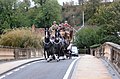 Coach ^ Horses on Shillingford Bridge - geograph.org.uk - 2664563.jpg 3,612 × 2,380; 1.53 MB
-
 Cottage by the barn - geograph.org.uk - 1725808.jpg 1,024 × 683; 159 KB
-
 Court Farm house - geograph.org.uk - 3761489.jpg 1,024 × 683; 177 KB
-
 Culvert for drain under A329 near Lower Grange - geograph.org.uk - 4336311.jpg 1,024 × 683; 394 KB
-
 Culvert for drain under the A329 at Lower Grange - geograph.org.uk - 3767323.jpg 1,024 × 683; 231 KB
-
 Culvert taking track over drain into The Thames - geograph.org.uk - 5191076.jpg 1,024 × 683; 357 KB
-
 Date on the hall - geograph.org.uk - 1727304.jpg 533 × 800; 86 KB
-
 Ditch and farmland, Warborough - geograph.org.uk - 2321674.jpg 640 × 427; 126 KB
-
 Ditch at the back - geograph.org.uk - 1726588.jpg 1,024 × 683; 177 KB
-
 Extension under way at ^2 Henley Road - geograph.org.uk - 3761176.jpg 1,024 × 683; 204 KB
-
 Farmland near Warborough - geograph.org.uk - 4179745.jpg 3,804 × 2,724; 2.39 MB
-
 Farmland, Warborough - geograph.org.uk - 1391526.jpg 640 × 427; 151 KB
-
 Farmland, Warborough - geograph.org.uk - 6157148.jpg 1,024 × 768; 218 KB
-
 Ferry House - geograph.org.uk - 5199123.jpg 2,560 × 1,920; 1.32 MB
-
 Field by the Thames Path - geograph.org.uk - 5032159.jpg 1,500 × 1,000; 169 KB
-
 Field near Warborough - geograph.org.uk - 2372568.jpg 1,500 × 1,000; 160 KB
-
 Flood level marker in Shillingford - geograph.org.uk - 2535163.jpg 680 × 1,024; 233 KB
-
 Footbridge on the Thames Path - geograph.org.uk - 1959362.jpg 1,500 × 978; 333 KB
-
 Footbridge on the Thames Path - geograph.org.uk - 5032151.jpg 1,500 × 1,000; 281 KB
-
 Footpath near Shillingford Court - geograph.org.uk - 3759719.jpg 1,024 × 683; 243 KB
-
 Footpath Stone - geograph.org.uk - 1993664.jpg 3,400 × 2,656; 3.48 MB
-
 Footpath-bridleway junction - geograph.org.uk - 3766218.jpg 683 × 1,024; 282 KB
-
 Former police station in Warborough - geograph.org.uk - 2370364.jpg 1,500 × 1,000; 266 KB
-
 Former pub, Warborough, Oxfordshire - geograph.org.uk - 4591788.jpg 800 × 532; 123 KB
-
 Former school, Warborough - geograph.org.uk - 6191112.jpg 1,024 × 684; 306 KB
-
 Gas Mark 3 - geograph.org.uk - 1878564.jpg 2,048 × 1,536; 503 KB
-
 Gate on the Thames Path - geograph.org.uk - 5032162.jpg 1,500 × 1,000; 330 KB
-
 Gate on the Thames Path - geograph.org.uk - 5032169.jpg 1,000 × 1,500; 367 KB
-
 Gate on the Thames Path - geograph.org.uk - 5078435.jpg 1,000 × 1,500; 356 KB
-
 Gate on the Thames Path - geograph.org.uk - 5078458.jpg 1,500 × 1,000; 346 KB
-
 Gated entrance - geograph.org.uk - 5199156.jpg 2,560 × 1,920; 1.62 MB
-
 Geese on the pond - geograph.org.uk - 1279761.jpg 640 × 426; 98 KB
-
 Green near the hall - geograph.org.uk - 1727286.jpg 1,024 × 683; 181 KB
-
 Greet Memorial Hall - geograph.org.uk - 2341819.jpg 1,926 × 1,408; 327 KB
-
 Hall by the junction - geograph.org.uk - 1726771.jpg 1,024 × 683; 142 KB
-
 Hall from the road - geograph.org.uk - 1727306.jpg 1,024 × 683; 114 KB
-
 Hammer Lane crosses Pain Way - geograph.org.uk - 2330660.jpg 1,940 × 1,408; 395 KB
-
 Hammer Lane sign - geograph.org.uk - 1392008.jpg 640 × 480; 280 KB
-
 Hammer Lane, Warborough 1 - geograph.org.uk - 1391991.jpg 640 × 480; 219 KB
-
 Hammer Lane, Warborough 2 - geograph.org.uk - 1391998.jpg 640 × 480; 222 KB
-
 Hammer Lane, Warborough 3 - geograph.org.uk - 1392003.jpg 640 × 480; 237 KB
-
 Hedgerow on Town Hill - geograph.org.uk - 1391974.jpg 640 × 481; 222 KB
-
 Henley Road, Shillingford - geograph.org.uk - 5865888.jpg 2,014 × 1,490; 1.85 MB
-
 House beside the - geograph.org.uk - 2535157.jpg 1,024 × 680; 163 KB
-
 House on The Green, Warborough, Oxfordshire - geograph.org.uk - 4590690.jpg 5,611 × 3,872; 3.57 MB
-
 Houses by the green - geograph.org.uk - 1725803.jpg 1,024 × 683; 91 KB
-
 Houses in Shillingford - geograph.org.uk - 2535159.jpg 1,024 × 680; 174 KB
-
 Houses on Oxford Road, Shillingford - geograph.org.uk - 4976163.jpg 2,304 × 1,728; 826 KB
-
 Houses on The Green, Warborough, Oxfordshire - geograph.org.uk - 4611452.jpg 2,214 × 2,056; 2.71 MB
-
 In the door - geograph.org.uk - 1219734.jpg 640 × 426; 51 KB
-
 Interesting stone - geograph.org.uk - 1725872.jpg 1,024 × 683; 163 KB
-
 Junction by the hall - geograph.org.uk - 1726764.jpg 1,024 × 683; 123 KB
-
 Junction of bridleways - geograph.org.uk - 4336223.jpg 1,024 × 683; 181 KB
-
 Junction of footpaths at Ladybrook Copse - geograph.org.uk - 3766199.jpg 1,024 × 683; 379 KB
-
 Junction of Wallingford Road and Henley road - geograph.org.uk - 2688931.jpg 3,227 × 2,492; 1.07 MB
-
 Junction of Warborough Road and Henley Road - geograph.org.uk - 3755856.jpg 1,024 × 683; 138 KB
-
 Junction on tracks beside the River Thame - geograph.org.uk - 4336211.jpg 1,024 × 683; 359 KB
-
 Large field near Warborough - geograph.org.uk - 4690276.jpg 2,592 × 1,944; 1.42 MB
-
 Looking from the Green South - geograph.org.uk - 1725862.jpg 1,024 × 683; 155 KB
-
 Midsomer Constabulary - geograph.org.uk - 2370366.jpg 1,500 × 974; 150 KB
-
 Mossy benchmark on pill box on SW side of A4074 - geograph.org.uk - 2440102.jpg 1,024 × 683; 273 KB
-
 Nearing the road - geograph.org.uk - 3176279.jpg 640 × 480; 98 KB
-
 No More Beer - geograph.org.uk - 2555409.jpg 1,024 × 683; 150 KB
-
 Notice board by the doorway - geograph.org.uk - 1727292.jpg 1,024 × 683; 109 KB
-
 Old Chapel, Warborough - geograph.org.uk - 2039758.jpg 1,898 × 1,424; 410 KB
-
 Onto the bypass - geograph.org.uk - 1279652.jpg 640 × 426; 56 KB
-
 Out of the embrasure - geograph.org.uk - 1219918.jpg 640 × 426; 60 KB
-
 Out of the embrasure - geograph.org.uk - 1219927.jpg 640 × 426; 108 KB
-
 Over the hedge - geograph.org.uk - 1279647.jpg 640 × 426; 51 KB
-
 Over the hedge to Dorchester - geograph.org.uk - 1279690.jpg 640 × 426; 60 KB
-
 Overgrown pill box on SW side of A4074 - geograph.org.uk - 2440824.jpg 1,024 × 683; 312 KB
-
 Oxford Road, Shillingford - geograph.org.uk - 4976154.jpg 2,304 × 1,728; 854 KB
-
 Oxford Road, Shillingford - geograph.org.uk - 4976292.jpg 2,304 × 1,728; 820 KB
-
 Pain Way by Town Hill - geograph.org.uk - 2372565.jpg 1,500 × 1,000; 131 KB
-
 Parapet with a bench mark - geograph.org.uk - 1771975.jpg 1,024 × 768; 218 KB
-
 Pasture by the box - geograph.org.uk - 1220819.jpg 640 × 426; 56 KB
-
 Pheasant on the roof - geograph.org.uk - 1727322.jpg 1,024 × 683; 53 KB
-
 Phone box near the green - geograph.org.uk - 1727312.jpg 1,024 × 683; 233 KB
-
 Pill box beside the A4074 - geograph.org.uk - 5191048.jpg 1,024 × 683; 288 KB
-
 Pill box NW of Shillingford - geograph.org.uk - 5191060.jpg 1,024 × 683; 266 KB
-
 Pillbox alongside stream - geograph.org.uk - 6436298.jpg 1,024 × 683; 298 KB
-
 Pillbox by the ditch - geograph.org.uk - 1220834.jpg 640 × 426; 84 KB
-
 Pillbox by the hedge - geograph.org.uk - 1279372.jpg 640 × 426; 52 KB
-
 Pillbox by the river - geograph.org.uk - 1219555.jpg 640 × 426; 83 KB
-
 Pillbox by the road - geograph.org.uk - 1104380.jpg 640 × 480; 132 KB
-
 Pillbox by the trees - geograph.org.uk - 1220824.jpg 640 × 426; 113 KB
-
 Pillbox entrance - geograph.org.uk - 1104391.jpg 640 × 480; 115 KB
-
 Pillbox in the flood plain - geograph.org.uk - 1219569.jpg 640 × 426; 92 KB
-
 Pillbox in the trees - geograph.org.uk - 1279768.jpg 640 × 426; 101 KB
-
 Pillbox near Shillingford - geograph.org.uk - 2535154.jpg 1,024 × 680; 230 KB
-
 Pillbox near the River Thames - geograph.org.uk - 5078444.jpg 1,500 × 968; 374 KB
-
 Pillbox over the hedge - geograph.org.uk - 1279340.jpg 640 × 426; 67 KB
-
 Plaques on the pavilion - geograph.org.uk - 1725813.jpg 1,024 × 683; 125 KB
-
 Playground in the corner - geograph.org.uk - 1725818.jpg 1,024 × 683; 88 KB
-
 Post box by the shop - geograph.org.uk - 1727308.jpg 1,024 × 683; 170 KB
-
 Priests' Moor Lane - geograph.org.uk - 1607337.jpg 640 × 480; 89 KB
-
 Private fishing - geograph.org.uk - 1279802.jpg 400 × 600; 84 KB
-
 Rebar sticking out - geograph.org.uk - 1279378.jpg 400 × 600; 74 KB
-
 Recreation ground at Warborough - geograph.org.uk - 1725769.jpg 1,024 × 683; 148 KB
-
 River Thame u-s of Warborough - geograph.org.uk - 2330715.jpg 2,048 × 1,536; 523 KB
-
 River Thames - geograph.org.uk - 1607227.jpg 640 × 480; 94 KB
-
 River Thames - geograph.org.uk - 6461564.jpg 1,200 × 805; 1.25 MB
-
 River Thames at Rush Court - geograph.org.uk - 5218481.jpg 3,805 × 2,864; 2.55 MB
-
 River Thames at Shillingford Bridge (4) - geograph.org.uk - 5199057.jpg 2,560 × 1,920; 1.64 MB
-
 Riverboats near Shillingford - geograph.org.uk - 2543092.jpg 3,780 × 2,232; 610 KB
-
 Road to Shillingford - geograph.org.uk - 1279684.jpg 640 × 426; 46 KB
-

-
 Rubbish inside - geograph.org.uk - 1219738.jpg 400 × 600; 60 KB
-
 Seat by the well - geograph.org.uk - 1727297.jpg 533 × 800; 123 KB
-

-
 Shillingford Bridge (1) - geograph.org.uk - 5199065.jpg 2,560 × 1,920; 1.55 MB
-
 Shillingford Bridge and Shillingford Bridge Hotel - geograph.org.uk - 3030654.jpg 3,872 × 2,592; 5.83 MB
-
 Shillingford Bridge from the Thames Path National Trail - geograph.org.uk - 5890748.jpg 4,608 × 3,456; 5.13 MB
-
 Shillingford Bridge Hotel (3) - geograph.org.uk - 5199046.jpg 2,560 × 1,920; 1.43 MB
-
 Shillingford Bridge, Rivet bench mark - geograph.org.uk - 1827392.jpg 686 × 1,024; 252 KB
-
 Shillingford Hill Park by the River Thames - geograph.org.uk - 5078413.jpg 1,500 × 1,000; 363 KB
-
 Shillingford roundabout from A4074 - geograph.org.uk - 3672609.jpg 640 × 413; 45 KB
-
 Shillingford, 'The Kingfisher' - geograph.org.uk - 6118067.jpg 768 × 1,024; 189 KB
-
 Shillingford, 59 Henley Road - geograph.org.uk - 1827769.jpg 686 × 1,024; 266 KB
-
 ShillingfordRiver01.JPG 2,048 × 1,536; 1.29 MB
-
 Shrine by the hedge - geograph.org.uk - 1279668.jpg 400 × 600; 80 KB
-
 Side room - geograph.org.uk - 1104454.jpg 480 × 640; 58 KB
-
 Sinodun View, Warborough - geograph.org.uk - 1589633.jpg 640 × 480; 141 KB
-
 St Laurence hall - geograph.org.uk - 1725923.jpg 1,024 × 683; 156 KB
-

-
 St Laurence, Warborough, churchyard (c) - geograph.org.uk - 4100219.jpg 480 × 640; 107 KB
-

-

-

-

-

-

-

-

-

-
-

-
 St Laurence, Warborough, Oxon - Dormer window - geograph.org.uk - 2060875.jpg 1,000 × 666; 229 KB
-

-

-

-

-

-
 Telephone Exchange, Shillingford - geograph.org.uk - 3683442.jpg 3,072 × 2,304; 1.77 MB
-
 Thame Road - geograph.org.uk - 1607240.jpg 640 × 480; 77 KB
-
 Thame road by the hall - geograph.org.uk - 1726767.jpg 1,024 × 683; 133 KB
-
 Thame Road in Warborough - geograph.org.uk - 2372533.jpg 1,500 × 1,000; 274 KB
-
 Thame road through Warborough - geograph.org.uk - 1727280.jpg 1,024 × 683; 211 KB
-
 Thame road towards Shillingford - geograph.org.uk - 1725893.jpg 1,024 × 683; 141 KB
-
 Thame Road, Warborough - geograph.org.uk - 1725879.jpg 1,024 × 683; 165 KB
-
 Thames Path crosses Wallingford Road (1) - geograph.org.uk - 5199072.jpg 2,560 × 1,920; 1.67 MB
-
 Thames Path crosses Wallingford Road (2) - geograph.org.uk - 5199092.jpg 2,560 × 1,920; 1.36 MB
-
 Thames Path near Shillingford - geograph.org.uk - 2535177.jpg 1,024 × 680; 344 KB


_-_geograph.org.uk_-_5199057.jpg)


_-_geograph.org.uk_-_3176280.jpg)
_-_geograph.org.uk_-_5199065.jpg)


_-_geograph.org.uk_-_5199046.jpg)


_-_geograph.org.uk_-_4100219.jpg)

_-_geograph.org.uk_-_4100227.jpg)
_-_geograph.org.uk_-_4100228.jpg)
_-_geograph.org.uk_-_4100233.jpg)
_-_geograph.org.uk_-_4100234.jpg)
_-_geograph.org.uk_-_4100238.jpg)
_-_geograph.org.uk_-_4100235.jpg)
_-_geograph.org.uk_-_4100236.jpg)
_-_geograph.org.uk_-_4100237.jpg)
_-_geograph.org.uk_-_4100239.jpg)
_-_geograph.org.uk_-_4100246.jpg)


_-_geograph.org.uk_-_4100223.jpg)
_-_geograph.org.uk_-_4101368.jpg)
_-_geograph.org.uk_-_4101372.jpg)


_-_geograph.org.uk_-_5199072.jpg)
_-_geograph.org.uk_-_5199092.jpg)
