Category:Watercraft on the River Thames
English: Ships, boats etc., depicted on the Thames. Note those in London, which are most media here, go into the subcategory: Watercraft on the River Thames in London or, ideally, one of its more specific subcategories.
- This category is overcrowded. Please use subcategories instead where possible, based on vessel type and location.
- Add appropriate categories for each vessel in an image, but vessels which are not clearly visible can be ignored.
- Add images also to categories for other depicted features, e.g., subcategories of Piers in London, Bridges over the River Thames, or River Thames in Berkshire.
| Category maintenance links | ||
|---|---|---|
| To categorize? | ||
Subcategories
This category has the following 9 subcategories, out of 9 total.
Media in category "Watercraft on the River Thames"
The following 200 files are in this category, out of 222 total.
(previous page) (next page)-
 "The New Orleans" - geograph.org.uk - 525432.jpg 480 × 640; 80 KB
-
 A boat on the Thames at Windsor - geograph.org.uk - 1520581.jpg 640 × 424; 65 KB
-
 A Field of Boats - geograph.org.uk - 66321.jpg 640 × 481; 55 KB
-
 Thames Path at Abingdon bridge - geograph.org.uk - 58879.jpg 640 × 474; 80 KB
-
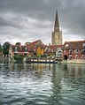 The Thames and Abingdon Church spire - geograph.org.uk - 612766.jpg 515 × 640; 125 KB
-

-
 Above Pinkhill Lock - geograph.org.uk - 914206.jpg 640 × 426; 152 KB
-
 Across the Thames - geograph.org.uk - 1085708.jpg 640 × 427; 62 KB
-
 Activity at Reading Waterfest - geograph.org.uk - 855273.jpg 640 × 427; 85 KB
-
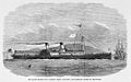 Alexandra ILN.jpg 994 × 625; 452 KB
-
 Approaching Boulter's Lock - geograph.org.uk - 948373.jpg 640 × 427; 197 KB
-
 Approaching Hambleden Lock - geograph.org.uk - 536819.jpg 640 × 480; 117 KB
-
 Baglady on the Thames - geograph.org.uk - 915041.jpg 640 × 480; 121 KB
-
 Barges on the Thames - geograph.org.uk - 970081.jpg 640 × 480; 82 KB
-
 Barges on the Thames at Abingdon - geograph.org.uk - 1403411.jpg 640 × 427; 84 KB
-
 BellWeirLock02.JPG 2,011 × 1,460; 1.2 MB
-
 BestandBestPunts.JPG 787 × 1,326; 442 KB
-
 Boat at Runnymede - geograph.org.uk - 948625.jpg 640 × 427; 182 KB
-
 Boat with Whale on the Thames - geograph.org.uk - 1140579.jpg 640 × 480; 117 KB
-
 Boathouse by the lock - geograph.org.uk - 1103118.jpg 640 × 480; 71 KB
-
 Boats by Dockett Point - geograph.org.uk - 648551.jpg 480 × 640; 82 KB
-

-
 Boats for Hire, Henley-On-Thames - geograph.org.uk - 504759.jpg 480 × 605; 370 KB
-
 Boats in tandem, River Thames, Hurley - geograph.org.uk - 597023.jpg 640 × 480; 123 KB
-
 Boats moored on the Thames - geograph.org.uk - 307355.jpg 640 × 480; 86 KB
-
 Boats on the Thames at Medley - geograph.org.uk - 1758515.jpg 1,500 × 1,000; 188 KB
-
 Boats on the Thames at Runnymede - geograph.org.uk - 1521969.jpg 640 × 427; 104 KB
-
 Boatyard on the Thames - geograph.org.uk - 958290.jpg 640 × 480; 99 KB
-
 Boulter's Lock - geograph.org.uk - 515648.jpg 640 × 480; 153 KB
-
 Boulter's Lock - geograph.org.uk - 958686.jpg 480 × 640; 90 KB
-
 Boulter's Lock, River Thames - geograph.org.uk - 374556.jpg 640 × 540; 145 KB
-
 Boulter's Lock, River Thames - geograph.org.uk - 630356.jpg 640 × 526; 75 KB
-
 Boulter's Lock, River Thames - geograph.org.uk - 630367.jpg 640 × 582; 95 KB
-
 Boydell-Thames.png 1,856 × 1,066; 150 KB
-
 Bridge over the Thames at Marlow - geograph.org.uk - 1516559.jpg 640 × 433; 56 KB
-

-
 Bulk Chemical Carrier and Jetty - geograph.org.uk - 636533.jpg 640 × 480; 76 KB
-
 Canal boats entering Sonning Lock.jpg 2,048 × 1,536; 266 KB
-
 Canal boats in Sonning Lock.jpg 2,048 × 1,536; 431 KB
-

-
 CavershamLockReach01.JPG 1,919 × 1,404; 1.08 MB
-
 Chertsey Bridge, from above - geograph.org.uk - 372251.jpg 640 × 519; 101 KB
-
 Chertsey Lock, River Thames - geograph.org.uk - 372200.jpg 640 × 513; 113 KB
-
 Chertsey Lock, River Thames. - geograph.org.uk - 379255.jpg 640 × 480; 129 KB
-

-
 Cookham Lock - geograph.org.uk - 1420622.jpg 480 × 640; 108 KB
-
 Cookham Lock - geograph.org.uk - 948332.jpg 640 × 427; 202 KB
-
 Cookham Lock, Berkshire.JPG 2,592 × 1,944; 2.64 MB
-
 Crane Boat in the River Thames - geograph.org.uk - 1558172.jpg 640 × 427; 44 KB
-
 Jack Spurling - The paddle steamer Crested Eagle.jpg 512 × 364; 46 KB
-
 Cruiser on the Thames - geograph.org.uk - 958302.jpg 640 × 480; 94 KB
-
 Cruising by Hambleden - geograph.org.uk - 536816.jpg 640 × 480; 141 KB
-
 Cruising on the Thames - geograph.org.uk - 611090.jpg 640 × 477; 112 KB
-
 Dagenham Dock - geograph.org.uk - 57614.jpg 640 × 462; 43 KB
-
 DaysLock01.JPG 1,839 × 1,357; 948 KB
-
 DaysLock02.JPG 1,880 × 1,353; 980 KB
-
 Downstream from Windsor Bridge - geograph.org.uk - 321984.jpg 640 × 480; 85 KB
-
 EghamRegatta01.JPG 1,828 × 1,152; 797 KB
-
 EghamRegatta02.JPG 1,777 × 1,198; 826 KB
-
 Eyot House, D'Oyly Carte Island - geograph.org.uk - 376622.jpg 640 × 439; 107 KB
-
 Former power station at New Osney - geograph.org.uk - 872640.jpg 473 × 640; 101 KB
-
 Frouillards & fumées. La tamise à St. Paul LCCN2003681773.jpg 9,815 × 7,018; 6.61 MB
-
 Fry's Island 4.JPG 2,160 × 1,440; 979 KB
-
 Fuel Barge - geograph.org.uk - 1762678.jpg 3,440 × 2,280; 1.13 MB
-
 Gasometer and Boathouses on the Thames - geograph.org.uk - 82399.jpg 640 × 426; 81 KB
-
 GeorgIvonGroßbritannienGeorgFriedrichHaendelHamman.jpg 3,216 × 2,594; 4.7 MB
-
 Going round the bend - geograph.org.uk - 1432432.jpg 640 × 426; 111 KB
-
 Going to Goring - geograph.org.uk - 1450883.jpg 640 × 480; 121 KB
-
 Goring Lock - geograph.org.uk - 945059.jpg 428 × 640; 86 KB
-
 Goring-on-Thames Riverside - geograph.org.uk - 915032.jpg 640 × 480; 127 KB
-
 Gravesend-Tilbury passenger ferry 'Gertrude' (1906).jpg 500 × 335; 53 KB
-
 GravesendCanalBasin3455.JPG 2,848 × 2,136; 1.42 MB
-
 GravesendCanalBasin3456.JPG 2,848 × 2,136; 1.48 MB
-
 GravesendThames3332.JPG 2,848 × 2,136; 1.48 MB
-
 GravesendThames3333.JPG 2,848 × 2,136; 1.54 MB
-
 GravesendThames3349.JPG 2,848 × 2,136; 1.49 MB
-
 GravesendThames3381.JPG 2,848 × 2,136; 1.34 MB
-
 GravesendThames3389.JPG 2,848 × 2,136; 1.41 MB
-
 GravesendThames3393.JPG 2,848 × 2,136; 1.53 MB
-
 GravesendThames3395.JPG 2,848 × 2,136; 1.49 MB
-
 GravesendThames3401.JPG 2,848 × 2,136; 1.48 MB
-
 GravesendThames3403.JPG 2,848 × 2,136; 1.43 MB
-
 GravesendThames3448.JPG 2,847 × 1,708; 422 KB
-
 GravesendThames3449.JPG 2,848 × 2,136; 1.49 MB
-
 Greenlands - geograph.org.uk - 536807.jpg 640 × 480; 140 KB
-
 Henley Moorings - geograph.org.uk - 525421.jpg 640 × 480; 123 KB
-
 Henley Regatta - geograph.org.uk - 298954.jpg 640 × 419; 67 KB
-
 Henley regatta race.jpg 800 × 514; 95 KB
-
 Henley Regatta, Henley-on-Thames, England, 1890s.jpg 3,556 × 2,636; 3.06 MB
-
 Henley-on-Thames - geograph.org.uk - 956377.jpg 640 × 480; 67 KB
-
 Henley01.JPG 2,008 × 1,405; 1.04 MB
-
 Henley2.jpg 1,024 × 768; 137 KB
-
 HMS Superb in Thames Estuary 1909 Flickr 4792721735 5ce34b9c0a o.jpg 1,280 × 971; 494 KB
-
 HMSBuckingham.jpg 1,280 × 858; 1.06 MB
-
 Hythe End waterworks - geograph.org.uk - 948699.jpg 640 × 427; 181 KB
-
 Jeanie T at Bavins Gulls (nancy).JPG 3,456 × 2,592; 4.16 MB
-
 Londra 2008 - David Gilmour Astoria - 03.JPG 2,592 × 1,944; 2.54 MB
-
 Looking up the Thames at Bourne End - geograph.org.uk - 958361.jpg 640 × 480; 66 KB
-
 Marlow Lock - geograph.org.uk - 948239.jpg 636 × 423; 205 KB
-
 Marlow Weir - geograph.org.uk - 395453.jpg 640 × 427; 72 KB
-
 MarshLock01.JPG 2,048 × 1,536; 1.22 MB
-
 MarshLock03.JPG 2,048 × 1,536; 1.28 MB
-
 Molesey Lock, River Thames - geograph.org.uk - 619244.jpg 640 × 519; 97 KB
-
 Moored across the river - geograph.org.uk - 1769428.jpg 1,024 × 683; 173 KB
-
-

-
 Moored on its own - geograph.org.uk - 1218442.jpg 640 × 426; 51 KB
-

-
 Moorings, Hampton - geograph.org.uk - 637552.jpg 640 × 480; 105 KB
-
 MV Celandine - geograph.org.uk - 361631.jpg 640 × 426; 92 KB
-
 Narrow boat on the river - geograph.org.uk - 765216.jpg 640 × 427; 77 KB
-
 Narrow boat on the Thames - geograph.org.uk - 1313042.jpg 640 × 426; 67 KB
-
 Narrow boat on the Thames - geograph.org.uk - 1605514.jpg 640 × 480; 84 KB
-
 Narrowboat at Kentwood Deeps - geograph.org.uk - 611076.jpg 640 × 477; 106 KB
-
 Narrowboat by Runsford Hole - geograph.org.uk - 915052.jpg 640 × 480; 98 KB
-
 Narrowboat moored to The Brocas, Eton - geograph.org.uk - 321960.jpg 640 × 480; 56 KB
-
 Narrowboat on the Thames - geograph.org.uk - 1464150.jpg 640 × 427; 113 KB
-
 New Southern Belle (3671473221).jpg 1,253 × 828; 195 KB
-
 No 2 Jetty, Grays Terminal - geograph.org.uk - 1593607.jpg 640 × 430; 104 KB
-
 On the Thames at Runnymede - geograph.org.uk - 1755072.jpg 1,558 × 2,180; 1.66 MB
-
 Oxford - Canal Boat on the River - geograph.org.uk - 1328017.jpg 640 × 480; 135 KB
-
 Path along the Thames - geograph.org.uk - 1709666.jpg 800 × 600; 118 KB
-
 Patrol Boat at Cleeve Lock - geograph.org.uk - 1885242.jpg 2,048 × 1,536; 458 KB
-
 Peking moored in the Thames - StateLibQld 70 146875.jpg 1,000 × 626; 163 KB
-
 Penton Hook Lock, River Thames - geograph.org.uk - 629269.jpg 640 × 537; 97 KB
-
 Pleasure Boat on the Thames - geograph.org.uk - 516780.jpg 640 × 480; 154 KB
-

-
 Portwey on the Thames - geograph.org.uk - 3106628.jpg 2,592 × 1,936; 1.24 MB
-

-

-
 River Thames above Lechlade - geograph.org.uk - 914138.jpg 640 × 426; 45 KB
-
 River Thames at Runnymede - geograph.org.uk - 660857.jpg 640 × 427; 76 KB
-
 River Thames at Streatley - geograph.org.uk - 337061.jpg 640 × 477; 85 KB
-
 River Thames by Lechlade Riverside Marina - geograph.org.uk - 333630.jpg 640 × 480; 103 KB
-
 River Thames in Abingdon - geograph.org.uk - 549839.jpg 640 × 480; 94 KB
-
 River Thames near Bray - geograph.org.uk - 157177.jpg 640 × 480; 71 KB
-
 River Thames, Cliveden House (7958629502).jpg 4,272 × 2,848; 5.7 MB
-
 River Thames, Datchet - geograph.org.uk - 25721.jpg 640 × 480; 81 KB
-
 River Thames, Goring - geograph.org.uk - 945074.jpg 428 × 640; 94 KB
-
 River Thames, Hampton - geograph.org.uk - 637518.jpg 640 × 480; 61 KB
-
 River Thames, Hampton Court Bridge - geograph.org.uk - 932763.jpg 640 × 480; 76 KB
-

-
 River Thames, Putney Pier - geograph.org.uk - 581943.jpg 640 × 480; 98 KB
-
 River Thames, Reading - geograph.org.uk - 1075491.jpg 640 × 480; 119 KB
-
 River Thames, Streatley - geograph.org.uk - 945085.jpg 640 × 428; 96 KB
-
 River Thames, Temple - geograph.org.uk - 292785.jpg 640 × 480; 72 KB
-
 Riverboat at Hampton Court Palace - geograph.org.uk - 587478.jpg 640 × 480; 127 KB
-
 RMS Quetta 1884a.jpg 1,000 × 698; 50 KB
-
 RNLI Lifeboats - geograph.org.uk - 800784.jpg 640 × 480; 107 KB
-
 Robert de Vere fleeing Radcot Bridge.jpg 923 × 689; 533 KB
-
 Romney Lock, River Thames - geograph.org.uk - 630381.jpg 640 × 534; 95 KB
-
 Royal Thames Yacht Club, the Yachts rounding near Chapman Head - ILN 1856.jpg 1,468 × 984; 863 KB
-
 Salter's Steamers at Marlow - geograph.org.uk - 957598.jpg 640 × 480; 64 KB
-
 Salters Steamers by Folly Bridge.jpg 3,072 × 2,304; 2.22 MB
-
 Second span in - geograph.org.uk - 832760.jpg 640 × 427; 36 KB
-
 Shillingford Court from the river - geograph.org.uk - 1658500.jpg 480 × 640; 67 KB
-
 Shiplake Lock - geograph.org.uk - 2467.jpg 427 × 640; 54 KB
-
 Steam launch at Laleham, River Thames - geograph.org.uk - 372291.jpg 640 × 478; 101 KB
-
 Steam Launch Nuneham - geograph.org.uk - 998089.jpg 640 × 335; 73 KB
-
 Sunbury, the River Thames - geograph.org.uk - 793337.jpg 640 × 480; 112 KB
-
 Sunburylock.JPG 1,024 × 768; 371 KB
-
 Swan Upping beginning at Sunbury Lock. - geograph.org.uk - 122592.jpg 640 × 435; 158 KB
-
 Tadpole Bridge - geograph.org.uk - 911211.jpg 640 × 426; 113 KB
-

-
 Temple Island - geograph.org.uk - 431805.jpg 3,888 × 2,592; 2.92 MB
-
 Thames at Oxford - geograph.org.uk - 346956.jpg 640 × 438; 65 KB
-
 Thames at Radcot - geograph.org.uk - 17887.jpg 640 × 427; 80 KB
-
 Thames at Sunbury - geograph.org.uk - 793324.jpg 640 × 480; 103 KB
-
 Thames Lock - geograph.org.uk - 949036.jpg 640 × 427; 202 KB
-
 Thames Marina - geograph.org.uk - 637612.jpg 640 × 480; 95 KB
-
 Thames north of Osney Bridge - geograph.org.uk - 872804.jpg 640 × 480; 120 KB
-
 Thames Path, Remenham - geograph.org.uk - 536446.jpg 640 × 480; 127 KB
-
 Thames side moorings at Caversham - geograph.org.uk - 951889.jpg 640 × 480; 75 KB
-
 ThamesAtAbingdon.jpg 883 × 594; 85 KB
-
 Thamescape Bénéteau KC 7686.JPG 3,488 × 2,616; 2.13 MB
-
 Thamescape Catamaran reaching.JPG 1,968 × 1,964; 773 KB
-
 Thamescape Hornisse KC 7692 (Modified (2)).JPG 1,677 × 1,234; 493 KB
-
 The River Thames at Henley - geograph.org.uk - 1419419.jpg 640 × 426; 68 KB
-
 The River Thames at Windsor - geograph.org.uk - 1520574.jpg 640 × 427; 115 KB
-
 The River Thames, Charvil - geograph.org.uk - 559060.jpg 640 × 480; 92 KB
-
 The River Thames, Hurley - geograph.org.uk - 597034.jpg 640 × 480; 106 KB
-
 The River Thames, Lechlade - geograph.org.uk - 504285.jpg 640 × 480; 95 KB
-
 The River Thames, Moulsford - geograph.org.uk - 695704.jpg 640 × 480; 78 KB
-
 The River Thames, Reading - geograph.org.uk - 597158.jpg 640 × 480; 89 KB
-
 The River Thames, Reading - geograph.org.uk - 597163.jpg 640 × 480; 90 KB
-
 The River Thames, Shiplake - geograph.org.uk - 657824.jpg 640 × 480; 101 KB
-
 The River Thames, Sonning - geograph.org.uk - 578576.jpg 640 × 480; 136 KB
-
 The River Thames. Hurley - geograph.org.uk - 605699.jpg 640 × 480; 159 KB
-
 The River, Thames, Henley - geograph.org.uk - 872560.jpg 640 × 480; 148 KB
-
 The Swan at Streatley - geograph.org.uk - 915247.jpg 640 × 480; 84 KB
-
 The Thames above Benson weir - geograph.org.uk - 948410.jpg 480 × 640; 83 KB
-
 The Thames at Henley - geograph.org.uk - 1149629.jpg 640 × 421; 99 KB
-
 The Thames at Old Windsor - geograph.org.uk - 106981.jpg 640 × 480; 84 KB
-
 The Thames at Streatley - geograph.org.uk - 583602.jpg 640 × 480; 85 KB
-
 The Thames at Windsor - geograph.org.uk - 908785.jpg 640 × 480; 56 KB
-
 The Thames below Bray Lock - geograph.org.uk - 383288.jpg 640 × 480; 216 KB
-
 The Thames from Cock Marsh - geograph.org.uk - 516764.jpg 640 × 480; 128 KB
-
 The Thames in the 1950s (4384598269).jpg 1,208 × 901; 598 KB
-
 The Thames near Spade Oak Farm - geograph.org.uk - 516790.jpg 640 × 480; 166 KB
-
 The Thames or Isis from Folly Bridge - geograph.org.uk - 17237.jpg 640 × 480; 97 KB


.jpg)


.JPG)


.jpg)


.jpg)


).JPG)


.jpg)

