Category:Waterdonken
| Object location | | View all coordinates using: OpenStreetMap |
|---|
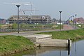
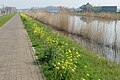
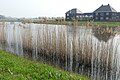
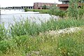
Nederlands: Afbeeldingen van de wijk Waterdonken in het noorden van Breda in de provincie Noord-Brabant in het zuiden van Nederland. Gelegen nabij de wijk de Geeren en Bouverijen in Teteringen.
neighborhood in Breda, the Netherlands  | |||||
| Upload media | |||||
| Instance of | |||||
|---|---|---|---|---|---|
| Location | Breda, North Brabant, Netherlands | ||||
 | |||||
Subcategories
This category has the following 8 subcategories, out of 8 total.
Media in category "Waterdonken"
The following 12 files are in this category, out of 12 total.
-
 Bouverijen P1360506.jpg 4,000 × 2,672; 5.93 MB
-
 Teteringen P1010478 copy.jpg 3,264 × 2,448; 2.33 MB
-
 Waterdonken P1010480.jpg 3,264 × 2,448; 3.95 MB
-
 Waterdonken P1360495.jpg 4,000 × 2,672; 6 MB
-
 Waterdonken P1360496.jpg 4,000 × 2,672; 5.75 MB
-
 Waterdonken P1360497.jpg 4,000 × 2,672; 6.13 MB
-
 Waterdonken P1360501.jpg 4,000 × 2,672; 5.78 MB
-
 Waterdonken P1360503.jpg 4,000 × 2,672; 6.08 MB
-
 Waterdonken P1360504.jpg 4,000 × 2,672; 5.65 MB
-
 Waterdonken P1360505.jpg 4,000 × 2,672; 6.07 MB
-
 Waterdonken P1390057.jpg 4,000 × 2,672; 4.88 MB
-
 Waterdonken P1390092.jpg 4,000 × 2,672; 6.17 MB


