Category:Waterhouses, Staffordshire
village and civil parish in Staffordshire, England  | |||||
| Upload media | |||||
| Instance of | |||||
|---|---|---|---|---|---|
| Location | Staffordshire Moorlands, Staffordshire, West Midlands, England | ||||
 | |||||
Subcategories
This category has the following 6 subcategories, out of 6 total.
Media in category "Waterhouses, Staffordshire"
The following 200 files are in this category, out of 247 total.
(previous page) (next page)-
 A bridge at the start of the Manifold Trail - geograph.org.uk - 2435724.jpg 4,592 × 3,056; 5.02 MB
-
 A little way west of the crossroads at Miles Knoll - geograph.org.uk - 5849034.jpg 1,469 × 1,102; 647 KB
-
 A52 at Calton Moor - geograph.org.uk - 1837604.jpg 640 × 480; 52 KB
-
 A523 at Winkhill village boundary - geograph.org.uk - 5139315.jpg 640 × 480; 40 KB
-
 A523 near Heath House - geograph.org.uk - 5139297.jpg 640 × 480; 57 KB
-
 Airy spot for a bath, or maybe a dip - geograph.org.uk - 5601158.jpg 5,376 × 3,024; 6.75 MB
-
 Alan's Bridge on the Manifold Way - geograph.org.uk - 2415512.jpg 769 × 1,024; 353 KB
-
 An unequal race - geograph.org.uk - 2761271.jpg 1,024 × 768; 331 KB
-
 Barn beside the A523 - geograph.org.uk - 3334654.jpg 640 × 427; 69 KB
-
 Beeston Tor - geograph.org.uk - 5008228.jpg 5,184 × 3,456; 1.67 MB
-
 Beeston Tor Farm - geograph.org.uk - 5008232.jpg 5,098 × 3,399; 1.67 MB
-
 Beeston Tor Farm - geograph.org.uk - 5565510.jpg 5,376 × 3,024; 2.75 MB
-
 Benty Grange Farm - geograph.org.uk - 2137547.jpg 1,200 × 900; 197 KB
-

-
 Bridge House - geograph.org.uk - 2137524.jpg 1,200 × 900; 299 KB
-
 Bridge on the Waterhouses Branch Line - geograph.org.uk - 2137996.jpg 1,200 × 900; 248 KB
-
 Bridge over Earlsway - geograph.org.uk - 2137758.jpg 1,200 × 900; 292 KB
-
 Bridge over the River Hamps - geograph.org.uk - 2137538.jpg 1,200 × 900; 219 KB
-
 Bridge over the River Hamps - geograph.org.uk - 2137743.jpg 1,200 × 900; 252 KB
-
 Bridge over the River Hamps - geograph.org.uk - 2286659.jpg 640 × 480; 111 KB
-

-
 Brown End Farm and the Manifold Way - geograph.org.uk - 3334542.jpg 640 × 427; 87 KB
-
 Brown End Quarry car park - geograph.org.uk - 4749562.jpg 640 × 480; 122 KB
-

-
 Butts Lane - geograph.org.uk - 2137955.jpg 1,200 × 900; 314 KB
-
 Butts Lane Bridge - geograph.org.uk - 2137947.jpg 1,200 × 900; 278 KB
-
 Byway near Calton Moor - geograph.org.uk - 5307392.jpg 1,280 × 960; 496 KB
-
 Caldon Mill lade - geograph.org.uk - 2137881.jpg 900 × 1,200; 301 KB
-
 Calton - geograph.org.uk - 5008191.jpg 5,184 × 3,456; 1.92 MB
-
 Calton - geograph.org.uk - 5008192.jpg 5,184 × 3,153; 1.6 MB
-
 Calton - geograph.org.uk - 5008194.jpg 5,184 × 3,052; 1.89 MB
-
 Calton Moor House - geograph.org.uk - 5041293.jpg 1,280 × 960; 625 KB
-
 Cattle grid above the Manifold Valley - geograph.org.uk - 4802507.jpg 6,000 × 4,000; 5.4 MB
-
 Cattle grid near Rushley - geograph.org.uk - 5578858.jpg 5,376 × 3,024; 2.54 MB
-
 Cattle grid on lane from Throwley to Rushley - geograph.org.uk - 2865402.jpg 4,000 × 3,000; 2.48 MB
-
 Cattle in the field by Huddale Farm - geograph.org.uk - 5849039.jpg 1,342 × 1,008; 525 KB
-
 Cauldon - geograph.org.uk - 5008187.jpg 4,193 × 2,607; 1.54 MB
-
 Cauldon Quarry - geograph.org.uk - 470185.jpg 640 × 427; 112 KB
-
 Cauldon Shale Quarry - geograph.org.uk - 2137914.jpg 1,200 × 900; 181 KB
-
 Cheshire Wood - geograph.org.uk - 1956860.jpg 640 × 480; 103 KB
-
 Common Lane - geograph.org.uk - 5008188.jpg 3,294 × 3,456; 1.94 MB
-
 Common Lane near Miles Knoll - geograph.org.uk - 5849028.jpg 1,578 × 1,184; 708 KB
-
 Cottage in Waterfall - geograph.org.uk - 5392730.jpg 1,600 × 1,067; 353 KB
-
 Cows above the Manifold Valley - geograph.org.uk - 4804933.jpg 6,000 × 4,000; 5.8 MB
-
 Cows near Throwley Hall Farm - geograph.org.uk - 4803772.jpg 5,436 × 3,624; 4.64 MB
-
 Cows near Throwley Old Hall - geograph.org.uk - 4803636.jpg 6,000 × 4,000; 6.35 MB
-
 Crossroads at Threelows - geograph.org.uk - 458967.jpg 640 × 480; 42 KB
-
 Crowtrees Fields - geograph.org.uk - 5721770.jpg 640 × 427; 123 KB
-
 Cutting on the Waterhouses branch line - geograph.org.uk - 2137977.jpg 1,200 × 900; 340 KB
-
 Cycle hire and car park, Manifold Way - geograph.org.uk - 3690897.jpg 1,600 × 1,064; 588 KB
-
 Daisy Bank Farm - geograph.org.uk - 5008189.jpg 5,184 × 3,143; 1.53 MB
-
 Derelict farm building in Hamps Valley - geograph.org.uk - 1917612.jpg 3,648 × 2,736; 2.08 MB
-
 Dew Pond - geograph.org.uk - 5008206.jpg 5,184 × 3,082; 1.54 MB
-
 Dewpond in a valley - geograph.org.uk - 2865525.jpg 4,000 × 3,000; 2.47 MB
-
 Disused siding at Cauldon Low - geograph.org.uk - 2761290.jpg 1,024 × 768; 432 KB
-
 Dove Way, Waterhouses - geograph.org.uk - 4174878.jpg 1,600 × 1,200; 581 KB
-
 Dried out dew pond - geograph.org.uk - 364548.jpg 640 × 425; 128 KB
-
 Dry bed of River Hamps near Waterhouses - geograph.org.uk - 1917729.jpg 3,648 × 2,736; 2 MB
-
 Dun Low bowl barrow - geograph.org.uk - 5323426.jpg 1,280 × 960; 424 KB
-
 Election poster - geograph.org.uk - 5401371.jpg 4,896 × 3,672; 6.99 MB
-
 End of the Line at Cauldon - geograph.org.uk - 3050925.jpg 1,200 × 900; 283 KB
-
 Ewe and lamb, Rushley - geograph.org.uk - 2865362.jpg 4,000 × 3,000; 2.47 MB
-
 Farm at Milk Hill - geograph.org.uk - 2315606.jpg 640 × 480; 79 KB
-
 Farm at Rushley - geograph.org.uk - 1869980.jpg 640 × 480; 75 KB
-
 Farm buildings - geograph.org.uk - 6223744.jpg 1,600 × 1,067; 442 KB
-
 Farm track on Cart Low - geograph.org.uk - 3176960.jpg 640 × 480; 116 KB
-
 Farmhouse at Milkhill Gate Farm - geograph.org.uk - 5849953.jpg 1,402 × 1,052; 605 KB
-
 Farwall - geograph.org.uk - 5008195.jpg 5,184 × 2,415; 1.92 MB
-
 Fields and Brush near Cauldon - geograph.org.uk - 5737083.jpg 1,024 × 755; 139 KB
-
 Footbridge access to Lee House Tea Rooms - geograph.org.uk - 2284906.jpg 640 × 480; 114 KB
-
 Footbridge across River Manifold - geograph.org.uk - 5574507.jpg 5,278 × 2,836; 2.82 MB
-
 Footbridge at Back O' Th' Brook - geograph.org.uk - 2286710.jpg 640 × 480; 101 KB
-
 Footbridge in Ilam Country Park - geograph.org.uk - 2315654.jpg 640 × 480; 127 KB
-
 Footbridge over the Manifold - geograph.org.uk - 1869971.jpg 480 × 640; 98 KB
-
 Footbridge over the River Manifold - geograph.org.uk - 2369404.jpg 1,024 × 768; 325 KB
-
 Footpath near Musden Low - geograph.org.uk - 1951566.jpg 640 × 480; 157 KB
-
 Footpath to Calton - geograph.org.uk - 4803646.jpg 6,000 × 4,000; 5.03 MB
-
 Footpath towards Upper Musden - geograph.org.uk - 1951582.jpg 640 × 480; 158 KB
-
 Ford and Footbridge at Winkhill - geograph.org.uk - 3049248.jpg 3,264 × 2,448; 4.91 MB
-
 Ford at Back O' Th' Brook - geograph.org.uk - 2286701.jpg 640 × 480; 130 KB
-
 Former stone terminal, Cauldon Low - geograph.org.uk - 2761281.jpg 1,024 × 768; 206 KB
-
 Frosted Snow - geograph.org.uk - 1706922.jpg 1,067 × 1,600; 703 KB
-
 Gate on Manifold Trail - geograph.org.uk - 2865512.jpg 4,000 × 3,000; 2.52 MB
-
 Gate on Slade Lane - geograph.org.uk - 2415913.jpg 768 × 1,024; 305 KB
-
 Green slopes above the Manifold Valley - geograph.org.uk - 4804941.jpg 6,000 × 4,000; 4.71 MB
-
 Hillside above the Manifold Valley - geograph.org.uk - 4803774.jpg 6,000 × 4,000; 5.76 MB
-
 Ipstones Edge from Waterfall Low - geograph.org.uk - 1311456.jpg 640 × 427; 72 KB
-
 It looks like a Green Lane but isn't - geograph.org.uk - 2315601.jpg 640 × 480; 86 KB
-
 It's steeper than it looks - geograph.org.uk - 3176963.jpg 640 × 480; 124 KB
-
 It's wet today on the Manifold Trail - geograph.org.uk - 2315611.jpg 640 × 480; 77 KB
-
 Lane between Rushley and Throwley - geograph.org.uk - 4802496.jpg 6,000 × 4,000; 4.48 MB
-
 Latham Hall off Green Lane on Calton Moor - geograph.org.uk - 4918379.jpg 3,648 × 2,048; 1.71 MB
-
 Lay-by on the A523 - geograph.org.uk - 5413592.jpg 480 × 640; 53 KB
-
 Lee House Tea Rooms, Hamps Valley - geograph.org.uk - 1917706.jpg 3,648 × 2,736; 2.18 MB
-
 Limestone View Farm - geograph.org.uk - 2966788.jpg 1,024 × 768; 175 KB
-
 Local industry in Waterhouses - geograph.org.uk - 987535.jpg 640 × 480; 88 KB
-
 Looking towards Moorend from Windy Harbour - geograph.org.uk - 4458813.jpg 4,320 × 3,240; 4.13 MB
-
 Loop at the end of the CVR Cauldon Lowe branch - geograph.org.uk - 2969915.jpg 1,024 × 768; 235 KB
-
 Manifold Trail - geograph.org.uk - 5008226.jpg 5,184 × 3,456; 1.94 MB
-
 Manifold Valley above Waterhouses - geograph.org.uk - 5233495.jpg 5,184 × 2,920; 5.6 MB
-
 Manifold Way - geograph.org.uk - 2010683.jpg 4,000 × 3,000; 2.46 MB
-
 Manifold Way - Lee House - geograph.org.uk - 3690909.jpg 1,600 × 1,064; 754 KB
-
 Manifold Way by Old Soles Wood - geograph.org.uk - 3690916.jpg 1,064 × 1,600; 826 KB
-
 Manifold Way leaves the A523 - geograph.org.uk - 3690899.jpg 1,600 × 1,064; 614 KB
-
 Manifold Way near Hell Hole - geograph.org.uk - 3690922.jpg 1,600 × 1,064; 772 KB
-
 Martins Low Ordnance Survey Trig Pillar - geograph.org.uk - 3846991.jpg 1,024 × 680; 191 KB
-
 Mere Hill - geograph.org.uk - 5009133.jpg 5,184 × 2,759; 1.6 MB
-
 Mere Hill and pastureland - geograph.org.uk - 2865504.jpg 4,000 × 3,000; 2.52 MB
-
 Milepost at SK 07265065.jpg 427 × 640; 141 KB
-
 Milepost at SK 08685019.jpg 427 × 640; 154 KB
-
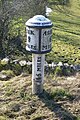 Milepost at SK 10004950.jpg 427 × 640; 102 KB
-
 Milepost at SK 11414872.jpg 427 × 640; 106 KB
-
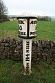
 Milepost beside the A523 - geograph.org.uk - 3334660.jpg 640 × 427; 65 KB
-
 Milepost beside the A523 - geograph.org.uk - 3334667.jpg 640 × 427; 75 KB
-
 Milepost beside the A523 - geograph.org.uk - 3334670.jpg 640 × 427; 76 KB
-
 Milepost on the A523 - geograph.org.uk - 2486396.jpg 640 × 427; 135 KB
-
 Milepost on the A523 - geograph.org.uk - 2486400.jpg 640 × 427; 141 KB
-
 Milepost on the A523 - geograph.org.uk - 2486402.jpg 640 × 427; 141 KB
-
 Milepost on the A523 - geograph.org.uk - 2888763.jpg 640 × 427; 94 KB
-
 Milepost on the A523 - geograph.org.uk - 2888775.jpg 640 × 427; 126 KB
-
 Milepost on the A523 - geograph.org.uk - 2888782.jpg 640 × 427; 94 KB
-
 Milepost on the A523 in Waterhouses - geograph.org.uk - 2576496.jpg 640 × 427; 121 KB
-
 Milepost on the A523 in Waterhouses - geograph.org.uk - 2576682.jpg 640 × 427; 134 KB
-
 Milepost on the A523 in Waterhouses - geograph.org.uk - 2576684.jpg 640 × 427; 136 KB
-
 Minor road to Waterfall - geograph.org.uk - 2286898.jpg 480 × 640; 86 KB
-
 Moorland near Cauldon Low - geograph.org.uk - 3553012.jpg 640 × 481; 313 KB
-
 Musden Grange Farm - geograph.org.uk - 4802460.jpg 5,468 × 3,645; 3.68 MB
-
 Musden Low Hillside towards Musden Wood - geograph.org.uk - 1951572.jpg 640 × 480; 142 KB
-
 Near to Waterhouses - geograph.org.uk - 5686868.jpg 2,000 × 1,333; 1.85 MB
-
 Nearing Rushley Barn - geograph.org.uk - 2356870.jpg 2,272 × 1,275; 521 KB
-
 Not a waterfall - geograph.org.uk - 225137.jpg 640 × 480; 146 KB
-
 Old farmstead - geograph.org.uk - 1706957.jpg 1,600 × 1,105; 397 KB
-

-

-
 Old Park Hill - geograph.org.uk - 5008222.jpg 5,184 × 3,325; 1.65 MB
-
 Old quarry and limekiln below Musden Low - geograph.org.uk - 5323445.jpg 1,280 × 960; 334 KB
-
 Old railway buildings at Waterhouse - geograph.org.uk - 5248954.jpg 1,167 × 1,458; 694 KB
-
 Old Stonyrock cottage - geograph.org.uk - 5849955.jpg 1,469 × 1,102; 739 KB
-
 On the lane by Milk Hill Cottage - geograph.org.uk - 5849952.jpg 1,402 × 1,052; 535 KB
-
 On the path to Calton above Manifold Valley - geograph.org.uk - 5233498.jpg 5,184 × 2,920; 5.15 MB
-
 Orchard Farm - geograph.org.uk - 1166396.jpg 640 × 479; 89 KB
-
 Over the top^ - geograph.org.uk - 470189.jpg 640 × 427; 137 KB
-
 Path through Musden Wood - geograph.org.uk - 3176981.jpg 640 × 480; 178 KB
-
 Peak ^ Northern Footpaths Society Sign No 460 - geograph.org.uk - 5601142.jpg 5,376 × 3,024; 6.44 MB
-

-
 Pick your path - geograph.org.uk - 2284904.jpg 640 × 480; 109 KB
-
 Pond, near Throwley Hall - geograph.org.uk - 2343530.jpg 640 × 427; 280 KB
-
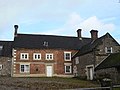
 Public road through Throwley Hall Farm - geograph.org.uk - 5565961.jpg 800 × 600; 121 KB
-
 Quarry crusher - geograph.org.uk - 1166404.jpg 640 × 479; 88 KB
-
 Railway bridge to Caldon Low Quarry - geograph.org.uk - 2137714.jpg 1,200 × 900; 242 KB
-
 Redmorlea Lower Barn - geograph.org.uk - 4749585.jpg 640 × 480; 88 KB
-
 Redway - geograph.org.uk - 5008200.jpg 5,184 × 3,456; 1.77 MB
-
 Redway Farm - geograph.org.uk - 3334649.jpg 427 × 640; 69 KB
-
 Return from Cauldon Low - geograph.org.uk - 2761287.jpg 1,024 × 768; 329 KB
-
 Right turn into Earlsway by the Old Crown Hotel - geograph.org.uk - 5849956.jpg 1,469 × 1,102; 513 KB
-
 River confluence - geograph.org.uk - 2286650.jpg 640 × 480; 129 KB
-
 River Hamps - geograph.org.uk - 2934290.jpg 427 × 640; 322 KB
-
 River Manifold below Ilam Hall - geograph.org.uk - 3852971.jpg 1,600 × 1,235; 606 KB
-
 River Manifold from Rushley Bridge - geograph.org.uk - 3265726.jpg 4,000 × 2,248; 2.43 MB
-
 River Manifold in Ilam Park - geograph.org.uk - 5582633.jpg 4,000 × 3,000; 4.83 MB
-
 Road through farm at Throwley Hall - geograph.org.uk - 5578696.jpg 5,376 × 3,024; 4.79 MB
-
 Rough grassland south of Willow House - geograph.org.uk - 2970056.jpg 1,024 × 768; 142 KB
-
 Ruinous farm at Upper Musden near Ilam - geograph.org.uk - 5233519.jpg 5,184 × 2,920; 5.97 MB
-
 Rushley - geograph.org.uk - 2343562.jpg 640 × 427; 248 KB
-
 Rushley from the road to Castern - geograph.org.uk - 2311416.jpg 640 × 427; 55 KB
-
 Sewage pumping station at Waterfall - geograph.org.uk - 2286705.jpg 480 × 640; 115 KB
-
 Sewage works by the Manifold Way - geograph.org.uk - 2284942.jpg 640 × 480; 136 KB
-
 Sheep above the Manifold Valley - geograph.org.uk - 4802501.jpg 6,000 × 4,000; 5.08 MB
-
 Sheep fold by Beeston Tor Farm - geograph.org.uk - 3103536.jpg 640 × 427; 77 KB
-
 Sheep fold by Beeston Tor Farm - geograph.org.uk - 3103557.jpg 640 × 427; 71 KB
-
 Sheep in the Manifold Valley - geograph.org.uk - 2392681.jpg 1,024 × 767; 219 KB
-
 Sheep Pasture, near Throwley Hall - geograph.org.uk - 2343533.jpg 640 × 427; 239 KB
-
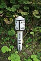
 Silver Jubilee Pillar, Manifold Track, Waterhouses - geograph.org.uk - 1917758.jpg 3,648 × 2,736; 2.09 MB
-
 Sports ground, Waterhouses - geograph.org.uk - 4175765.jpg 1,600 × 1,200; 607 KB
-
 Staffordshire moorlands near Willow House - geograph.org.uk - 2970060.jpg 1,024 × 768; 132 KB
-
 Stanton Dale Farm - geograph.org.uk - 5008068.jpg 5,076 × 2,788; 1.78 MB
-

-
 Start-End of the Cycle Trail - geograph.org.uk - 2315592.jpg 640 × 480; 92 KB
-
 Station House - geograph.org.uk - 2137768.jpg 1,200 × 900; 183 KB
-
 Stepping Stones, River Manifold - geograph.org.uk - 2934326.jpg 640 × 427; 316 KB
-
 Stop, end of running line, Cauldon Lowe - geograph.org.uk - 2969919.jpg 1,024 × 768; 262 KB
-
 Summit of Musden Low near Ilam - geograph.org.uk - 5233515.jpg 5,184 × 2,920; 5.98 MB
-
 Terraced houses at Stony Lane, Moorend - geograph.org.uk - 2966784.jpg 1,024 × 768; 164 KB
-
 Terraced houses on Stony Lane - geograph.org.uk - 4458833.jpg 4,320 × 3,240; 4.1 MB
-
 Terraces near Oldpark Hill - geograph.org.uk - 2934301.jpg 640 × 427; 258 KB
-
 The A523 - geograph.org.uk - 3334677.jpg 640 × 427; 60 KB
-
 The A523 out of Winkhill - geograph.org.uk - 6223746.jpg 1,600 × 1,067; 397 KB
-
 The back of the shack - geograph.org.uk - 1984822.jpg 3,072 × 2,304; 2.85 MB
-
 The Battle Stone beside the path - geograph.org.uk - 2309164.jpg 640 × 427; 84 KB
-
 The gateway leading to Blunder Cottage on Green Lane - geograph.org.uk - 4918383.jpg 3,648 × 2,048; 2.55 MB
-
 The Manifold Valley - geograph.org.uk - 4803631.jpg 6,000 × 4,000; 4.8 MB
-
 The Manifold Valley near Rushley - geograph.org.uk - 4802477.jpg 6,000 × 4,000; 4.68 MB
-
 The Manifold Way - geograph.org.uk - 2415892.jpg 1,024 × 768; 299 KB
-
 The Manifold Way - geograph.org.uk - 3334622.jpg 427 × 640; 88 KB
-
 The Manifold Way below Old Scholes Wood - geograph.org.uk - 2415995.jpg 1,024 × 768; 318 KB
-
 The Manifold Way just south of Hell Hole - geograph.org.uk - 5851108.jpg 1,469 × 1,102; 953 KB
-
 The Manifold Way NE of Old Soles Wood - geograph.org.uk - 5851729.jpg 1,142 × 857; 552 KB
-
 The Manifold Way near Lee House - geograph.org.uk - 5851106.jpg 1,469 × 1,102; 683 KB
-
 The Manifold Way near Sparrowlee Bridge - geograph.org.uk - 5851104.jpg 1,316 × 988; 658 KB
-
 The Manifold Way not far out of Waterhouses - geograph.org.uk - 5851101.jpg 1,469 × 1,102; 672 KB


