Category:Watford

town in Hertfordshire, England .jpg) Watford Town Hall  | |||||
| Upload media | |||||
| Instance of | |||||
|---|---|---|---|---|---|
| Location | Watford, Hertfordshire, East of England, England | ||||
| Population |
| ||||
| Area |
| ||||
| Elevation above sea level |
| ||||
| Different from | |||||
| official website | |||||
 | |||||
Subcategories
This category has the following 9 subcategories, out of 9 total.
A
C
E
G
H
P
S
T
Media in category "Watford"
The following 117 files are in this category, out of 117 total.
-
 A derelict clock tower - geograph.org.uk - 6277609.jpg 3,747 × 2,811; 1.75 MB
-
 A path through Cassiobury Park - geograph.org.uk - 6277665.jpg 4,000 × 3,000; 4.63 MB
-
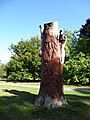
 A tree carving in Cassiobury Park - geograph.org.uk - 6277707.jpg 3,663 × 2,747; 2.06 MB
-
 A tree carving in Cassiobury Park - geograph.org.uk - 6277711.jpg 3,000 × 4,000; 4.19 MB
-
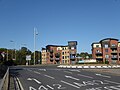
 A412 - geograph.org.uk - 6442180.jpg 1,024 × 684; 277 KB
-
 Apartments by the A412 - geograph.org.uk - 6442177.jpg 1,024 × 684; 181 KB
-
 Ascot Road - geograph.org.uk - 6271107.jpg 4,000 × 3,000; 4.69 MB
-
 Bandstand in Cassiobury Park - geograph.org.uk - 6271516.jpg 3,210 × 2,408; 1.7 MB
-
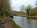
 Bridge 167 and lock 77, Grand Union Canal - geograph.org.uk - 6444387.jpg 1,024 × 768; 562 KB
-

-
 Car carrying narrow boat - geograph.org.uk - 6444390.jpg 1,024 × 768; 413 KB
-
 Carpenders Park Post Office.jpg 3,072 × 2,304; 1.41 MB
-
 Cassiobury Park - geograph.org.uk - 6442165.jpg 1,024 × 684; 359 KB
-
 Cassiobury Park Avenue (2) - geograph.org.uk - 6390121.jpg 1,024 × 768; 251 KB
-
 Cassiobury Park Avenue (2) - geograph.org.uk - 6390129.jpg 1,024 × 768; 255 KB
-
 Cassiobury Park Avenue - geograph.org.uk - 6390118.jpg 1,024 × 768; 190 KB
-
 Cassiobury Park Avenue - geograph.org.uk - 6390126.jpg 1,024 × 768; 271 KB
-
 Cassiobury Park Avenue - Rickmansworth Road - geograph.org.uk - 6390131.jpg 1,024 × 768; 266 KB
-
 Cassiobury Park Avenue, Swiss Avenue junction - geograph.org.uk - 6442147.jpg 1,024 × 684; 184 KB
-
 Church Car Park, Exchange Road - geograph.org.uk - 6391193.jpg 1,024 × 768; 150 KB
-

-

-

-

-
 Coal tax boundary post no.46, Water Lane - geograph.org.uk - 6394900.jpg 576 × 1,024; 177 KB
-

-

-

-

-

-

-
 Course, West Herts Golf Club - geograph.org.uk - 6444372.jpg 1,024 × 768; 291 KB
-
 Course, West Herts Golf Club - geograph.org.uk - 6444383.jpg 1,024 × 768; 287 KB
-
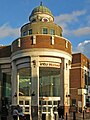
 Cupola with clock on intu Watford - geograph.org.uk - 6394644.jpg 1,024 × 768; 146 KB
-
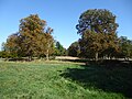
 First signs of Autumn in Cassiobury Park - geograph.org.uk - 6271513.jpg 3,869 × 2,901; 2.94 MB
-
 Footbridge over Ironbridge Lock - geograph.org.uk - 6277646.jpg 4,000 × 3,000; 4.64 MB
-
 Footbridge over River Gade, Cassiobury Park - geograph.org.uk - 6442167.jpg 1,024 × 684; 307 KB
-
 Gade Avenue - geograph.org.uk - 6442162.jpg 1,024 × 684; 241 KB
-
 Gade Avenue - geograph.org.uk - 6442163.jpg 1,024 × 684; 269 KB
-

-

-
 George V postbox, Whippendell Road - Park Avenue - geograph.org.uk - 6391167.jpg 576 × 1,024; 167 KB
-

-
 Golf course path - geograph.org.uk - 6444377.jpg 1,024 × 768; 663 KB
-
 Grand Union Canal - geograph.org.uk - 6444392.jpg 1,024 × 768; 434 KB
-
 High Street - New Street (2) - geograph.org.uk - 6393181.jpg 1,024 × 768; 203 KB
-
 High Street - New Street - geograph.org.uk - 6393179.jpg 1,024 × 768; 182 KB
-
 Into intu - geograph.org.uk - 6394647.jpg 768 × 1,024; 190 KB
-
 Ironbridge Lock - geograph.org.uk - 6277641.jpg 4,000 × 3,000; 4.86 MB
-
 Leavesden Aerodrome area from the air (geograph 5568998).jpg 600 × 922; 105 KB
-
 Marlborough Road - geograph.org.uk - 6391182.jpg 1,024 × 768; 235 KB
-
 MD Pharmacy, Whippendell Road - geograph.org.uk - 6391180.jpg 768 × 1,024; 171 KB
-
 Metropolitan Line Bridge - geograph.org.uk - 6442173.jpg 1,024 × 684; 278 KB
-
 Metropolitan Line Bridge, Gade Avenue - geograph.org.uk - 6442171.jpg 1,024 × 684; 161 KB
-
 Metropolitan Line Bridge, River Gade - geograph.org.uk - 6442172.jpg 684 × 1,024; 289 KB
-
 Mildred Avenue - geograph.org.uk - 6390138.jpg 1,024 × 768; 230 KB
-

-
 New Street - geograph.org.uk - 6393195.jpg 1,024 × 768; 185 KB
-
 New Street - High Street - geograph.org.uk - 6393198.jpg 768 × 1,024; 187 KB
-
 O'Neill's, Station Road - geograph.org.uk - 6396853.jpg 1,024 × 768; 207 KB
-
 Office block above Watford Junction station - geograph.org.uk - 6396850.jpg 1,024 × 768; 177 KB
-
 Park Avenue - geograph.org.uk - 6390134.jpg 1,024 × 768; 224 KB
-

-
 Path through Cassiobury Park - geograph.org.uk - 6277662.jpg 3,777 × 2,833; 2.62 MB
-
 Railway viaduct over the River Colne (2) - geograph.org.uk - 6395456.jpg 1,024 × 768; 310 KB
-
 Railway viaduct over the River Colne - geograph.org.uk - 6395450.jpg 1,024 × 768; 365 KB
-
 Recreation ground by the River Colne - geograph.org.uk - 6395453.jpg 1,024 × 768; 326 KB
-
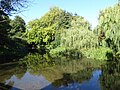
 Reflections in the Grand Union Canal - geograph.org.uk - 6271290.jpg 4,000 × 3,000; 4.85 MB
-
 Reflections in the Grand Union Canal - geograph.org.uk - 6277636.jpg 3,837 × 2,879; 2.7 MB
-
 Reflections in the River Gade - geograph.org.uk - 6277654.jpg 4,000 × 3,000; 4.68 MB
-
 River Gade - geograph.org.uk - 6442168.jpg 1,024 × 684; 277 KB
-
 River Gade - geograph.org.uk - 6442169.jpg 1,024 × 684; 341 KB
-
 River Gade - geograph.org.uk - 6442174.jpg 1,024 × 684; 350 KB
-
 River Gade - geograph.org.uk - 6444785.jpg 1,024 × 768; 498 KB
-
 River Gade hidden in trees - geograph.org.uk - 6442179.jpg 1,024 × 685; 295 KB
-
 Roundabout, A412 - geograph.org.uk - 6442178.jpg 1,024 × 588; 133 KB
-

-

-
 Swiss Avenue - geograph.org.uk - 6442148.jpg 1,024 × 684; 161 KB
-
 Swiss Avenue - geograph.org.uk - 6442150.jpg 1,024 × 684; 165 KB
-
 Swiss Avenue, Gade Avenue junction - geograph.org.uk - 6442160.jpg 1,024 × 685; 173 KB
-

-

-

-
 The Bandstand in Cassiobury Park - geograph.org.uk - 6277703.jpg 3,869 × 2,901; 2.07 MB
-
 The beginning of autumn in Cassiobury Park - geograph.org.uk - 6277659.jpg 4,000 × 3,000; 4.46 MB
-

-

-

-
 The Moon Under The Water on High Street - geograph.org.uk - 6347888.jpg 2,700 × 2,025; 507 KB
-
 The River Colne by Stephenson Way (2) - geograph.org.uk - 6396821.jpg 1,024 × 768; 432 KB
-
 The River Colne by Stephenson Way - geograph.org.uk - 6396817.jpg 1,024 × 768; 342 KB
-
 The River Colne by Stephenson Way - geograph.org.uk - 6396825.jpg 1,024 × 768; 368 KB
-
 The River Colne north of Link Road - geograph.org.uk - 6396831.jpg 1,024 × 768; 312 KB
-
 The River Colne north of the A411 bridge (2) - geograph.org.uk - 6394939.jpg 1,024 × 768; 411 KB
-
 The River Colne north of the A411 bridge - geograph.org.uk - 6394936.jpg 1,024 × 768; 404 KB
-
 The River Colne north of Water Lane - geograph.org.uk - 6394655.jpg 1,024 × 768; 245 KB
-
 The River Colne south of Link Road - geograph.org.uk - 6396828.jpg 1,024 × 768; 312 KB
-
 The River Colne south of Water Lane - geograph.org.uk - 6394653.jpg 1,024 × 768; 351 KB
-
 The River Colne underneath the A411 bridge - geograph.org.uk - 6394934.jpg 1,024 × 768; 194 KB
-

-

-
 Water Lane (2) - geograph.org.uk - 6394651.jpg 1,024 × 768; 203 KB
-
 Water Lane (3) - geograph.org.uk - 6394920.jpg 1,024 × 768; 384 KB
-
 Water Lane (4) - geograph.org.uk - 6394929.jpg 1,024 × 768; 371 KB
-
 Water Lane (5) - geograph.org.uk - 6394932.jpg 1,024 × 768; 362 KB
-
 Water Lane - geograph.org.uk - 6394649.jpg 1,024 × 768; 196 KB
-
 Watford Borough Council 2018.svg 360 × 185; 2 KB
-
 Watford tube station - entrance building - geograph.org.uk - 6389447.jpg 1,024 × 768; 217 KB
-
 Watford UK ward map 2018.svg 990 × 1,266; 168 KB
-
 Watford UK ward map 2019.svg 990 × 1,266; 168 KB
-
 Watford UK ward map 2023.svg 990 × 1,266; 168 KB
-
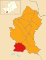 Watford UK ward map 2024.svg 990 × 1,266; 168 KB
-
 Watford.JPG 256 × 331; 25 KB
-
 WatfordSkyline.jpg 1,593 × 295; 314 KB
-
 Whippendell Road - Park Avenue - geograph.org.uk - 6391177.jpg 1,024 × 768; 184 KB
-
 Woodland by The River Colne - geograph.org.uk - 6396818.jpg 1,024 × 768; 363 KB


_-_geograph.org.uk_-_6390121.jpg)
_-_geograph.org.uk_-_6390129.jpg)


_-_geograph.org.uk_-_6393181.jpg)


.jpg)


_-_geograph.org.uk_-_6395456.jpg)


.jpg)
.jpg)
.jpg)


_-_geograph.org.uk_-_6396821.jpg)


_-_geograph.org.uk_-_6394939.jpg)


_-_geograph.org.uk_-_6394651.jpg)
_-_geograph.org.uk_-_6394920.jpg)
_-_geograph.org.uk_-_6394929.jpg)
_-_geograph.org.uk_-_6394932.jpg)


