Category:Watlowes Valley
Media in category "Watlowes Valley"
The following 10 files are in this category, out of 10 total.
-
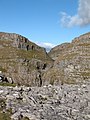 'Dry Waterfall' at Comb Scar - geograph.org.uk - 1175935.jpg 480 × 640; 102 KB
-
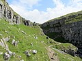
 Cave in valley above the dry waterfall - geograph.org.uk - 1095712.jpg 451 × 640; 134 KB
-
 Descending Comb Hill on the Pennine Way - geograph.org.uk - 6309964.jpg 6,000 × 4,000; 6.07 MB
-
 Pennine Way above Watlowes Valley - geograph.org.uk - 2467010.jpg 4,320 × 3,240; 5.78 MB
-
 Pennine Way below Comb Hill - geograph.org.uk - 2467017.jpg 4,320 × 3,240; 3.99 MB
-
 Pennine Way, Watlowes Dry Valley - geograph.org.uk - 4572915.jpg 640 × 426; 113 KB
-
 Pennine Way, Watlowes Dry Valley - geograph.org.uk - 4572916.jpg 640 × 426; 90 KB
-
 Pennine Way, Watlowes Dry Valley - geograph.org.uk - 4572920.jpg 640 × 426; 76 KB
-
 The Pennine Way heads for Malham Cove - geograph.org.uk - 3562148.jpg 1,600 × 1,200; 480 KB
-
 The Pennine Way traverses Ing Scar - geograph.org.uk - 2219380.jpg 1,600 × 1,198; 646 KB


