Category:Wauldby
English: Wauldby is a hamlet in the civil parish of Welton in East Riding of Yorkshire, England. It is situated approximately 2 miles (3.2 km) north of Welton and 3 miles (4.8 km) west of Willerby.
human settlement in United Kingdom  | |||||
| Upload media | |||||
| Instance of | |||||
|---|---|---|---|---|---|
| Location |
| ||||
 | |||||
Subcategories
This category has the following 7 subcategories, out of 7 total.
F
- Fox Covert, Wauldby (7 F)
L
- Littlefield Plantation (4 F)
- Long Plantation, Brantingham (6 F)
N
- Nut Wood and Wauldby Scrogs (19 F)
T
- Tom Potts' Plantation (4 F)
W
Media in category "Wauldby"
The following 135 files are in this category, out of 135 total.
-
 A footpath near Wauldby Manor Farm - geograph.org.uk - 565028.jpg 640 × 480; 128 KB
-
 A typical Yorkshire Wolds field - geograph.org.uk - 649950.jpg 640 × 480; 96 KB
-
 A Yorkshire Wolds Bridleway - geograph.org.uk - 649949.jpg 640 × 480; 61 KB
-
 A Yorkshire Wolds farm track - geograph.org.uk - 649951.jpg 640 × 480; 82 KB
-
 A Yorkshire Wolds' Bridleway - geograph.org.uk - 565030.jpg 640 × 480; 104 KB
-
 A Yorkshire Wolds' Bridleway - geograph.org.uk - 565034.jpg 640 × 480; 78 KB
-
 Approaching Turtle Hill - geograph.org.uk - 1368461.jpg 640 × 480; 97 KB
-
 Beech tree at Little Wauldby Farm (geograph 4188331).jpg 1,024 × 768; 242 KB
-
 Beech tree, Turtle Hill, Yorkshire Wolds Way (geograph 4860879).jpg 640 × 427; 90 KB
-
 Bottom Plantation (geograph 5952246).jpg 1,024 × 768; 332 KB
-
 Bridleway and gate at Little Wauldby Farm (geograph 4188337).jpg 1,024 × 768; 254 KB
-
 Bridleway at Little Wauldby Farm (geograph 5220654).jpg 1,200 × 772; 387 KB
-
 Bridleway at Little Wauldby Farm (geograph 6686500).jpg 1,600 × 1,065; 549 KB
-
 Bridleway at Wauldby Manor Farm (geograph 6686462).jpg 1,600 × 1,065; 507 KB
-
 Bridleway at Wauldby Scrogs (geograph 6686511).jpg 1,600 × 1,065; 719 KB
-
 Bridleway near Little Wauldby (geograph 5656055).jpg 640 × 480; 81 KB
-
 Bridleway near Wauldby Manor Farm (geograph 4188358).jpg 1,024 × 768; 146 KB
-
 Bridleway to Elloughton - geograph.org.uk - 121540.jpg 640 × 480; 180 KB
-
 Bridleway to Nut Wood - geograph.org.uk - 579772.jpg 640 × 480; 85 KB
-
 Bridleway to Raywell (geograph 4188382).jpg 1,024 × 768; 146 KB
-
 Bridleway to Wauldby Manor Farm - geograph.org.uk - 579771.jpg 640 × 480; 83 KB
-
 Bridleway towards Little Wauldby Farm (geograph 6686484).jpg 1,600 × 1,065; 529 KB
-
 Bridleway towards Turtle Hill (geograph 6686529).jpg 1,600 × 1,065; 575 KB
-
 Bridleways are for horses, not cars or 4x4s (geograph 4342441).jpg 4,000 × 2,248; 5.47 MB
-
 By Braffords Clump with Fox Covert to left horizon (geograph 4342491).jpg 4,000 × 2,248; 5.74 MB
-
 By Skiftings Clump - geograph.org.uk - 677275.jpg 640 × 480; 208 KB
-
 Cattle feeding (geograph 4188376).jpg 1,024 × 768; 276 KB
-
 Cereal Crop - geograph.org.uk - 208515.jpg 427 × 640; 108 KB
-
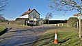
 Cottages near Wauldby Manor Farm - geograph.org.uk - 1368528.jpg 640 × 480; 110 KB
-
 Crossed Wires II - geograph.org.uk - 566910.jpg 640 × 458; 152 KB
-
 Descending Turtle Hill (geograph 4380789).jpg 4,000 × 2,248; 2.5 MB
-
 Dropping down into Elloughton Dale (geograph 4505264).jpg 640 × 427; 50 KB
-
 Elloughton Dale (geograph 5681321).jpg 640 × 454; 124 KB
-
 Elloughton Dale (geograph 6298795).jpg 1,024 × 708; 879 KB
-
 Elloughton Dale - geograph.org.uk - 126591.jpg 640 × 480; 159 KB
-
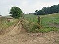
 Entrance to the track to Brantingham (geograph 4505226).jpg 640 × 427; 80 KB
-
 Fantastic Farm Flowerbed - geograph.org.uk - 788679.jpg 640 × 480; 112 KB
-
 Farm Track and public footpath - geograph.org.uk - 126580.jpg 640 × 480; 87 KB
-
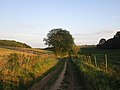
 Farm track towards Turtle Hill (geograph 5254233).jpg 1,200 × 799; 388 KB
-
 Farmland near Little Wauldby Farm - geograph.org.uk - 1733620.jpg 800 × 600; 145 KB
-
 Finger boards and old gate post, Turtle Hill (geograph 4860871).jpg 640 × 427; 61 KB
-
 Footpath crossroads - geograph.org.uk - 688198.jpg 640 × 480; 144 KB
-
 Footpath Crossroads in Elloughton Dale (geograph 4880347).jpg 4,608 × 3,456; 3.49 MB
-
 Footpath on High Hunsley Circuit (geograph 4380757).jpg 4,000 × 2,248; 7.74 MB
-
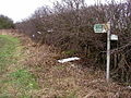
 Footpath signpost near Wauldby Manor Farm (geograph 4383735).jpg 800 × 533; 115 KB
-
 Fox Covert and Braffords Clump - geograph.org.uk - 1368584.jpg 640 × 480; 87 KB
-

-
 From the Wauldby Green Bridleway - geograph.org.uk - 565065.jpg 640 × 480; 96 KB
-
 Hedge trimming near Little Wauldby Farm (geograph 6686490).jpg 1,600 × 1,065; 484 KB
-
 High Hunsley Circuit.jpg 480 × 640; 149 KB
-

-

-
-
-
 Lightning Tree - geograph.org.uk - 565084.jpg 480 × 640; 84 KB
-
 Lightning Tree Stump at Turtle Hill - geograph.org.uk - 649954.jpg 480 × 640; 65 KB
-
 Lightning Trees in the low winter sun - geograph.org.uk - 649953.jpg 640 × 480; 72 KB
-
 Lightning-struck tree at Wauldby - geograph.org.uk - 9574.jpg 480 × 640; 50 KB
-
 Little Wauldby Farm (geograph 4188346).jpg 1,024 × 768; 145 KB
-
 Little Wauldby Farm - geograph.org.uk - 791024.jpg 640 × 443; 244 KB
-
 Little Wauldby Farm, Welton - geograph.org.uk - 283498.jpg 640 × 480; 131 KB
-
 Long Plantation - geograph.org.uk - 675287.jpg 517 × 640; 169 KB
-
 Looking towards Brafford's Clump - geograph.org.uk - 565080.jpg 640 × 424; 82 KB
-

-
 Minor road into Elloughton Dale (geograph 4781121).jpg 4,608 × 3,456; 7.73 MB
-
 Minor Road to Little Wauldby Farm - geograph.org.uk - 1733621.jpg 800 × 600; 99 KB
-
 Mole hills and sheep, Wauldby Green (geograph 4860883).jpg 640 × 427; 54 KB
-
 Near Wauldby Manor Farm - geograph.org.uk - 691597.jpg 640 × 438; 168 KB
-
 Near Wauldby Scrogs - geograph.org.uk - 1368486.jpg 640 × 480; 88 KB
-
 Near Welton Top - geograph.org.uk - 691622.jpg 640 × 480; 188 KB
-

-
 On the 'Beverley 20' Path - geograph.org.uk - 565025.jpg 640 × 480; 162 KB
-
 On the track to Welton - geograph.org.uk - 565087.jpg 640 × 480; 122 KB
-
 Panoramic view across to Wauldby Green - geograph.org.uk - 1368645.jpg 640 × 480; 108 KB
-
 Pastoral scene near Braffords Clump - geograph.org.uk - 1368475.jpg 640 × 455; 83 KB
-
 Path by Nut Wood (geograph 6430947).jpg 1,024 × 768; 211 KB
-
 Path near Braffords Clump (geograph 6686523).jpg 1,600 × 1,065; 597 KB
-
 Path near Wauldby Manor Farm (geograph 6686414).jpg 1,600 × 1,065; 805 KB
-
 Path towards Wauldby Manor (geograph 6686407).jpg 1,600 × 1,065; 499 KB
-
 Paths cross in Wauldby Gates Plantation (geograph 4380747).jpg 4,000 × 2,248; 7.16 MB
-

-
 Snails in the trees - geograph.org.uk - 1285334.jpg 427 × 640; 241 KB
-
 Snowdrops in the wood - geograph.org.uk - 668046.jpg 475 × 633; 210 KB
-
 South Wold , near Elloughton Dale - geograph.org.uk - 675280.jpg 480 × 640; 172 KB
-
 Southern Yorkshire Wolds' Bridleway - geograph.org.uk - 565040.jpg 640 × 480; 113 KB
-
 Spout Hill track (geograph 4380803).jpg 4,000 × 2,248; 2.32 MB
-
 The bridleway from Wauldby Green - geograph.org.uk - 565074.jpg 640 × 480; 109 KB
-
 The bridleway to Wauldby Green - geograph.org.uk - 565071.jpg 640 × 480; 130 KB
-
 The Footpath to Wauldby Farm - geograph.org.uk - 788675.jpg 480 × 640; 128 KB
-
 The Willerby to Welton road - geograph.org.uk - 121543.jpg 640 × 364; 67 KB
-
 The Willerby to Welton road - geograph.org.uk - 121545.jpg 640 × 343; 46 KB
-
 The Wolds Way - geograph.org.uk - 579770.jpg 640 × 480; 92 KB
-
 The Wolds Way above Wauldby - geograph.org.uk - 807274.jpg 640 × 621; 295 KB
-
 The Wolds Way near Bottom Plantation - geograph.org.uk - 713882.jpg 640 × 480; 102 KB
-
 The Wolds Way near Wauldby Manor Farm - geograph.org.uk - 807259.jpg 640 × 326; 169 KB
-
 The Yorkshire Wolds Way below Turtle Hill (geograph 4383728).jpg 800 × 533; 171 KB
-
 There are some lovely walks near Wauldby.... (geograph 4342428).jpg 3,966 × 2,188; 6.57 MB
-
 There may be a pond in there somewhere (geograph 5952241).jpg 1,024 × 768; 145 KB
-

-
 Towards Melton Bottom - geograph.org.uk - 668254.jpg 640 × 480; 180 KB
-
 Towards Tom Potts' Plantation - geograph.org.uk - 668246.jpg 640 × 464; 187 KB
-
 Track on Turtle Hill. (geograph 3553284).jpg 640 × 381; 55 KB
-
 Track to Little Wauldby Farm (geograph 5952242).jpg 1,024 × 768; 185 KB
-
 Track towards Wauldby Scrogs and Nut Wood (geograph 4342448).jpg 3,890 × 2,026; 5.14 MB
-
 Tree arch over the bridleway near Wauldby Scrogs (geograph 4860887).jpg 640 × 427; 107 KB
-
 Tree lined road through Elloughton Dale (geograph 4781112).jpg 4,518 × 3,334; 7.27 MB
-
 Trees at Turtle Hill - geograph.org.uk - 788681.jpg 480 × 640; 118 KB
-
 Turtle Hill Trees - geograph.org.uk - 788893.jpg 640 × 609; 135 KB
-
 Turtle Hill, Wauldby - geograph.org.uk - 624327.jpg 640 × 463; 102 KB
-
 Turtle Hill, Wauldby - geograph.org.uk - 624329.jpg 640 × 467; 108 KB
-
 Turtle Hill, Wauldby - geograph.org.uk - 624332.jpg 461 × 640; 84 KB
-

-
 View towards Hull - geograph.org.uk - 133313.jpg 640 × 480; 99 KB
-
 Walkers on course of Beverley 20 (geograph 4380794).jpg 4,000 × 2,248; 1.58 MB
-

-
 Wauldby - aerial 2015 (geograph 4609986).jpg 640 × 427; 63 KB
-
 Wauldby Gates Plantation - geograph.org.uk - 623808.jpg 640 × 451; 145 KB
-
 Wauldby Green - geograph.org.uk - 1368614.jpg 640 × 480; 77 KB
-
 Wauldby Green - geograph.org.uk - 624328.jpg 640 × 373; 55 KB
-
 Wauldby Scrogs? (geograph 4342472).jpg 3,908 × 2,068; 5.16 MB
-
 Welton Wold - geograph.org.uk - 283499.jpg 480 × 640; 173 KB
-
 Wind break near Wauldby Manor Farm (geograph 4342961).jpg 640 × 360; 70 KB
-
 Wold's Farm Road and Bridleway - geograph.org.uk - 565042.jpg 640 × 480; 127 KB
-
 Wolds Bridleway - geograph.org.uk - 126593.jpg 640 × 480; 180 KB
-
 Wolds Way - geograph.org.uk - 675261.jpg 480 × 640; 192 KB
-
 Wolds Way and Beverley 20 track (geograph 5681322).jpg 640 × 480; 89 KB
-
 Wolds' Bridleway - geograph.org.uk - 565052.jpg 640 × 480; 79 KB
-
 Wolds' farm Track - geograph.org.uk - 565046.jpg 640 × 480; 99 KB
-
 Woodland near Wauldby Manor - geograph.org.uk - 565090.jpg 640 × 480; 118 KB
-
 Woodland path on the High Hunsley Circuit (geograph 4383759).jpg 533 × 800; 205 KB
-
 Yorkshire Wolds Way (geograph 6156211).jpg 1,024 × 683; 260 KB
-
 Yorkshire Wolds Way at Bottom Plantation (geograph 6686380).jpg 1,600 × 1,071; 925 KB
-
 Yorkshire Wolds Way at Elloughton Dale (geograph 6686333).jpg 1,600 × 1,065; 785 KB
-
 Yorkshire Wolds Way at Turtle Hill (geograph 4342501).jpg 4,000 × 2,248; 6.26 MB
-
 Yorkshire Wolds Way fingerpost at Turtle Hill (geograph 6686388).jpg 1,065 × 1,600; 688 KB


.jpg)
.jpg)
.jpg)
.jpg)
.jpg)
.jpg)
.jpg)
.jpg)
.jpg)
.jpg)


.jpg)

.jpg)
.jpg)
.jpg)
.jpg)

.jpg)


.jpg)
.jpg)
.jpg)
.jpg)

.jpg)


.jpg)

.jpg)

.jpg)
.jpg)
.jpg)


.jpg)

.jpg)
.jpg)
.jpg)
.jpg)


.jpg)


.jpg)
.jpg)

.jpg)


.jpg)


.jpg)
.jpg)
.jpg)
.jpg)
.jpg)
.jpg)


.jpg)


.jpg)
.jpg)
.jpg)
.jpg)


.jpg)
.jpg)
.jpg)
.jpg)
.jpg)


.jpg)

.jpg)

.jpg)


.jpg)

.jpg)


.jpg)


.jpg)
.jpg)
.jpg)
.jpg)
.jpg)
.jpg)