Category:Wealdway
Long-distance footpath in Kent and East Sussex | |||||
| Upload media | |||||
| Location |
| ||||
|---|---|---|---|---|---|
 | |||||
Main Wikipedia article: Wealdway.

Media in category "Wealdway"
The following 200 files are in this category, out of 281 total.
(previous page) (next page)-
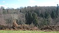
 A stand of conifers by the Wealdway - geograph.org.uk - 1584500.jpg 640 × 430; 210 KB
-

-

-

-
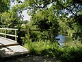
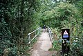 Bridge by the River Medway, The Wealdway - geograph.org.uk - 1502002.jpg 640 × 430; 198 KB
-

-
 Burrs Wood - geograph.org.uk - 1735395.jpg 3,072 × 1,728; 1.67 MB
-
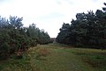 Conifers line the Wealdway - geograph.org.uk - 1584462.jpg 640 × 430; 124 KB
-
 Conifers line the Wealdway - geograph.org.uk - 1584479.jpg 640 × 430; 128 KB
-
 Coombe Hill - geograph.org.uk - 2709481 - cropped.jpg 6,943 × 2,637; 3.96 MB
-
 Coombe Hill - geograph.org.uk - 2709481.jpg 12,943 × 2,637; 7.49 MB
-
 Coppicing in Shipbourne Forest - geograph.org.uk - 1200049.jpg 640 × 481; 123 KB
-
 Crossover in Long Distance pathways - geograph.org.uk - 1165027.jpg 640 × 481; 80 KB
-
 Crowhurst Oast on Wealdway - geograph.org.uk - 1201920.jpg 640 × 481; 88 KB
-
 Diverted Wealdway on Wrotham Road - geograph.org.uk - 1112161.jpg 481 × 640; 48 KB
-
 Farm Track and Wealdway Footpath - geograph.org.uk - 925843.jpg 640 × 480; 80 KB
-
 Field near Endlewick Farm, Arlington - geograph.org.uk - 866735.jpg 640 × 480; 142 KB
-

-

-
 Fishpond Farm from the Weald Way - geograph.org.uk - 1275998.jpg 640 × 430; 61 KB
-
 Fishpond Farm seen from the Wealdway - geograph.org.uk - 1519399.jpg 640 × 337; 53 KB
-
 Follow the sign, Weald Way - geograph.org.uk - 1276002.jpg 640 × 430; 141 KB
-
 Footbridge across the River Medway - geograph.org.uk - 1585990.jpg 640 × 430; 143 KB
-
 Footbridge for the Weald Way - geograph.org.uk - 215299.jpg 640 × 480; 320 KB
-
 Footbridge on the Kent and Sussex Border - geograph.org.uk - 1735498.jpg 3,072 × 2,304; 1.86 MB
-
 Footbridge on the Wealdway - geograph.org.uk - 1391381.jpg 640 × 430; 127 KB
-
 Footbridge on the Wealdway - geograph.org.uk - 1391397.jpg 640 × 430; 128 KB
-
 Footpath crosses Hanson Quarry entrance - geograph.org.uk - 1177008.jpg 640 × 481; 133 KB
-
 Footpath junction in Valley Wood - geograph.org.uk - 1196249.jpg 640 × 481; 142 KB
-
 Footpath junction in White Horse Wood - geograph.org.uk - 1164817.jpg 640 × 481; 134 KB
-
 Footpath junction near Luddesdown - geograph.org.uk - 1118218.jpg 640 × 481; 131 KB
-
 Footpath Junction Near Luddesdown - geograph.org.uk - 925824.jpg 640 × 480; 76 KB
-
 Footpath junction on Wealdway - geograph.org.uk - 1200042.jpg 640 × 481; 149 KB
-
 Footpath junction on Wealdway - geograph.org.uk - 1200053.jpg 640 × 481; 150 KB
-

-
 Footpath sign at Tonbridge and Malling, Kent.jpg 480 × 640; 104 KB
-
 Footpath to Jevington - geograph.org.uk - 1135073.jpg 480 × 640; 52 KB
-

-
 Friendship Bridge, Haysden Country Park - geograph.org.uk - 1527333.jpg 640 × 430; 167 KB
-

-

-
 Gate on the Wealdway, Hurst Wood - geograph.org.uk - 1571765.jpg 640 × 430; 199 KB
-

-

-
 High Weald Way crosses a small stream - geograph.org.uk - 1104198.jpg 640 × 430; 140 KB
-
 High Weald Way near Tutty Farm. - geograph.org.uk - 1056447.jpg 430 × 640; 125 KB
-
 High Weald Way through High Wood - geograph.org.uk - 1056378.jpg 430 × 640; 130 KB
-
 High Weald Way through the woods - geograph.org.uk - 1056474.jpg 640 × 430; 146 KB
-

-

-
 Kissing gate and gate on the Wealdway near Burrs Wood - geograph.org.uk - 1735420.jpg 3,072 × 1,728; 1.42 MB
-
 Kissing gate on the Wealdway - geograph.org.uk - 1670833.jpg 640 × 430; 161 KB
-
 Kissing gate on the Wealdway - geograph.org.uk - 1670851.jpg 640 × 430; 158 KB
-
 Kissing Gate on the Wealdway - geograph.org.uk - 1735388.jpg 3,072 × 2,304; 2.92 MB
-

-
 Kissing Gate on Wealdway near Farm - geograph.org.uk - 1119463.jpg 640 × 481; 146 KB
-
 Lake in Grove Farm - geograph.org.uk - 1202653.jpg 640 × 481; 115 KB
-

-

-

-
 M20 underpass, Addington.jpg 5,152 × 3,864; 4.35 MB
-
 Not the Weald Way Footpath ^^^ - geograph.org.uk - 1301324.jpg 640 × 480; 108 KB
-

-
 Path off the Wealdway - geograph.org.uk - 1586921.jpg 640 × 430; 86 KB
-
 Peckham Place Farm Oast on Wealdway - geograph.org.uk - 1201950.jpg 640 × 481; 85 KB
-
 Pillbox by the Wealdway - geograph.org.uk - 1502056.jpg 640 × 430; 131 KB
-
 Promenade on the Wealdway - geograph.org.uk - 1396101.jpg 640 × 480; 88 KB
-
 Railway bridge over the long distance paths - geograph.org.uk - 1735492.jpg 3,072 × 2,304; 2.55 MB
-
 Railway bridge over two long distance paths - geograph.org.uk - 1735495.jpg 3,072 × 2,304; 2.49 MB
-
 Railway bridge over Wealdway - geograph.org.uk - 1196254.jpg 640 × 481; 137 KB
-
 River Medway near Tonbridge - geograph.org.uk - 175027.jpg 640 × 480; 93 KB
-
 Rugby Pitch by The Wealdway - geograph.org.uk - 1501983.jpg 640 × 430; 112 KB
-
 Rugby posts by the Wealdway - geograph.org.uk - 1199705.jpg 640 × 430; 72 KB
-
 Signpost on the Wealdway - geograph.org.uk - 1586910.jpg 640 × 430; 85 KB
-

-
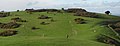
 Small footbridge in golf course - geograph.org.uk - 1196238.jpg 640 × 481; 92 KB
-
 Small footbridge on the Wealdway - geograph.org.uk - 1670835.jpg 640 × 430; 159 KB
-
 Snow covered field by the Wealdway - geograph.org.uk - 1670861.jpg 640 × 430; 103 KB
-
 Steep climb on the Wealdway - geograph.org.uk - 1735483.jpg 3,072 × 2,304; 2.16 MB
-
 Stile and gate on the Wealdway - geograph.org.uk - 1585985.jpg 640 × 430; 166 KB
-
 Stile and gate on the Wealdway - geograph.org.uk - 1735481.jpg 3,072 × 2,304; 2.45 MB
-

-
 Stile near Little Clayton's Wood - geograph.org.uk - 1735592.jpg 3,072 × 2,304; 2.37 MB
-
 Stile on a diversion of the Wealdway - geograph.org.uk - 1585016.jpg 640 × 430; 174 KB
-
 Stile on the High Weald Way - geograph.org.uk - 1056459.jpg 640 × 430; 136 KB
-
 Stile on the Wealdway - geograph.org.uk - 1585970.jpg 640 × 430; 129 KB
-
 Stile on the Wealdway - geograph.org.uk - 1586658.jpg 640 × 430; 121 KB
-

-
 Stile on the Wealdway west of Speldhurst - geograph.org.uk - 1151214.jpg 640 × 430; 144 KB
-
 Stile on Wealdway - geograph.org.uk - 1101851.jpg 481 × 640; 129 KB
-
 Stiles on the Wealdway near Claytons Wood - geograph.org.uk - 1735485.jpg 3,072 × 2,304; 3.14 MB
-
 Stream near Great Streele Farm - geograph.org.uk - 1751338.jpg 428 × 640; 162 KB
-
 Subway under M20 Motorway - geograph.org.uk - 1176987.jpg 640 × 481; 89 KB
-

-

-

-
 The Finches from the Weald Way - geograph.org.uk - 1276008.jpg 640 × 430; 81 KB
-
 The High Weald Way near Rusthall - geograph.org.uk - 1047563.jpg 640 × 430; 132 KB
-
 The High Weald Way near Rusthall - geograph.org.uk - 1047570.jpg 640 × 430; 123 KB
-

-

-

-

-

-
-

-

-

-

-

-
 The Wealdway - geograph.org.uk - 1391327.jpg 640 × 430; 107 KB
-
 The Wealdway - geograph.org.uk - 1391330.jpg 640 × 430; 121 KB
-
 The Wealdway - geograph.org.uk - 1391335.jpg 640 × 430; 80 KB
-
 The Wealdway - geograph.org.uk - 1584452.jpg 640 × 430; 130 KB
-
 The Wealdway - geograph.org.uk - 1757571.jpg 1,704 × 2,272; 3.16 MB
-

-

-
-

-

-

-

-

-
 The Wealdway at Stone Cross - geograph.org.uk - 1550375.jpg 640 × 430; 213 KB
-
 The Wealdway by the River Medway - geograph.org.uk - 1502068.jpg 640 × 430; 119 KB
-
 The Wealdway by the River Medway - geograph.org.uk - 1502098.jpg 640 × 430; 119 KB
-
 The Wealdway by the River Medway - geograph.org.uk - 1502105.jpg 640 × 430; 107 KB
-
 The Wealdway crosses Ford Lane - geograph.org.uk - 1178152.jpg 640 × 481; 121 KB
-
 The Wealdway crosses Swanton Road - geograph.org.uk - 1202695.jpg 640 × 481; 123 KB
-
 The Wealdway crosses the River Medway - geograph.org.uk - 1502582.jpg 640 × 430; 164 KB
-

-

-

-

-

-

-
 The Wealdway heading north from Withyham - geograph.org.uk - 1585981.jpg 640 × 430; 122 KB
-

-
 The Wealdway heading towards Stone Cross - geograph.org.uk - 1735407.jpg 3,072 × 2,304; 1.93 MB
-
 The Wealdway heading towards the Kent-Sussex Border - geograph.org.uk - 1735413.jpg 3,072 × 2,304; 1.72 MB
-
 The Wealdway heading towards Withyham - geograph.org.uk - 1585528.jpg 640 × 430; 178 KB
-
 The Wealdway heading towards Withyham - geograph.org.uk - 1585543.jpg 640 × 430; 161 KB
-

-

-
 The Wealdway in Five Hundred Acre Wood - geograph.org.uk - 1584577.jpg 640 × 430; 184 KB
-
 The Wealdway in Five Hundred Acre Wood - geograph.org.uk - 1584984.jpg 640 × 430; 194 KB
-
 The Wealdway in Haysden Country Park - geograph.org.uk - 1526662.jpg 640 × 430; 208 KB
-
 The Wealdway Information Board - geograph.org.uk - 1344768.jpg 640 × 480; 90 KB
-
 The Wealdway joins the Greensand Way - geograph.org.uk - 1202683.jpg 640 × 481; 118 KB
-
 The Wealdway joins The Greensand Way - geograph.org.uk - 1358689.jpg 640 × 430; 149 KB
-
 The Wealdway meest The Greensand Way - geograph.org.uk - 1202658.jpg 640 × 481; 96 KB
-
 The Wealdway meets the Pilgrim's Way - geograph.org.uk - 1165052.jpg 640 × 481; 141 KB
-
 The Wealdway near Burrs Wood - geograph.org.uk - 1735433.jpg 3,072 × 2,304; 1.75 MB
-
 The Wealdway off The Lane - geograph.org.uk - 1549167.jpg 640 × 430; 191 KB
-
 The Wealdway off The Lane - geograph.org.uk - 1549176.jpg 640 × 430; 166 KB
-
 The Wealdway on Ashdown Forest - geograph.org.uk - 1584495.jpg 640 × 430; 121 KB
-
 The Wealdway on Ashdown Forest - geograph.org.uk - 1584508.jpg 640 × 430; 120 KB
-
 The Wealdway on Ashdown Forest - geograph.org.uk - 1584548.jpg 640 × 430; 134 KB
-

-
 The Wealdway on the right - geograph.org.uk - 1584571.jpg 640 × 430; 184 KB
-
 The Wealdway on top of Ashdown Forest - geograph.org.uk - 1584446.jpg 640 × 430; 116 KB
-
 The Wealdway reaches Gover Hill - geograph.org.uk - 1202687.jpg 640 × 481; 106 KB
-

-

-

-
 The Wealdway turns at this point - geograph.org.uk - 1201954.jpg 640 × 481; 91 KB
-
 The Wealdway, Five Hundred Acre Wood - geograph.org.uk - 1584978.jpg 640 × 430; 198 KB
-
 The Wealdway, Five Hundred Acre Wood - geograph.org.uk - 1584979.jpg 640 × 430; 195 KB
-
 The Wealdway, Five Hundred Acre Wood - geograph.org.uk - 1584987.jpg 640 × 430; 184 KB
-
 The Wealdway, Five Hundred Acre Wood - geograph.org.uk - 1584988.jpg 640 × 430; 183 KB
-
 The Wealdway, Five Hundred Acre Wood - geograph.org.uk - 1584991.jpg 640 × 430; 162 KB
-
 The Wealdway, Five Hundred Acre Wood - geograph.org.uk - 1585006.jpg 640 × 430; 209 KB
-
 The Wealdway, Hurst Wood - geograph.org.uk - 1571609.jpg 640 × 430; 194 KB
-
 The Wealdway, Hurst Wood - geograph.org.uk - 1571622.jpg 640 × 430; 214 KB
-
 The Wealdway, Hurst Wood - geograph.org.uk - 1571631.jpg 640 × 430; 218 KB
-
 The Wealdway, Hurst Wood - geograph.org.uk - 1571638.jpg 640 × 430; 211 KB
-
 The Wealdway, Hurst Wood - geograph.org.uk - 1571641.jpg 640 × 430; 211 KB
-
 The Wealdway, Hurst Wood - geograph.org.uk - 1571649.jpg 640 × 430; 204 KB
-
 The Wealdway, Hurst Wood - geograph.org.uk - 1571658.jpg 640 × 430; 206 KB
-
 The Wealdway, Hurst Wood - geograph.org.uk - 1571663.jpg 640 × 430; 212 KB
-
 The Wealdway, Hurst Wood - geograph.org.uk - 1571667.jpg 640 × 430; 211 KB
-
 The Wealdway, Hurst Wood - geograph.org.uk - 1571669.jpg 640 × 430; 198 KB
-
 The Wealdway, Hurst Wood - geograph.org.uk - 1571686.jpg 640 × 430; 220 KB
-
 The Wealdway, Hurst Wood - geograph.org.uk - 1571688.jpg 640 × 430; 206 KB
-
 The Wealdway, Hurst Wood - geograph.org.uk - 1571697.jpg 640 × 430; 210 KB
-
 The Wealdway, Hurst Wood - geograph.org.uk - 1571775.jpg 640 × 430; 208 KB
-

-

-
 The Wealdway, track junction - geograph.org.uk - 1584483.jpg 640 × 430; 124 KB
-
 Track by lower Castle Field Car Park - geograph.org.uk - 1200102.jpg 640 × 430; 114 KB
-
 Track junction, the Wealdway - geograph.org.uk - 1584545.jpg 640 × 430; 148 KB
-

-
 Trees by the Wealdway near Fisher's Gate - geograph.org.uk - 1585412.jpg 640 × 430; 116 KB
-
 Trees by the Wealdway near Fisher's Gate - geograph.org.uk - 1585479.jpg 640 × 430; 127 KB
-
 Triangular Junction, Fishers Gate - geograph.org.uk - 316672.jpg 640 × 428; 165 KB
-
 Unused CTRL footbridge - geograph.org.uk - 1112173.jpg 640 × 481; 78 KB
-
 Valley near Foxendown - geograph.org.uk - 925831.jpg 640 × 480; 65 KB
-
 View down the Weald Way - geograph.org.uk - 2793088.jpg 640 × 425; 81 KB
-
 View north on the Weald Way - geograph.org.uk - 1172140.jpg 640 × 480; 90 KB
-
 Walking Only^ - geograph.org.uk - 1526454.jpg 640 × 430; 183 KB


_-_geograph.org.uk_-_1391347.jpg)
_-_geograph.org.uk_-_1391391.jpg)
_-_geograph.org.uk_-_1391360.jpg)


_-_geograph.org.uk_-_1200098.jpg)


