Category:Wegekreuz Johannes-Häbler-Straße/Kastanienstraße (Nierendorf)
| Object location | | View all coordinates using: OpenStreetMap |
|---|
Media in category "Wegekreuz Johannes-Häbler-Straße/Kastanienstraße (Nierendorf)"
The following 2 files are in this category, out of 2 total.
-
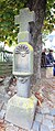 Grafschaft Nierendorf (RLP); Nischenkreuz von 1753 a.jpg 2,069 × 4,934; 2.14 MB
-
 Grafschaft Nierendorf (RLP); Nischenkreuz von 1753 b.jpg 1,438 × 4,884; 1.5 MB
;_Nischenkreuz_von_1753_a.jpg)
;_Nischenkreuz_von_1753_b.jpg)