Category:Wegweiserstein (Lengenfeld, Vogtland)
| Object location | | View all coordinates using: OpenStreetMap |
|---|
.jpg) | |||||
| Upload media | |||||
| Instance of | |||||
|---|---|---|---|---|---|
| Location | Lengenfeld, Vogtlandkreis, Saxony, Germany | ||||
| Street address |
| ||||
| Heritage designation | |||||
| Inception |
| ||||
 | |||||
| (Wikidata) |
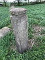
This is the category for an architectural monument.
It is on the list of cultural monuments of Lengenfeld (Vogtland), no. 08980445.
It is on the list of cultural monuments of Lengenfeld (Vogtland), no. 08980445.
Media in category "Wegweiserstein (Lengenfeld, Vogtland)"
The following 8 files are in this category, out of 8 total.
-
 Wegestein.jpg 3,024 × 4,032; 4.84 MB
-
 Wegweiserstein Lengenfeld, Vogtland (1).jpg 2,048 × 1,536; 655 KB
-
 Wegweiserstein Lengenfeld, Vogtland (2).jpg 4,608 × 3,456; 6.03 MB
-
 Wegweiserstein Lengenfeld, Vogtland (3).jpg 3,456 × 4,608; 6.59 MB
-
 Wegweiserstein Lengenfeld, Vogtland (4).jpg 3,456 × 4,608; 6.35 MB
-
 Wegweiserstein Lengenfeld, Vogtland (5).jpg 3,456 × 4,608; 6.38 MB
-
 Wegweiserstein Lengenfeld, Vogtland (6).jpg 4,608 × 3,456; 6.24 MB
-
 Wegweiserstein Lengenfeld, Vogtland (7) Blick zum Pilz.jpg 4,608 × 3,456; 6.43 MB

.jpg)
.jpg)
.jpg)
.jpg)
.jpg)
_Blick_zum_Pilz.jpg)