<nowiki>Weißenstadter Forst-Süd; Weißenstadter Forst-Süd; Weißenstadter Forst-Süd; Weißenstadter Forst-Süd; Weißenstadter Forst-Süd; Weißenstadter Forst-Süd; Weißenstadter Forst-Süd; Weißenstadter Forst-Süd; Weißenstadter Forst-Süd; Weißenstadter Forst-Süd; Weißenstadter Forst-Süd; Weißenstadter Forst-Süd; Weißenstadter Forst-Süd; Weißenstadter Forst-Süd; Weißenstadter Forst-Süd; Weißenstadter Forst-Süd; Weißenstadter Forst-Süd; Weißenstadter Forst-Süd; Weißenstadter Forst-Süd; Weißenstadter Forst-Süd; Weißenstadter Forst-Süd; Weißenstadter Forst-Süd; Weißenstadter Forst-Süd; Weißenstadter Forst-Süd; Weißenstadter Forst-Süd; Weißenstadter Forst-Süd; Weißenstadter Forst-Süd; Weißenstadter Forst-Süd; Weißenstadter Forst-Süd; Weißenstadter Forst-Süd; Weißenstadter Forst-Süd; Weißenstadter Forst-Süd; Weißenstadter Forst-Süd; Weißenstadter Forst-Süd; Weißenstadter Forst-Süd; Weißenstadter Forst-Süd; Weißenstadter Forst-Süd; Weißenstadter Forst-Süd; Weißenstadter Forst-Süd; Weißenstadter Forst-Süd; Weißenstadter Forst-Süd; Weißenstadter Forst-Süd; Weißenstadter Forst-Süd; Weißenstadter Forst-Süd; Weißenstadter Forst-Süd; Weißenstadter Forst-Süd; Weißenstadter Forst-Süd; Weißenstadter Forst-Süd; Weißenstadter Forst-Süd; Weißenstadter Forst-Süd; Weißenstadter Forst-Süd; Weißenstadter Forst-Süd; Weißenstadter Forst-Süd; Weißenstadter Forst-Süd; Weißenstadter Forst-Süd; Weißenstadter Forst-Süd; Weißenstadter Forst-Süd; Weißenstadter Forst-Süd; Weißenstadter Forst-Süd; Weißenstadter Forst-Süd; Weißenstadter Forst-Süd; Weißenstadter Forst-Süd; Weißenstadter Forst-Süd; Weißenstadter Forst-Süd; Weißenstadter Forst-Süd; Weißenstadter Forst-Süd; Weißenstadter Forst-Süd; Weißenstadter Forst-Süd; Weißenstadter Forst-Süd; Weißenstadter Forst-Süd; Weißenstadter Forst-Süd; Weißenstadter Forst-Süd; Weißenstadter Forst-Süd; Gemeindefreies Gebiet im Landkreis Wunsiedel in Bayern; unincorporated area in Germany; Weissenstadter Forst-Sued</nowiki>
Subcategories
This category has only the following subcategory.


 Backöfele 1 - panoramio.jpg 4,068 × 3,052; 1.49 MB
 Backöfele 2 - panoramio.jpg 4,376 × 3,288; 1.89 MB
 Digitales Orthofoto von Weißenstadter Forst-Süd (Bayerische Vermessungsverwaltung).tif 17,500 × 20,000; 547.71 MB
 Granit, Holz und Beton - panoramio.jpg 4,608 × 3,456; 2.65 MB
 Habersteinsattel - panoramio.jpg 4,608 × 3,456; 8.55 MB
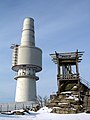 Schneeburg - Tower and Viewing platform in the Snow - panoramio.jpg 900 × 1,200; 194 KB
 Schneeburg Gate - Cold War - panoramio.jpg 1,680 × 539; 120 KB
 Schneeburg Tower in wintry conditions - panoramio.jpg 3,072 × 2,304; 1.1 MB
 Trail in the snow - panoramio.jpg 900 × 1,200; 361 KB
 Weißenstadter Forst-Süd in WUN.svg 520 × 390; 529 KB


