Category:Weigh bridges in the United Kingdom
Media in category "Weigh bridges in the United Kingdom"
The following 50 files are in this category, out of 50 total.
-

-
 Avery weighbridge.jpg 3,072 × 2,304; 1.54 MB
-
 Avon & Gloucestershire Railway Weighbridge.png 4,608 × 3,456; 28.61 MB
-
 Buildings at Londonderry Wharf near Keynsham - geograph.org.uk - 1754029.jpg 1,600 × 991; 557 KB
-
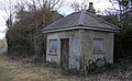
 Former Industry - geograph.org.uk - 2150003.jpg 800 × 531; 143 KB
-
 Castle Ward, June 2011 (19).JPG 2,848 × 4,272; 6.23 MB
-
 Caughley Quarry weighbridge - geograph.org.uk - 724084.jpg 640 × 480; 59 KB
-
 Council weighbridge - geograph.org.uk - 621125.jpg 640 × 389; 66 KB
-

-
 Disused weighbridge - geograph.org.uk - 1068936.jpg 640 × 480; 110 KB
-

-
 Disused weighbridge, Garton Quarry (geograph 5414760).jpg 1,024 × 768; 250 KB
-
 Disused weighbridge, Gasworks Lane, Elland - geograph.org.uk - 4803503.jpg 1,497 × 1,740; 671 KB
-
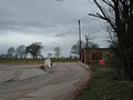
 Entrance to former Garton Quarry (geograph 5414752).jpg 1,024 × 768; 198 KB
-
 Erwood station weighbridge, Mid Wales Line, Powys, Wales.jpg 1,806 × 899; 973 KB
-
 Erwood station's old weighbridge, Mid Wales Line, Powys, Wales.jpg 1,580 × 1,000; 927 KB
-
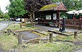
 Farm Weighbridge - geograph.org.uk - 1190967.jpg 640 × 480; 98 KB
-
 Former weighbridge, Moss Bridge Road, Rodley - geograph.org.uk - 4721999.jpg 1,024 × 768; 661 KB
-
 Gleneagles Station - old weighbridge house.JPG 4,608 × 3,456; 3.53 MB
-
 Great Harbour weighbridge - geograph.org.uk - 621128.jpg 640 × 480; 73 KB
-
 2018 at Great Malvern station - parcels weighbridge.JPG 1,366 × 910; 573 KB
-
 Kirkton Village, Kirkmahoe Parish, Dumfries and Galloway. Old weighbridge and cottage.jpg 3,737 × 2,282; 1.66 MB
-
 Oakworth Goods Yard - geograph.org.uk - 1218129.jpg 640 × 258; 49 KB
-
 Old Village Weighbridge - geograph.org.uk - 279295.jpg 640 × 480; 90 KB
-
 Old weighbridge detail, Abergavenny - geograph.org.uk - 5984174.jpg 2,733 × 1,850; 1.51 MB
-
 Old weighbridge detail, Kirkton, Kirkmahoe Parish, Dumfries & Galloway.jpg 4,571 × 2,569; 2.54 MB
-
 Old weighbridge, Kirkton, Kirkmahoe Parish, Dumfries & Galloway.jpg 4,258 × 2,700; 2.97 MB
-

-
 Quarry track, Garton Slack (geograph 3524863).jpg 1,024 × 768; 145 KB
-
 Redmire Station weighbridge - geograph.org.uk - 1586126.jpg 640 × 467; 251 KB
-
 Stone terminal Rye House - 50066004042.jpg 3,072 × 2,304; 5.59 MB
-
 Swanage, former weighbridge - geograph.org.uk - 1206740.jpg 640 × 480; 65 KB
-
 The old weighbridge, Kirkton, Kirkmahoe Parish, Dumfries & Galloway.jpg 4,266 × 2,238; 2.9 MB
-
 The Public Weighbridge House, Half Moon Street, Sherborne, Dorset 7007080538.jpg 2,736 × 3,648; 1.72 MB
-
 2009 at Totnes station - GWR platform barrow.jpg 1,024 × 768; 252 KB
-
 Town railway weighbridge, Beamish Museum, 11 September 2011.jpg 3,008 × 2,000; 746 KB
-
 Town railway weighbridge, Beamish Museum, 29 July 2011.jpg 800 × 531; 120 KB
-
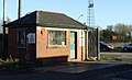
 2013 at Twyford station - weighbridge office.JPG 1,024 × 683; 443 KB
-
 Vehicle Testing Station - geograph.org.uk - 881296.jpg 426 × 640; 54 KB
-
 VOSA Weighbridge and Checksite - geograph.org.uk - 421158.jpg 640 × 427; 64 KB
-
 Weigh bridge by the railway - geograph.org.uk - 865421.jpg 427 × 640; 64 KB
-
 Weigh Office No. 8 - geograph.org.uk - 532106.jpg 640 × 480; 96 KB
-
 Weighbridge - geograph.org.uk - 471317.jpg 611 × 480; 96 KB
-
 Weighbridge and weighbridge office.jpeg 654 × 723; 142 KB
-
 Weighbridge by the station - geograph.org.uk - 1026408.jpg 640 × 426; 104 KB
-
 Weighbridge House, Horton-in-Ribblesdale station, Yorkshire, England.jpg 1,920 × 1,080; 1.07 MB
-

-
 Weighbridge, Winchcombe Station - geograph.org.uk - 1949119.jpg 640 × 480; 85 KB
-
 Weighbridges at James Watt Dock - geograph.org.uk - 419935.jpg 640 × 488; 80 KB
-
 Weighing Machine, Taunton Railway Station - geograph.org.uk - 364824.jpg 640 × 480; 102 KB


.JPG)


.jpg)

.jpg)


.jpg)
.jpg)


