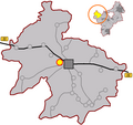
Category:Weiher (Hollfeld)
| Upload media | |||||
| Instance of |
| ||||
|---|---|---|---|---|---|
| Location | Hollfeld, Bayreuth, Upper Franconia, Bavaria, Germany | ||||
 | |||||
Media in category "Weiher (Hollfeld)"
This category contains only the following file.
-
Weiher in Hollfeld.png 939 × 881; 139 KB

