Category:Weirs in Cheshire
Ceremonial counties of England: Bedfordshire · Berkshire · Buckinghamshire · Cambridgeshire · Cheshire · Cornwall · Cumbria · Derbyshire · Devon · Dorset · Durham · East Riding of Yorkshire · East Sussex · Essex · Gloucestershire · Greater London · Greater Manchester · Hampshire · Herefordshire · Hertfordshire · Kent · Lancashire · Leicestershire · Lincolnshire · Merseyside · Norfolk · North Yorkshire · Northamptonshire · Northumberland · Nottinghamshire · Oxfordshire · Shropshire · Somerset · South Yorkshire · Staffordshire · Suffolk · Surrey · Tyne and Wear · Warwickshire · West Midlands · West Sussex · West Yorkshire · Wiltshire · Worcestershire
City-counties: Bristol ·
Former historic counties:
Other former counties:
City-counties: Bristol ·
Former historic counties:
Other former counties:
Subcategories
This category has the following 2 subcategories, out of 2 total.
C
- Chester Weir (40 F)
W
- Weir at Quarry Bank Mill (25 F)
Media in category "Weirs in Cheshire"
The following 41 files are in this category, out of 41 total.
-
 Above the Anderton Boat Lift. - geograph.org.uk - 129951.jpg 640 × 437; 106 KB
-
 Broken Weir, Chadkirk - geograph.org.uk - 2731897.jpg 1,280 × 960; 824 KB
-
 Broken Weir, River Goyt - geograph.org.uk - 2731893.jpg 1,280 × 960; 917 KB
-
 Canal overflow - geograph.org.uk - 641460.jpg 462 × 640; 122 KB
-
 Chadkirk Bridge site and works - geograph.org.uk - 2934666.jpg 3,456 × 2,304; 4.18 MB
-
 Chadkirk Bridge, not yet built - geograph.org.uk - 2859426.jpg 4,000 × 3,000; 2.59 MB
-
 Chadkirk Weir - geograph.org.uk - 2732196.jpg 1,280 × 960; 915 KB
-
 Chadkirk Weir, repairs - geograph.org.uk - 2859416.jpg 4,000 × 3,000; 2.58 MB
-
 Chadkirk Weir, River Goyt - geograph.org.uk - 2731895.jpg 1,280 × 960; 762 KB
-
 Congleton Old Mill Weir 2441.JPG 3,264 × 2,448; 2.04 MB
-
 Congleton Old Mill Weir 2442.JPG 3,264 × 2,448; 2.05 MB
-
 Dutton Sluice.jpg 4,928 × 3,264; 9.05 MB
-
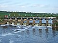 Dutton Sluices - geograph.org.uk - 1143556.jpg 640 × 480; 76 KB
-
 Feed to Hurleston Reservoir, view SE - geograph.org.uk - 853578.jpg 488 × 640; 191 KB
-
 Havannah Weir.jpg 4,052 × 3,070; 2.1 MB
-

-
 Northwich (7548015630).jpg 3,612 × 2,271; 8 MB
-
 Overflow weir, Anderton - geograph.org.uk - 804466.jpg 426 × 640; 144 KB
-
 Overflow weir, Trent & Mersey Canal, Middlewich - geograph.org.uk - 5187889.jpg 1,024 × 768; 153 KB
-
 Overflow weir, Trent and Mersey Canal - geograph.org.uk - 641046.jpg 473 × 640; 68 KB
-
 Oxen Bridge on the River Gowy - geograph.org.uk - 715842.jpg 640 × 480; 81 KB
-
 River Mersey at Latchford - geograph.org.uk - 713601.jpg 640 × 480; 61 KB
-
 River Weaver Weir near Hunt's Locks - geograph.org.uk - 3960152.jpg 1,600 × 1,064; 482 KB
-
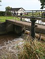
 Sluice at Hankelow Mill - geograph.org.uk - 1311045.jpg 640 × 426; 78 KB
-
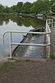
 Sluice gates (detail) - geograph.org.uk - 257260.jpg 480 × 640; 130 KB
-
 Sluice gates of weir on the River Weaver - geograph.org.uk - 257254.jpg 640 × 471; 164 KB
-
 The Weir on Cheney Brook - geograph.org.uk - 279479.jpg 640 × 480; 152 KB
-
 The weir with footbridge - geograph.org.uk - 3163009.jpg 2,304 × 3,456; 2.46 MB
-
 These sluice gates on TheWeaver near Northwich Cheshire England.(1280x835).jpg 1,280 × 835; 984 KB
-

-
 Trent and Mersey Weir - geograph.org.uk - 1373203.jpg 640 × 480; 82 KB
-

-
 Weir (1746111034).jpg 3,872 × 2,592; 8.62 MB
-
 Weir At North End Of Clough Pool.jpg 2,304 × 3,456; 4.55 MB
-
 Weir on Cheney Brook - geograph.org.uk - 259581.jpg 508 × 640; 232 KB
-
-
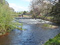
 Weir on River Dane - geograph.org.uk - 117987.jpg 640 × 433; 130 KB
-
 Weir on River Gowy - geograph.org.uk - 34767.jpg 640 × 480; 211 KB
-
 Weir on River Goyt at Marple - geograph.org.uk - 3124574.jpg 4,000 × 3,000; 2.99 MB
-
 Weir on the River Gowy at Gowy Meadows, Cheshire - DSC06317.JPG 3,648 × 2,736; 3.59 MB
-
 Overflow - geograph.org.uk - 79517.jpg 640 × 480; 247 KB


.jpg)


_-_geograph.org.uk_-_257260.jpg)


.jpg)


.jpg)


