Category:Wells Street Bridge (Chicago, 1922 bascule)
| Object location | | View all coordinates using: OpenStreetMap |
|---|
bridge in United States of America  | |||||
| Upload media | |||||
| Instance of | |||||
|---|---|---|---|---|---|
| Location | Chicago, Cook County, Illinois | ||||
| Crosses | |||||
| Date of official opening |
| ||||
| Structure replaces | |||||
 | |||||
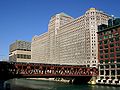
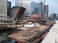
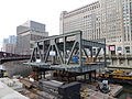
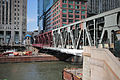
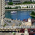
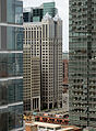
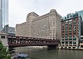
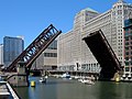
English: The Wells Street Bridge carries the 300 block of North Wells Street (200 west), and the Brown Line and Purple Line of the Chicago 'L', over the Chicago River in Chicago, Illinois, USA. For the predecessor bridge, see Category:Wells Street Bridge (1888).
Media in category "Wells Street Bridge (Chicago, 1922 bascule)"
The following 52 files are in this category, out of 52 total.
-
 1998-D029017 (4203857679).jpg 781 × 535; 378 KB
-
 20040701 22 Chicago River @ Wells St. (8114504823).jpg 2,560 × 1,920; 1.05 MB
-
 20040701 Chicago River @ Wells St.jpg 2,476 × 1,857; 1.28 MB
-
 2007-09-13 2400x1800 chicago merchandise mart.jpg 2,400 × 1,800; 619 KB
-
 20130302 03 CTA Service Change Announcement (8541282712).jpg 2,816 × 2,112; 1.15 MB
-
 20130302 44 Wells St. bridge construction.jpg 2,816 × 2,112; 1.8 MB
-
 20130302 45 Wells St. bridge construction.jpg 2,816 × 2,112; 1.57 MB
-
 20130304 15 Wells St. Bridge Construction (8576729418).jpg 2,816 × 2,112; 1.53 MB
-
 20130304 7 Wells St. Bridge Construction (8576729732).jpg 2,816 × 2,112; 1.29 MB
-
 20130307 48 CTA North Side L @ Merchandise Mart (8626588994).jpg 2,816 × 2,112; 1.52 MB
-
 300 North LaSalle.jpg 2,348 × 3,300; 1.48 MB
-
 Brown Line train to the Loop (5597871811).jpg 1,024 × 741; 881 KB
-
 Chicago - Merchandise Mart from Marina City (4279842177).jpg 960 × 639; 268 KB
-
 Chicago Bridge being renovated Photo Walk Chicago September 2, 2013-4873.jpg 5,760 × 3,840; 10.56 MB
-
 Chicago River bridges.jpg 4,368 × 2,912; 5.27 MB
-
 ChicagO RiveR ChicagO IL (5153661766).jpg 3,872 × 2,592; 2.15 MB
-
 Chicago River Floes - panoramio.jpg 2,304 × 3,072; 8.01 MB
-
 Chicago Riverwalk.jpg 1,800 × 1,200; 1.84 MB
-
 Chicago, Illinois, USA (48812650777).jpg 3,030 × 3,030; 7.97 MB
-
 Chicago, June 2015 - 141.jpg 4,000 × 3,000; 2.93 MB
-
 Chicago, June 2015 - 142.jpg 4,000 × 3,000; 3.07 MB
-
 Chicago, June 2015 - 144.jpg 4,000 × 3,000; 3.17 MB
-
 Chicago-school-building.JPG 1,024 × 768; 176 KB
-
 Chicagowatertaxiunderbridge.jpg 458 × 640; 262 KB
-
 CTA crossing the river (3543525830).jpg 663 × 900; 801 KB
-

-

-
-
 Frozen Chicago River.jpg 2,448 × 1,632; 1.16 MB
-
 GOYK1191s.JPG 600 × 400; 140 KB
-
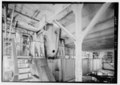
 Inside the Wells Street Bridge, lower deck.jpg 4,264 × 2,845; 3.51 MB
-

-

-
 Marshall Suloway Bridge - Chicago, Illinois, USA - October 8, 2023 03.jpg 8,005 × 5,718; 20.7 MB
-
New Wells Street bridge.webm 54 s, 1,280 × 720; 26.79 MB
-
 Train on the bridge.jpg 5,760 × 3,840; 4.98 MB
-
 Wacker Drive taken from Merchandise Mart looking south, Chicago (60771).jpg 3,380 × 2,168; 2.82 MB
-
 Waterview Tower construction (1).jpg 580 × 1,103; 209 KB
-
 Wells Bridge Reconstruction (8527512791).jpg 4,608 × 3,456; 8.26 MB
-
 Wells Bridge Reconstruction (8530472599).jpg 4,608 × 3,456; 7.49 MB
-
 Wells Bridge Reconstruction (8533300653).jpg 4,608 × 3,456; 8.05 MB
-
 Wells Bridge Reconstruction (8535970055).jpg 4,608 × 3,456; 7.34 MB
-
 Wells Bridge Reconstruction (8539896592).jpg 4,608 × 3,456; 6.59 MB
-
 Wells St Bridge (5680788299).jpg 2,893 × 2,893; 2.84 MB
-
 Wells St Bridge (8663529751).jpg 3,456 × 4,608; 5.94 MB
-
 Wells Street Bridge - Chicago, Illinois, USA - October 8, 2023 01.jpg 5,362 × 6,703; 18.95 MB
-
 Wells Street Bridge - Chicago, Illinois, USA - October 8, 2023 02.jpg 8,256 × 5,897; 24.15 MB
-
 Wells Street Bridge - Chicago, Illinois, USA - October 8, 2023.jpg 8,256 × 6,605; 22.9 MB
-
 Wells Street Bridge - panoramio.jpg 5,472 × 3,648; 12.85 MB
-
 Wells Street Bridge 070512.jpg 2,272 × 1,704; 661 KB
-
 Wells Street Bridge.jpg 4,190 × 2,990; 3.25 MB
-
 Wells Train over River (7169739499).jpg 4,032 × 3,024; 2.69 MB
.jpg)
.jpg)


.jpg)


.jpg)
.jpg)
.jpg)

.jpg)
.jpg)


.jpg)


.jpg)


.jpg)


.jpg)
.jpg)
.jpg)
.jpg)
.jpg)
.jpg)
.jpg)
.jpg)
.jpg)


.jpg)