Category:Wendens Ambo
English: Wendens Ambo is a small village of approximately 400 people in Essex, England. Its unusual name originates from the joining of two villages, Great and Little Wenden, to form Wendens Ambo, meaning "both Wendens".
Русский: Уенденс Амбо — деревня в Великобритании, в графстве Эссекс.

village and civil parish in Essex, UK  | |||||
| Upload media | |||||
| Instance of | |||||
|---|---|---|---|---|---|
| Location | Uttlesford, Essex, East of England, England | ||||
| Population |
| ||||
 | |||||
Subcategories
This category has the following 5 subcategories, out of 5 total.
Media in category "Wendens Ambo"
The following 200 files are in this category, out of 237 total.
(previous page) (next page)-
 3, Church Path - geograph.org.uk - 5534391.jpg 640 × 426; 78 KB
-
 A kink in the path - geograph.org.uk - 3888431.jpg 1,200 × 847; 1.23 MB
-
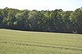
 A small woodland - geograph.org.uk - 6604477.jpg 1,024 × 684; 222 KB
-
 Access to Bearwalden Business Park - geograph.org.uk - 5534224.jpg 640 × 426; 78 KB
-
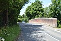
 At Sir Joshua's Bridge - geograph.org.uk - 4867182.jpg 1,024 × 732; 1.01 MB
-
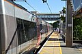
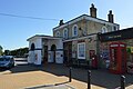
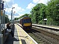 Audley End Railway Station - geograph.org.uk - 5400641.jpg 640 × 480; 111 KB
-
 Audley End Railway Station - geograph.org.uk - 5400650.jpg 640 × 480; 72 KB
-
 Audley End Railway Station - geograph.org.uk - 5401089.jpg 2,741 × 1,549; 1,021 KB
-
 Audley End Railway Station - geograph.org.uk - 6255296.jpg 800 × 554; 146 KB
-
 Audley End Railway Station - geograph.org.uk - 6255298.jpg 800 × 600; 144 KB
-
 Audley End Station - geograph.org.uk - 5534209.jpg 640 × 426; 71 KB
-
 Audley End Station - geograph.org.uk - 5534211.jpg 640 × 426; 63 KB
-
 Audley End Station - geograph.org.uk - 5534213.jpg 640 × 426; 76 KB
-
 Audley End Station - geograph.org.uk - 5534214.jpg 640 × 426; 62 KB
-
 Audley End Station - geograph.org.uk - 5569401.jpg 640 × 426; 84 KB
-
 B1039 - geograph.org.uk - 5534227.jpg 640 × 426; 100 KB
-
 B1039 - geograph.org.uk - 5534256.jpg 640 × 426; 93 KB
-
 B1039 - geograph.org.uk - 5534306.jpg 640 × 426; 102 KB
-
 B1039 - geograph.org.uk - 5569384.jpg 640 × 426; 97 KB
-
 B1039, Wendens Ambo - geograph.org.uk - 5534310.jpg 640 × 426; 108 KB
-
 B1309 passes under the M11 - geograph.org.uk - 3406430.jpg 4,320 × 3,240; 4.55 MB
-
 B1383, B1039 junction - geograph.org.uk - 5569377.jpg 640 × 426; 80 KB
-
 B1383, London Rd - geograph.org.uk - 5569369.jpg 640 × 426; 69 KB
-
 Beam End - geograph.org.uk - 5534382.jpg 640 × 426; 94 KB
-
 Bell Inn - geograph.org.uk - 5534354.jpg 640 × 425; 90 KB
-
 Bend, B1039 - geograph.org.uk - 5534389.jpg 640 × 426; 93 KB
-
 Beware children and horses - geograph.org.uk - 3889889.jpg 1,200 × 1,072; 1.6 MB
-
 Big fields, pylons and the M11 - geograph.org.uk - 3888401.jpg 1,200 × 900; 1.1 MB
-
 Boundary Marker on London Road - geograph.org.uk - 4410433.jpg 4,000 × 2,666; 7.55 MB
-
 Boundary Marker on London Road - geograph.org.uk - 4410447.jpg 4,000 × 2,666; 7.45 MB
-
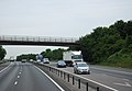
 Bridge over the M11 - geograph.org.uk - 3888407.jpg 1,200 × 900; 1.52 MB
-
 Bridge over the M11 Southbound - geograph.org.uk - 6240749.jpg 800 × 533; 628 KB
-
 Bridge over the railway north of Audley End - geograph.org.uk - 3888166.jpg 833 × 1,024; 1.28 MB
-
 Bridge Over the River Cam - geograph.org.uk - 4413602.jpg 4,000 × 2,666; 7.04 MB
-
 Bridge Over the River Cam - geograph.org.uk - 4413612.jpg 4,000 × 2,666; 6.91 MB
-
 Bridge over the River Cam - geograph.org.uk - 5534372.jpg 640 × 426; 93 KB
-
 Cambridge train nearing Audley End Tunnel - geograph.org.uk - 3888175.jpg 1,024 × 1,024; 1.36 MB
-
 Car park, Audley End Station - geograph.org.uk - 5576827.jpg 640 × 426; 64 KB
-
 Church path - geograph.org.uk - 5534320.jpg 640 × 426; 105 KB
-
 Church Path - geograph.org.uk - 5534392.jpg 640 × 426; 106 KB
-
 Church Street, Wendens Ambo - geograph.org.uk - 4628337.jpg 4,000 × 3,000; 4.07 MB
-
 Church Street, Wendens Ambo - geograph.org.uk - 4628338.jpg 4,000 × 3,000; 3.97 MB
-
 Church Street, Wendens Ambo - geograph.org.uk - 4628344.jpg 4,000 × 3,000; 4.33 MB
-

-
 Converted farm building - geograph.org.uk - 5539861.jpg 640 × 426; 74 KB
-
 Cottages in Wendens Ambo - geograph.org.uk - 5469533.jpg 640 × 426; 66 KB
-
 Cricket at Wendens Ambo - geograph.org.uk - 2477555.jpg 2,804 × 1,400; 1.03 MB
-
 Crop field, Wendens Ambo - geograph.org.uk - 5398579.jpg 640 × 480; 53 KB
-
 Crops by the Saffron Trail - geograph.org.uk - 5539876.jpg 640 × 426; 79 KB
-
 Crops by the Saffron Trail - geograph.org.uk - 5539881.jpg 640 × 426; 79 KB
-
 Cycling to Wendens Ambo - geograph.org.uk - 3888188.jpg 1,024 × 768; 894 KB
-

-
 Down hill to Clanverend Farm (geograph 3889903).jpg 1,200 × 898; 1.13 MB
-
 Down Neville Hill - geograph.org.uk - 3888143.jpg 1,200 × 900; 1.49 MB
-
 Drayton Farm Cottages - geograph.org.uk - 5534724.jpg 640 × 426; 94 KB
-
 Duck St - geograph.org.uk - 5534383.jpg 640 × 426; 88 KB
-
 Duck St - geograph.org.uk - 5539828.jpg 640 × 426; 104 KB
-
 Duddenhoe Lane - geograph.org.uk - 3891160.jpg 768 × 1,024; 1.01 MB
-

-

-
 Elizabeth II postbox, Audley End Railway Station - geograph.org.uk - 5401083.jpg 1,369 × 2,615; 675 KB
-
 Entering Wendens Ambo, B1039 - geograph.org.uk - 5569381.jpg 640 × 426; 102 KB
-

-
 Estate track, Audley End - geograph.org.uk - 4684650.jpg 640 × 480; 116 KB
-
 Farm building by the M11 - geograph.org.uk - 2587302.jpg 640 × 296; 43 KB
-
 Farm buildings off Royston Road - geograph.org.uk - 4040001.jpg 4,320 × 3,240; 4.42 MB
-
 Farm buildings off Royston Road B1039 - geograph.org.uk - 3494296.jpg 4,320 × 3,240; 2.92 MB
-
 Farmland near the Willows - geograph.org.uk - 5576823.jpg 640 × 476; 68 KB
-
 Fighting Cocks - geograph.org.uk - 5569373.jpg 640 × 426; 81 KB
-
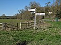
 Finger Post - geograph.org.uk - 1177218.jpg 480 × 640; 90 KB
-
 Flint built house - geograph.org.uk - 5534216.jpg 640 × 426; 102 KB
-
 Flint wall, Duck St - geograph.org.uk - 5539832.jpg 640 × 426; 92 KB
-
 Footbridge across the M11 - geograph.org.uk - 1970051.jpg 640 × 430; 58 KB
-
 Footbridge crosses the M11 - geograph.org.uk - 2722436.jpg 640 × 427; 51 KB
-
 Footbridge crossing the M11 - geograph.org.uk - 3759108.jpg 640 × 443; 52 KB
-
 Footbridge over the M11 - geograph.org.uk - 2587304.jpg 640 × 430; 52 KB
-
 Footpath And Track - geograph.org.uk - 5065324.jpg 1,024 × 768; 214 KB
-
 Footpath Junction - geograph.org.uk - 5065379.jpg 1,024 × 768; 252 KB
-
 Footpath off Duck St - geograph.org.uk - 5534379.jpg 640 × 426; 93 KB
-
 Ford at Wendens Ambo - geograph.org.uk - 3411697.jpg 3,872 × 2,592; 2.35 MB
-
 Harcamlow Way - geograph.org.uk - 6604447.jpg 1,024 × 684; 206 KB
-
 Harcamlow Way goes left - geograph.org.uk - 6604440.jpg 1,024 × 684; 201 KB
-
 House on Duck St - geograph.org.uk - 5534385.jpg 640 × 426; 66 KB
-
 House on Duck St - geograph.org.uk - 5539819.jpg 640 × 426; 101 KB
-
 House on Royston Road, Wendens Ambo - geograph.org.uk - 5588962.jpg 2,044 × 1,530; 799 KB
-
 House on Station Rd - geograph.org.uk - 5534257.jpg 640 × 426; 95 KB
-
 House, Norton End - geograph.org.uk - 5539834.jpg 640 × 426; 75 KB
-
 Houses on Station Road, Wendens Ambo - geograph.org.uk - 5398577.jpg 640 × 480; 69 KB
-
 Houses, Station Road, Wendens Ambo - geograph.org.uk - 5635723.jpg 640 × 428; 82 KB
-
 Junction at Clanver End - geograph.org.uk - 4039990.jpg 4,320 × 3,240; 5.41 MB
-
 Junction on B1383 - geograph.org.uk - 5635730.jpg 640 × 428; 79 KB
-
 Large farm building - geograph.org.uk - 5539836.jpg 640 × 426; 69 KB
-
 Level crossing at Rookery Lane - geograph.org.uk - 4627984.jpg 4,000 × 3,000; 4.25 MB
-
 Level crossing, Wendens Ambo - geograph.org.uk - 4684637.jpg 640 × 480; 134 KB
-

-
 London Road - geograph.org.uk - 4410592.jpg 3,973 × 2,648; 7.78 MB
-
 London Road, Audley End - geograph.org.uk - 5583486.jpg 1,960 × 1,412; 1.07 MB
-
 London Road, Wendens Ambo - geograph.org.uk - 4410309.jpg 4,000 × 2,666; 7.21 MB
-
 London train at Audley End Station - geograph.org.uk - 5534187.jpg 640 × 425; 64 KB
-
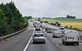
 M11 - Journey time trial - geograph.org.uk - 2640665.jpg 640 × 428; 90 KB
-
 M11 heading south - geograph.org.uk - 1970059.jpg 640 × 401; 80 KB
-
 M11 heads for the hills - geograph.org.uk - 2640642.jpg 640 × 428; 81 KB
-
 M11 northbound passing Wendens Ambo - geograph.org.uk - 3546820.jpg 2,274 × 1,335; 1.49 MB
-
 M11 passes through wheat fields - geograph.org.uk - 2722443.jpg 640 × 430; 49 KB
-
 M11, northbound - geograph.org.uk - 3759096.jpg 640 × 430; 45 KB
-
 Mallards - geograph.org.uk - 5534377.jpg 640 × 425; 85 KB
-
 Matlow Farm cricket pitch - geograph.org.uk - 5584916.jpg 2,004 × 1,476; 1.02 MB
-
 Mobile phone mast near Littlebury Green (2) - geograph.org.uk - 4040013.jpg 4,320 × 3,240; 4.89 MB
-

-
 Mutlow Hill at the junction of Station Road - geograph.org.uk - 5582132.jpg 2,048 × 1,536; 1.5 MB
-
 Nearing the crest of the hill - geograph.org.uk - 3891131.jpg 841 × 1,024; 1.14 MB
-
 Neville House - geograph.org.uk - 5534388.jpg 640 × 425; 85 KB
-
 Neville House - geograph.org.uk - 5927024.jpg 1,200 × 901; 279 KB
-

-

-
 Oilseed rape and the M11 - geograph.org.uk - 3891350.jpg 1,200 × 900; 1.41 MB
-

-
 On Duck St - geograph.org.uk - 5534361.jpg 640 × 426; 90 KB
-
 On Duck St - geograph.org.uk - 5534362.jpg 426 × 640; 83 KB
-
 On Royston Rd, Wendens Ambo - geograph.org.uk - 5534316.jpg 640 × 426; 88 KB
-
 On Walden Road - geograph.org.uk - 3911759.jpg 1,200 × 795; 1.12 MB
-
 Out-of-use Post Box - geograph.org.uk - 3420046.jpg 476 × 1,250; 449 KB
-
 Phone box, post box, wall, Wendens Ambo - geograph.org.uk - 5635680.jpg 640 × 480; 141 KB
-
 Pillbox by River Cam - geograph.org.uk - 5569324.jpg 640 × 426; 73 KB
-
 Pillbox by Sir Joshua's Bridge - geograph.org.uk - 5569355.jpg 640 × 426; 119 KB
-

-
 Pillbox, Audley End - geograph.org.uk - 2396928.jpg 800 × 600; 101 KB
-
 Platform 1, Audley End Station - geograph.org.uk - 5576828.jpg 640 × 426; 88 KB
-
 Platform 2, Audley End Station - geograph.org.uk - 5576833.jpg 640 × 426; 78 KB
-

-
 Postbox at Norton End - geograph.org.uk - 3906370.jpg 862 × 1,024; 1.13 MB
-
 Pylon - geograph.org.uk - 6604438.jpg 1,024 × 684; 112 KB
-
 Pylon by the M11 - geograph.org.uk - 3759105.jpg 640 × 422; 29 KB
-
 Railway Bridge, Station Rd - geograph.org.uk - 5534223.jpg 640 × 426; 101 KB
-
 Railway Cottages - geograph.org.uk - 5534218.jpg 640 × 426; 81 KB
-
 Railway Cottages, Wendens Ambo - geograph.org.uk - 4409735.jpg 3,973 × 2,648; 6.61 MB
-
 Railway Cottges - geograph.org.uk - 5534220.jpg 640 × 426; 86 KB
-

-
 Riding to Newport on Sunday morning - geograph.org.uk - 3891152.jpg 1,200 × 900; 1.08 MB
-
 River Cam - geograph.org.uk - 5534373.jpg 640 × 425; 84 KB
-
 River Cam - geograph.org.uk - 5534374.jpg 640 × 426; 109 KB
-
 River Cam - geograph.org.uk - 5569307.jpg 640 × 426; 126 KB
-
 River Cam - geograph.org.uk - 5569314.jpg 640 × 426; 140 KB
-
 Riverside Belt - geograph.org.uk - 5569279.jpg 640 × 426; 109 KB
-
 Riverside Belt - geograph.org.uk - 5569290.jpg 640 × 426; 74 KB
-
 Road by the cricket ground - geograph.org.uk - 5534309.jpg 640 × 426; 95 KB
-
 Road Junction - geograph.org.uk - 1170884.jpg 640 × 480; 78 KB
-
 Road Junction - geograph.org.uk - 5065357.jpg 1,024 × 768; 209 KB
-
 Road Sign - geograph.org.uk - 5065369.jpg 1,024 × 768; 323 KB
-
 Rookery Lane - geograph.org.uk - 5539869.jpg 640 × 426; 101 KB
-
 Rookery Lane, Wendens Ambo - geograph.org.uk - 5398584.jpg 640 × 480; 97 KB
-
 Rookery Lane, Wendens Ambo - geograph.org.uk - 5635595.jpg 640 × 480; 175 KB
-
 Royston Rd - geograph.org.uk - 5534314.jpg 640 × 426; 105 KB
-
 Royston Rd - geograph.org.uk - 5534352.jpg 640 × 426; 107 KB
-
 Royston Road - geograph.org.uk - 5065348.jpg 1,024 × 768; 206 KB
-
 Royston Road, Clanver End - geograph.org.uk - 5589020.jpg 1,970 × 1,424; 687 KB
-
 Royston Road, Wendens Ambo - geograph.org.uk - 5589010.jpg 1,946 × 1,388; 667 KB
-
 Royston Road, Wendens Ambo - geograph.org.uk - 5589012.jpg 2,048 × 1,536; 1.49 MB
-
 Saffron Trail - geograph.org.uk - 5426694.jpg 640 × 469; 56 KB
-
 Saffron Trail - geograph.org.uk - 5539870.jpg 640 × 426; 62 KB
-
 Saffron Trail - geograph.org.uk - 5539879.jpg 640 × 426; 63 KB
-

-
 Signpost at Clanver End - geograph.org.uk - 3889884.jpg 1,200 × 885; 1.54 MB
-
 Sir Joshua's Bridge - geograph.org.uk - 3910282.jpg 824 × 1,024; 1.31 MB
-
 Sir Joshua's Bridge - geograph.org.uk - 5569301.jpg 640 × 426; 88 KB
-
 Southbound M11 - geograph.org.uk - 6240751.jpg 800 × 534; 605 KB
-
 Station House, Audley End Station - geograph.org.uk - 5569395.jpg 640 × 426; 52 KB
-
 Station House, Audley End Station - geograph.org.uk - 5569396.jpg 640 × 426; 58 KB
-
 Station Rd - geograph.org.uk - 5569386.jpg 640 × 426; 69 KB
-
 Station Road (B1039), Wendens Ambo - geograph.org.uk - 5398578.jpg 2,848 × 2,136; 1.34 MB
-
 Stubble field beside the Willows - geograph.org.uk - 5523359.jpg 640 × 480; 68 KB
-
 Sunset over London Road, Audley End - geograph.org.uk - 5583485.jpg 2,048 × 1,536; 1.11 MB
-
 Terrace on Station Road - geograph.org.uk - 5927037.jpg 1,200 × 881; 322 KB
-
 Thatched cottage, Wendens Ambo - geograph.org.uk - 5534318.jpg 640 × 426; 87 KB
-
 Thatched cottages on Church Street, Wendens Ambo - geograph.org.uk - 4628335.jpg 4,000 × 3,000; 4.04 MB
-
 Thatched cottages on Church Street, Wendens Ambo - geograph.org.uk - 4628341.jpg 4,000 × 3,000; 4.39 MB
-
 The Bell, Wendens Ambo - geograph.org.uk - 5929151.jpg 1,200 × 851; 309 KB
-
 The Cottage in Wendons Ambo - geograph.org.uk - 5426691.jpg 480 × 640; 78 KB
-
 The Cottage, Duck St - geograph.org.uk - 5534733.jpg 640 × 426; 80 KB
-
 The Cottage, Duck St - geograph.org.uk - 5534743.jpg 640 × 426; 83 KB
-
 The Fighting Cocks - geograph.org.uk - 5426712.jpg 640 × 480; 67 KB
-
 The Fighting Cocks public house - geograph.org.uk - 5401106.jpg 2,848 × 2,136; 1.23 MB
-

-
 The ford at Wendens Ambo - geograph.org.uk - 3906365.jpg 1,024 × 1,024; 1.45 MB
-
 The M11 - geograph.org.uk - 5065311.jpg 1,024 × 768; 199 KB
-
 The M11 from the air - geograph.org.uk - 2963860.jpg 640 × 480; 125 KB
-
 The Old School House - geograph.org.uk - 5929220.jpg 1,200 × 900; 256 KB
-
 Towards Royston on the B1039 - geograph.org.uk - 3889867.jpg 1,024 × 1,024; 1.23 MB
-
 Towards Saffron Walden on the B1039 - geograph.org.uk - 3889873.jpg 820 × 1,024; 1.24 MB
-
 Towards the M11 - geograph.org.uk - 3888437.jpg 1,200 × 890; 1.5 MB
-
 Track to Littlebury Green - geograph.org.uk - 3888449.jpg 1,200 × 867; 1.21 MB
-
 Tree plantation - geograph.org.uk - 400838.jpg 640 × 480; 109 KB
-
 Trees lining dismantled railway - geograph.org.uk - 5569331.jpg 640 × 426; 99 KB
-
 Triangulation pillar at TL 501 348 - geograph.org.uk - 404858.jpg 640 × 480; 99 KB
-
 Trout Hall - geograph.org.uk - 5534368.jpg 640 × 426; 72 KB
-
 Under the M11 - geograph.org.uk - 3891353.jpg 800 × 800; 949 KB
-
 Up the hill to Arkesden and Wicken Bonhunt (geograph 3891338).jpg 1,200 × 900; 1.46 MB
-
 Up the hill towards Three Corner Plantation - geograph.org.uk - 3891315.jpg 1,200 × 892; 1.22 MB
-
 View from the level crossing at Rookery Lane - geograph.org.uk - 4627988.jpg 4,000 × 3,000; 4.34 MB
-
 Walden Rd - geograph.org.uk - 5569357.jpg 640 × 426; 80 KB


.jpg)


_towards_Littlebury_-_geograph.org.uk_-_5523366.jpg)


_-_geograph.org.uk_-_4040013.jpg)


,_Wendens_Ambo_-_geograph.org.uk_-_5398578.jpg)


.jpg)


