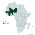
Category:West Africa
Deutsch: Westafrika
English: West Africa
Español: África Occidental
Français : Afrique de l'Ouest, anciennement Afrique occidentale
Latina: Africa occidentalis
日本語: 西アフリカ
العربية : غرب أفريقيا
westernmost region of the African continent   | |||||
| Upload media | |||||
| Pronunciation audio | |||||
|---|---|---|---|---|---|
| Instance of | |||||
| Part of | |||||
| Location | Africa, Southern Hemisphere | ||||
| Has part(s) | |||||
 | |||||
Subcategories
This category has the following 24 subcategories, out of 24 total.
Media in category "West Africa"
The following 174 files are in this category, out of 174 total.
-

-
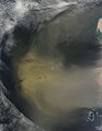
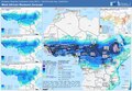
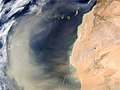
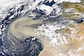 2000-Feb-26 NASA SeaWiFS African Dust Storm.jpg 2,880 × 1,944; 1.76 MB
-
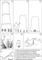 African bloomery furnace types.png 1,578 × 2,251; 319 KB
-
 African Clay molding.jpg 4,032 × 3,024; 2.59 MB
-
 Airport @ Roberts-Field Monrovia, Liberia - panoramio.jpg 730 × 486; 281 KB
-
 Anti-domestic violence sign in Liberia panoramio (193).jpg 1,024 × 759; 400 KB
-
 Assemblée Nationale du Bénin en construction.jpg 9,216 × 6,912; 15.46 MB
-
 AWMT Community Banner.png 1,024 × 520; 62 KB
-
 Babatu Sword - weapon used by Babatu a famous slave master in Northern Ghana.jpg 1,800 × 4,000; 981 KB
-
 Bags of rice.JPG 1,676 × 1,200; 1.34 MB
-
-
-
-
 Central Mausoleum of the Column Tomb.jpg 580 × 521; 251 KB
-
 Central Mausoleum.jpg 580 × 251; 178 KB
-

-
 Chili girl.JPG 1,800 × 1,200; 759 KB
-
 Clay moldings.jpg 3,024 × 4,032; 2.59 MB
-
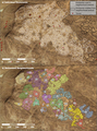
 Cluster 9 funerary monuments in their landscape context.jpg 2,128 × 1,479; 396 KB
-
 Complex compound subdivisions in the central area of Akreijit.webp 1,865 × 1,110; 163 KB
-

-
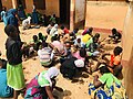 Creative Arts lesson.jpg 4,032 × 3,024; 2.95 MB
-
-
 Dee Moneey.jpg 5,760 × 3,840; 1.55 MB
-
 Densities of sites, permanent water, and impermanent water.webp 969 × 1,204; 179 KB
-
 Documented site locations, permanent water, and impermanent water.webp 1,854 × 1,313; 184 KB
-
 Dogon Mask.jpg 2,144 × 1,635; 827 KB
-
 Dupuis-Yacouba-Maxar map and satellite image.png 1,652 × 1,555; 1,010 KB
-
 Dust off West Africa (MODIS 2018-10-30).jpg 8,239 × 6,988; 5.32 MB
-
 Dust off West Africa (MODIS 2019-02-10).jpg 7,993 × 6,468; 5.14 MB
-
 Dust off West Africa (MODIS 2019-02-28).jpg 7,895 × 6,507; 2.01 MB
-
 Dust off West Africa (MODIS 2019-06-11).jpg 7,071 × 5,398; 4.9 MB
-
 Dust off West Africa (MODIS 2019-06-30).jpg 7,218 × 5,077; 6.48 MB
-
 Dust storm off West Africa (MODIS 2015-01-05).jpg 2,400 × 3,200; 609 KB
-
 Dust storm off West Africa (MODIS 2015-01-10).jpg 2,800 × 3,600; 899 KB
-
 Dust storm off West Africa (MODIS 2015-01-18).jpg 5,600 × 7,800; 7.47 MB
-
 Dust storm off West Africa (MODIS 2015-03-12).jpg 5,600 × 7,200; 4.9 MB
-
 Dust storm off West Africa (MODIS 2015-06-25).jpg 5,600 × 7,200; 3.65 MB
-
 Dust storm off West Africa (MODIS 2015-06-28).jpg 5,600 × 7,200; 3.5 MB
-
 Dust storm off West Africa (MODIS 2015-07-26).jpg 5,000 × 6,400; 3.59 MB
-
 Dust storm off West Africa (MODIS 2016-03-10).jpg 2,800 × 3,600; 1.12 MB
-
 Dust storm off West Africa (MODIS 2017-01-07).jpg 7,200 × 9,400; 8.83 MB
-
 Dust storm off West Africa (MODIS 2017-02-04).jpg 2,800 × 3,600; 951 KB
-
 Dust storm off West Africa (MODIS 2017-03-19).jpg 3,400 × 4,400; 1.08 MB
-
 Dust storm off West Africa (MODIS 2017-05-14).jpg 6,000 × 7,800; 4.26 MB
-
 Dust storm off West Africa (MODIS 2017-10-19).jpg 5,000 × 6,400; 3.46 MB
-
 Dust storm off West Africa (MODIS 2018-01-24).jpg 5,600 × 7,200; 5.89 MB
-
 Dust storms off West Africa (MODIS 2016-07-31).jpg 7,200 × 9,400; 8.63 MB
-
 Dust storms off West Africa (MODIS 2017-01-15).jpg 2,200 × 2,800; 693 KB
-
 ECDM 20240619 Monsoon West Africa.pdf 1,625 × 1,125; 604 KB
-

-

-

-

-

-

-

-

-

-
 Entrance of St Andrews Catholic Cathedral in Wa.jpg 607 × 1,080; 74 KB
-
 Field boundary on the western shore of Lake Fati.png 1,652 × 1,105; 652 KB
-

-
 Fires and Poor Air Quality in West Africa (MODIS 2020-01-23).jpg 7,857 × 6,102; 2.9 MB
-
 Fires in West Africa (MODIS 2021-12-27).jpg 3,855 × 2,730; 719 KB
-

-
 Fufu con pollo y vino.png 604 × 477; 365 KB
-
 Gapaver.png 1,121 × 1,100; 496 KB
-
 Glass beads of different colors and shapes from Ile-Ife, Nigeria.webp 850 × 1,472; 229 KB
-
-
-
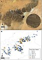
 Gridded site complex in Dhar Tagant.jpg 2,128 × 1,171; 407 KB
-
How to create a wikipedia account - Ghanaian Sign Language version.webm 2 min 6 s, 854 × 480; 9.72 MB
-
 Imam Abdul Ghaniyy Agbotomokekere (grand Imam of Ibadan).jpg 864 × 1,080; 72 KB
-
 Individual Burial from the Column Tomb.jpg 580 × 435; 358 KB
-
 Katja-Werthmann.Studioline.de.©Katja Werthmann.2019.jpg 3,008 × 2,008; 1.57 MB
-
 Kaworen townen pulaaku.png 600 × 200; 75 KB
-
 Kaworen townen pulaaku¹.png 600 × 200; 60 KB
-
 Landscape and excavations at the Nok site Ido.webp 989 × 1,378; 528 KB
-
 Leonhard-Harding.2010.jpg 2,336 × 3,504; 2.08 MB
-
 Les roches du quartier yagma a Ouagadougou.jpg 2,016 × 4,592; 4.27 MB
-
 Lunar Umbra (solar eclipse shadow) over western Africa (10673117984).jpg 11,200 × 9,000; 23.18 MB
-
 Mafa down-draught type of low-shaft furnaces.png 1,865 × 1,294; 589 KB
-
 Massive Dust Storm off West Africa (MODIS 2020-06-10).jpg 8,114 × 7,420; 5.97 MB
-

-
 Meule sur un site du Baten de Tichitt.jpg 580 × 430; 236 KB
-
 Molded clay cake.jpg 4,032 × 3,024; 2.68 MB
-
 Molded Items.jpg 4,032 × 3,024; 3.01 MB
-
 Monuments that were visible in four different visualisation types.jpg 535 × 535; 223 KB
-

-
-
 Nauclea latifolia modern fruit and seed collected in Burkina Faso.webp 990 × 1,351; 333 KB
-
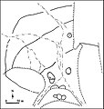
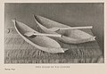
 Negro Culture in West Africa plate 1.jpg 1,331 × 1,880; 1.13 MB
-
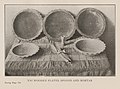
 Negro Culture in West Africa plate 10.jpg 1,782 × 1,338; 1.2 MB
-
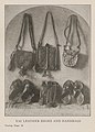
 Negro Culture in West Africa plate 11.jpg 1,635 × 1,359; 1.1 MB
-
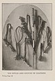
 Negro Culture in West Africa plate 12.jpg 1,180 × 1,971; 1.17 MB
-
 Negro Culture in West Africa plate 13.jpg 1,763 × 1,292; 1.2 MB
-
 Negro Culture in West Africa plate 14.jpg 1,722 × 1,336; 1.07 MB
-
 Negro Culture in West Africa plate 15.jpg 1,147 × 1,828; 923 KB
-
 Negro Culture in West Africa plate 16.jpg 1,204 × 1,648; 1,009 KB
-
 Negro Culture in West Africa plate 17.jpg 1,800 × 1,316; 1.2 MB
-
 Negro Culture in West Africa plate 18.jpg 1,190 × 1,922; 1.1 MB
-
 Negro Culture in West Africa plate 19.jpg 1,600 × 1,349; 1.12 MB
-
 Negro Culture in West Africa plate 2.jpg 1,113 × 1,867; 889 KB
-
 Negro Culture in West Africa plate 20.jpg 1,785 × 1,350; 1.19 MB
-
 Negro Culture in West Africa plate 21.jpg 1,903 × 1,378; 1.06 MB
-
 Negro Culture in West Africa plate 22.jpg 1,871 × 1,299; 1.27 MB
-
 Negro Culture in West Africa plate 23.jpg 1,829 × 1,354; 1.31 MB
-
 Negro Culture in West Africa plate 24.jpg 1,776 × 1,324; 1.23 MB
-
 Negro Culture in West Africa plate 25.jpg 1,769 × 1,451; 1.17 MB
-
 Negro Culture in West Africa plate 3.jpg 1,768 × 1,314; 1.12 MB
-
 Negro Culture in West Africa plate 4.jpg 1,804 × 1,336; 1.18 MB
-
 Negro Culture in West Africa plate 5.jpg 1,187 × 1,652; 1.05 MB
-
 Negro Culture in West Africa plate 6.jpg 1,165 × 1,718; 1.02 MB
-
 Negro Culture in West Africa plate 7.jpg 1,163 × 1,943; 909 KB
-
 Negro Culture in West Africa plate 8.jpg 1,802 × 1,404; 1.09 MB
-
 Negro Culture in West Africa plate 9.jpg 1,166 × 1,694; 846 KB
-
 Oblique false-colour 3D rendering of an example tumulus.jpg 624 × 992; 184 KB
-
 OFWA TOT Workshop 2023 012.jpg 3,024 × 4,032; 2.26 MB
-
 Ordeal Tree.jpg 1,024 × 683; 217 KB
-
 P Hall.png 218 × 271; 58 KB
-
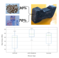
 Percentage of items per taxon of Nok culture.webp 1,521 × 716; 48 KB
-
 Pesticide workshop in West Africa.jpg 4,592 × 3,448; 5.71 MB
-
 Petite jarre du village v.72 (échelle - 10 cm).jpg 428 × 500; 112 KB
-
 Plan of the entire funerary complex of the Column Tomb.jpg 580 × 509; 155 KB
-
 Poids de filet en grès (échelle - 3 cm), Dhar Tichitt-Oualata.jpg 580 × 228; 110 KB
-
 Pointes de flèches, Dhar Tichitt-Oualata.jpg 580 × 457; 212 KB
-
 Possible pillar structures in village sites of the Mali Lakes Region.webp 1,652 × 2,314; 565 KB
-
 Poste de transformation électrique à Womey, Abomey-calavi, Bénin.jpg 9,216 × 6,912; 16.13 MB
-

-
 Prof Honorat Aguessy (cropped).jpg 1,445 × 1,070; 399 KB
-
 Prof Honorat Aguessy.jpg 1,920 × 1,080; 231 KB
-
 Rained again 01.jpg 3,968 × 2,976; 2.98 MB
-
 Rained again 03.jpg 2,976 × 3,968; 2.76 MB
-
-
 Round the black man's garden (1893) (14773097011).jpg 1,520 × 2,288; 711 KB
-
 Saharan Dust off West Africa.jpg 514 × 385; 51 KB
-

-

-

-
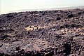
 Satellite view of Tumuli Cluster 8 from Dhar Tagant.jpg 2,128 × 1,402; 495 KB
-
 Schematic plan of the central mausoleum.jpg 580 × 486; 132 KB
-
 SEM illustration of archaeobotanical material from Pangwari.png 991 × 1,060; 742 KB
-
-
 Size-based distribution of funerary tumuli.jpg 802 × 954; 163 KB
-

-
 Statuettes zoomorphes du village, Dhar Tichitt.jpg 580 × 438; 129 KB
-
 Stone pillar structure at Fati 6.webp 1,652 × 1,108; 421 KB
-
 Stop gender based violence sign in Liberia - panoramio (196).jpg 722 × 750; 330 KB
-
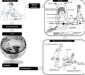
 Structural diagram of burial.jpg 543 × 945; 61 KB
-
 Studies in primitive looms (1918) (14784096942).jpg 3,056 × 1,460; 317 KB
-

-
 The forest of parakou, Benin.jpg 768 × 1,024; 202 KB
-
 The ship holds exactly the straight course.png 1,018 × 1,489; 946 KB
-
 The zoology of the voyage of the H.M.S. Erebus and Terror (6258372718).jpg 1,703 × 1,323; 171 KB
-
 Tichitt Tradition drystone tumulus.jpg 388 × 214; 112 KB
-
 TOpoku.png 198 × 183; 38 KB
-
 Travel times based on the generation of isochrones.jpg 811 × 916; 344 KB
-
 Tuareg with a sword in Timbuktu, Mali.jpg 2,849 × 4,379; 6.53 MB
-

-
 Typical bloomery iron production operational sequence.webp 1,865 × 1,656; 278 KB
-
 Tête de boviné du village v.62, Dhar Tichitt.jpg 580 × 565; 173 KB
-
 Ubiquity of the five main species of Nok culture.webp 1,511 × 1,074; 56 KB
-
 Un aspect du village v.72, Dhar Tichitt-Oualata.jpg 580 × 388; 243 KB
-
-
 1005-WesternAfricafromplane.jpg 2,112 × 2,816; 713 KB
-
 West African Development Bank Map.png 4,800 × 4,795; 1.3 MB
-
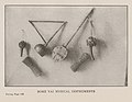
 West African table.JPG 1,280 × 960; 279 KB
-
 Western peripheral enclosure with individual stone houses.webp 1,865 × 1,136; 303 KB
-
 Wheels Down (15549047005).jpg 5,760 × 3,840; 7.5 MB
-
 Where Animals Talk (West African folk lore tales).djvu 2,437 × 3,675, 264 pages; 10.3 MB
-
 Wikimedians at DRIF 2024.jpg 1,280 × 960; 275 KB
-
 Window of Light.jpg 4,134 × 2,756; 3.2 MB
-
 « Poinçons » en os du village v.157 (échelle - 5 cm).jpg 580 × 124; 39 KB
-
 المسالك والممالك.jpg 2,684 × 2,684; 2.33 MB


.jpg)


,_Dhar_Tichitt.jpg)


.jpg)


.jpg)
.jpg)
.jpg)
.jpg)
.jpg)
.jpg)
.jpg)
.jpg)
.jpg)
.jpg)
.jpg)
.jpg)
.jpg)
.jpg)
.jpg)
.jpg)
.jpg)
.jpg)
.jpg)
.jpg)
.jpg)


.jpg)
.jpg)


.jpg)


_over_western_Africa_(10673117984).jpg)

.jpg)


.jpg)


.jpg)


_(402137881).jpg)
_(14773097011).jpg)

.jpg)

.jpg)


.jpg)

_(14784096942).jpg)


.jpg)


.jpg)


,_Dhar_Tichitt-Oualata.jpg)
-to-transmit-Zika-virus-12879_2015_1231_Fig1_HTML.jpg)
.jpg)