Category:West Dunbartonshire

Council areas (municipalities) of Scotland: Aberdeen · Aberdeenshire · Angus · Argyll and Bute · Clackmannanshire · Dumfries and Galloway · Dundee · East Ayrshire · East Dunbartonshire · East Lothian · East Renfrewshire · Edinburgh · Falkirk · Fife · Glasgow · Highland · Inverclyde · Midlothian · Moray · North Ayrshire · North Lanarkshire · Outer Hebrides · Orkney Islands · Perth and Kinross · Renfrewshire · Scottish Borders · Shetland Islands · South Ayrshire · South Lanarkshire · Stirling · West Dunbartonshire · West Lothian

Scottish council area   | |||||
| Upload media | |||||
| Instance of | |||||
|---|---|---|---|---|---|
| Part of |
| ||||
| Location | Scotland | ||||
| Capital | |||||
| Legislative body |
| ||||
| Population |
| ||||
| Area |
| ||||
| official website | |||||
 | |||||
Subcategories
This category has the following 24 subcategories, out of 24 total.
+
A
E
G
H
I
N
P
S
T
Media in category "West Dunbartonshire"
The following 200 files are in this category, out of 281 total.
(previous page) (next page)-
 2015 October Holidays (21554683773).jpg 3,264 × 4,928; 3.07 MB
-
 A bend in the road - geograph.org.uk - 6181279.jpg 1,024 × 768; 267 KB
-

-
 Alderwood Care Home construction site - geograph.org.uk - 6325937.jpg 1,024 × 640; 174 KB
-
 Alderwood Care Home construction site - geograph.org.uk - 6325945.jpg 1,024 × 768; 233 KB
-
 Alderwood Care Home construction site - geograph.org.uk - 6325949.jpg 1,600 × 800; 323 KB
-
 Alderwood Care Home construction site - geograph.org.uk - 6386449.jpg 1,024 × 640; 162 KB
-
 Alderwood Care Home construction site - geograph.org.uk - 6439083.jpg 1,600 × 889; 273 KB
-
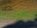 Algal bloom at the shoreline - geograph.org.uk - 6277949.jpg 1,024 × 768; 237 KB
-
 An old boundary - geograph.org.uk - 6278081.jpg 1,024 × 768; 262 KB
-
 Anemometer mast - geograph.org.uk - 2495812.jpg 768 × 1,024; 114 KB
-
 Approaching Inchmurrin - geograph.org.uk - 5504830.jpg 1,280 × 960; 704 KB
-
 Approaching Net Bay Viewpoint - geograph.org.uk - 6278093.jpg 1,024 × 768; 294 KB
-
 Artizan-Artisan Bridge, Dumbarton - geograph.org.uk - 6375657.jpg 800 × 601; 346 KB
-
 Ben Lomond viewed from the Loch - geograph.org.uk - 6280827.jpg 800 × 534; 561 KB
-
 Beside a path in the Overtoun Estate - geograph.org.uk - 6225983.jpg 1,024 × 768; 289 KB
-
 Between parallel boundaries - geograph.org.uk - 6278124.jpg 1,024 × 768; 285 KB
-
 Between the old Sea Lock and the New Sea Lock - geograph.org.uk - 5591579.jpg 1,024 × 768; 272 KB
-
 Blocked footpath - geograph.org.uk - 6213166.jpg 1,024 × 768; 213 KB
-
 Blocked footpath - geograph.org.uk - 6213174.jpg 1,024 × 768; 238 KB
-
 Blocked footpath - geograph.org.uk - 6238042.jpg 1,600 × 800; 451 KB
-
 Blue plaque - geograph.org.uk - 6422575.jpg 1,600 × 1,442; 415 KB
-
 Boat Graveyard In Bowling Harbour - geograph.org.uk - 4013198.jpg 3,448 × 4,592; 3.27 MB
-
 Boat on the River Leven - geograph.org.uk - 6421978.jpg 1,600 × 1,167; 229 KB
-
 Boats on the River Leven - geograph.org.uk - 6416449.jpg 1,600 × 1,200; 411 KB
-
 Boats on the River Leven - geograph.org.uk - 6416572.jpg 1,275 × 1,600; 342 KB
-
 Bowling Basin Entrance - geograph.org.uk - 2667900.jpg 1,600 × 1,200; 554 KB
-
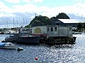
 Bowling Harbour - geograph.org.uk - 2667874.jpg 3,688 × 2,729; 7.27 MB
-
 Bowling Harbour - geograph.org.uk - 5591581.jpg 1,024 × 714; 86 KB
-
 Bowling Harbour - geograph.org.uk - 6401783.jpg 1,600 × 856; 211 KB
-
 Building detail, énergie fitness - geograph.org.uk - 6416533.jpg 1,594 × 1,600; 421 KB
-
 Cameron House, Loch Lomond - geograph.org.uk - 5504808.jpg 1,280 × 960; 707 KB
-
 Cameron on the Clyde - geograph.org.uk - 5253166.jpg 640 × 480; 150 KB
-
 Cameron on the Clyde - geograph.org.uk - 5253168.jpg 640 × 480; 164 KB
-
 Cameron on the Clyde - geograph.org.uk - 5253171.jpg 640 × 480; 159 KB
-
 Cardinal Mark and Dumbarton Rock - geograph.org.uk - 2220627.jpg 1,024 × 768; 86 KB
-
 Castle Street, Dumbarton - geograph.org.uk - 6144929.jpg 1,024 × 683; 135 KB
-
 Caterpillar of Elephant Hawk-moth - geograph.org.uk - 6270909.jpg 1,600 × 1,200; 656 KB
-
 Cats Castle - geograph.org.uk - 5257271.jpg 640 × 480; 163 KB
-
 Changes at Bowling Harbour - geograph.org.uk - 5429440.jpg 1,024 × 768; 199 KB
-
 Church noticeboard, Riverside Parish Church, Dumbarton - geograph.org.uk - 6422534.jpg 1,209 × 1,600; 360 KB
-
 Church Street, Dumbarton - geograph.org.uk - 6422565.jpg 1,446 × 1,600; 364 KB
-
 Cleared forestry land - geograph.org.uk - 6183075.jpg 1,024 × 768; 224 KB
-
 Cleared ground behind Castle Terrace - geograph.org.uk - 6463538.jpg 1,600 × 800; 338 KB
-
 Cleared site of Langcraigs Care Home - geograph.org.uk - 6198011.jpg 1,024 × 683; 203 KB
-
 Cleared site of Langcraigs Care Home - geograph.org.uk - 6198019.jpg 1,024 × 768; 223 KB
-
 Cleared site of Langcraigs Care Home - geograph.org.uk - 6274691.jpg 1,024 × 768; 205 KB
-
 Cleared site of Langcraigs Care Home - geograph.org.uk - 6274694.jpg 1,024 × 768; 201 KB
-
 Cleared woodland - geograph.org.uk - 6146053.jpg 1,600 × 960; 478 KB
-
 Closed footpath - geograph.org.uk - 6087353.jpg 1,024 × 768; 247 KB
-
 Clyde shoreline - geograph.org.uk - 5590048.jpg 1,024 × 768; 144 KB
-
 Construction on former distillery site - geograph.org.uk - 6328860.jpg 1,024 × 768; 244 KB
-
 Creinch - geograph.org.uk - 1877168.jpg 640 × 480; 55 KB
-
 Creinch - geograph.org.uk - 3462622.jpg 640 × 458; 266 KB
-
 Creinch and Torrinch - geograph.org.uk - 4973293.jpg 3,371 × 2,128; 2.66 MB
-
 Creinch from Net Bay View Point - geograph.org.uk - 4973282.jpg 3,136 × 2,072; 2.2 MB
-
 Da Cui Yun approaching Dumbarton - geograph.org.uk - 5146989.jpg 640 × 293; 70 KB
-
 Demolition of Langcraigs residential care home - geograph.org.uk - 6164646.jpg 1,600 × 800; 261 KB
-
 Demolition of Langcraigs residential care home - geograph.org.uk - 6164661.jpg 1,600 × 800; 301 KB
-
 Demolition of West Bridgend Community Centre - geograph.org.uk - 5559735.jpg 1,600 × 1,200; 566 KB
-
 Derelict boat, River Leven - geograph.org.uk - 6416545.jpg 1,306 × 1,600; 411 KB
-
 Dumbarton - Church St ^ view towards Riverside Parish Church - geograph.org.uk - 6333299.jpg 5,184 × 2,920; 4.36 MB
-
 Dumbarton - R Leven ^ view to Dumbarton Rock - geograph.org.uk - 6333305.jpg 5,184 × 2,920; 4.8 MB
-
 Dumbarton - Riverside Parish Church - geograph.org.uk - 6333302.jpg 2,920 × 5,184; 4.31 MB
-
 Dumbarton - W Dunbarton Council Offices - geograph.org.uk - 6333300.jpg 2,920 × 5,184; 1.44 MB
-
 Dumbarton and Ben Lomond - geograph.org.uk - 6103765.jpg 1,024 × 548; 207 KB
-
 Dumbarton Bridge - geograph.org.uk - 3357619.jpg 1,600 × 889; 703 KB
-
 Dumbarton Bridge - geograph.org.uk - 3357724.jpg 1,024 × 512; 133 KB
-
 Dumbarton Bridge - geograph.org.uk - 5271961.jpg 1,024 × 768; 129 KB
-
 Dumbarton Bridge and tower blocks - geograph.org.uk - 5590036.jpg 1,024 × 768; 133 KB
-
 Dumbarton Central Station, 1965 - geograph.org.uk - 6158938.jpg 1,280 × 847; 302 KB
-
 Dumbarton Distillery Tower - geograph.org.uk - 5262525.jpg 610 × 640; 145 KB
-
 Dumbarton from the rock - geograph.org.uk - 3567640.jpg 640 × 480; 189 KB
-
 Dumbarton Prison, Burgh Arms - geograph.org.uk - 6036177.jpg 1,024 × 768; 183 KB
-
 Dumbarton Prison, cell windows - geograph.org.uk - 6036161.jpg 1,600 × 1,200; 391 KB
-
 Dumbarton Prison, door - geograph.org.uk - 6036167.jpg 1,200 × 1,600; 437 KB
-
 Dumbarton Railway Bridge - geograph.org.uk - 4312004.jpg 1,600 × 1,152; 414 KB
-
 Dumbarton Railway Bridge - geograph.org.uk - 5216165.jpg 1,600 × 727; 283 KB
-
 Dumbarton Railway Bridge - geograph.org.uk - 5216170.jpg 1,600 × 800; 250 KB
-
 Dumbarton Rock - geograph.org.uk - 2389761.jpg 640 × 480; 160 KB
-
-
 Eastern coast of Inchmurrin - geograph.org.uk - 3462331.jpg 640 × 423; 343 KB
-
 Eastern Shore of Loch Lomond - geograph.org.uk - 2922576.jpg 640 × 480; 60 KB
-
 Endrick Viewpoint - geograph.org.uk - 6278077.jpg 1,600 × 1,000; 553 KB
-
 Endrick Viewpoint to Net Bay Viewpoint - geograph.org.uk - 6278118.jpg 1,024 × 768; 286 KB
-
 Farm track - geograph.org.uk - 6278049.jpg 1,024 × 576; 204 KB
-
 Field at Kilmaronock - geograph.org.uk - 6181264.jpg 1,600 × 1,200; 434 KB
-
 Field boundary - geograph.org.uk - 6274842.jpg 1,024 × 768; 227 KB
-
 Flooding at Riverside Lane - geograph.org.uk - 3815352.jpg 1,600 × 1,026; 510 KB
-
 Flooding at Riverside Lane - geograph.org.uk - 3815374.jpg 1,600 × 900; 668 KB
-
 Flooding at Riverside Lane - geograph.org.uk - 3815384.jpg 1,024 × 768; 442 KB
-
 Footbridge over the Carling Burn - geograph.org.uk - 6145916.jpg 1,024 × 768; 232 KB
-
 Forestry track - geograph.org.uk - 6183042.jpg 1,024 × 768; 186 KB
-
 Forestry track - geograph.org.uk - 6183072.jpg 1,024 × 768; 252 KB
-
 Former site of a mill dam in Silverton - geograph.org.uk - 6386575.jpg 1,024 × 683; 195 KB
-
 Former site of a mill dam in Silverton - geograph.org.uk - 6386596.jpg 1,600 × 800; 202 KB
-
 G-LAUD - Cessna 208 Caravan (36746632013).jpg 2,056 × 1,451; 1.86 MB
-
 Gate - panoramio (22).jpg 3,000 × 4,000; 6.01 MB
-
 Glasgow Road, Dumbarton (A814) - geograph.org.uk - 6375649.jpg 800 × 601; 825 KB
-
 Government offices beside the River Leven - geograph.org.uk - 5272025.jpg 1,024 × 768; 138 KB
-
 Half-submerged boat - geograph.org.uk - 6421994.jpg 1,399 × 1,600; 353 KB
-
 Heading South on Loch Lomond - geograph.org.uk - 6280939.jpg 800 × 600; 536 KB
-
 Heat Pump Titan-QQ.jpg 2,048 × 1,536; 688 KB
-
 Heavy - panoramio.jpg 4,000 × 3,000; 1.91 MB
-
 House on Inchmurrin - geograph.org.uk - 6280865.jpg 800 × 533; 733 KB
-
 In need of some TLC - geograph.org.uk - 6416435.jpg 1,600 × 1,188; 479 KB
-

-
 Inchmurrin - geograph.org.uk - 2922563.jpg 640 × 480; 104 KB
-
 Inchmurrin - geograph.org.uk - 2922565.jpg 640 × 480; 39 KB
-

-
 Inchmurrin, Loch Lomond - geograph.org.uk - 2922556.jpg 640 × 480; 51 KB
-
 Inchmurrin, Loch Lomond - geograph.org.uk - 2922572.jpg 640 × 480; 60 KB
-
 Islands In Loch Lomond - panoramio.jpg 3,264 × 2,176; 3.01 MB
-
 Land between two walls - geograph.org.uk - 6278021.jpg 1,024 × 768; 236 KB
-
 Langcraigs Care Home - geograph.org.uk - 6167265.jpg 1,024 × 640; 161 KB
-
 Leven Perch - geograph.org.uk - 2976870.jpg 1,024 × 768; 150 KB
-
 Linear feature on the shore - geograph.org.uk - 2890362.jpg 640 × 480; 94 KB
-
 Linear feature on the shore - geograph.org.uk - 2890369.jpg 1,024 × 640; 117 KB
-
 Loch Lomond - geograph.org.uk - 3462320.jpg 640 × 441; 279 KB
-
 Loch Lomond - geograph.org.uk - 5505139.jpg 1,280 × 960; 650 KB
-
 Loch Lomond - geograph.org.uk - 5505235.jpg 1,280 × 960; 679 KB
-
 Loch Lomond - geograph.org.uk - 6117333.jpg 2,047 × 1,536; 600 KB
-
 Loch Lomond - geograph.org.uk - 6208304.jpg 1,024 × 680; 186 KB
-
 Loch Lomond - geograph.org.uk - 6280414.jpg 800 × 600; 569 KB
-
 Loch lomond - panoramio.jpg 2,816 × 2,112; 3.05 MB
-
 Loch Lomond from Duncryne Hill - geograph.org.uk - 5657419.jpg 640 × 480; 121 KB
-
 Loch lomond from near croftamie - panoramio.jpg 2,816 × 2,112; 2.75 MB
-
 Loch Lomond from the Net Bay Viewpoint - geograph.org.uk - 4973243.jpg 3,420 × 2,199; 2.14 MB
-
 Loch Lomond, Duck Bay Marina - geograph.org.uk - 6280183.jpg 800 × 533; 638 KB
-
 Loch Lomond, Inchmurrin - geograph.org.uk - 2922568.jpg 640 × 480; 56 KB
-
 Loch Lomond, south of Inchmurrin Island - geograph.org.uk - 6280925.jpg 800 × 600; 549 KB
-
 Lock 38 on the Forth and Clyde Canal at Bowling, West Dumbartonshire. - panoramio.jpg 4,000 × 3,000; 4.06 MB
-
 Lock 40, Bowling Basin - geograph.org.uk - 6401728.jpg 1,600 × 931; 317 KB
-
 Lock 40, Bowling Basin - geograph.org.uk - 6401740.jpg 1,170 × 1,600; 283 KB
-
 Looking across Loch Lomond - geograph.org.uk - 4973337.jpg 3,432 × 2,227; 2.71 MB
-
 Looking north from A812 Leven Bridge - geograph.org.uk - 3530716.jpg 640 × 480; 75 KB
-
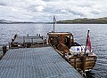 Mailboat at Inchmurrin pier - geograph.org.uk - 3462362.jpg 640 × 467; 407 KB
-
 Mawson's Lungwort - geograph.org.uk - 6442291.jpg 1,600 × 1,600; 385 KB
-
 Net Bay Viewpoint - geograph.org.uk - 6278095.jpg 1,024 × 768; 254 KB
-
 Net Bay Viewpoint to Endrick Viewpoint - geograph.org.uk - 6278113.jpg 1,024 × 768; 251 KB
-
 New building under construction - geograph.org.uk - 6416461.jpg 1,600 × 1,063; 352 KB
-
 New red beacon in the Clyde - geograph.org.uk - 5682500.jpg 1,024 × 768; 177 KB
-
 New section of riverside path - geograph.org.uk - 6463574.jpg 1,024 × 768; 190 KB
-
 New supermarket - geograph.org.uk - 6439154.jpg 1,024 × 640; 123 KB
-

-

-
 Old tidal basin of shipyard - geograph.org.uk - 6463610.jpg 1,024 × 768; 192 KB
-
 On Knockvadie - geograph.org.uk - 6146065.jpg 1,024 × 640; 183 KB
-
 On Knockvadie - geograph.org.uk - 6146071.jpg 1,024 × 768; 229 KB
-
 Path behind Langcraigs Care Home - geograph.org.uk - 6167275.jpg 1,024 × 768; 276 KB
-
 Path crossing forestry track - geograph.org.uk - 6146107.jpg 1,024 × 683; 183 KB
-
 Path crossing forestry track - geograph.org.uk - 6146109.jpg 1,024 × 683; 190 KB
-
 Path entering the woods - geograph.org.uk - 6146080.jpg 1,024 × 768; 231 KB
-
 Path meeting forestry track - geograph.org.uk - 6145907.jpg 1,024 × 768; 221 KB
-
 Path through cleared woodland - geograph.org.uk - 6146006.jpg 1,024 × 768; 265 KB
-
 Path through cleared woodland - geograph.org.uk - 6146013.jpg 1,024 × 768; 258 KB
-
 Path through cleared woodland - geograph.org.uk - 6146027.jpg 1,600 × 1,067; 511 KB
-
 Path through the woods - geograph.org.uk - 6146092.jpg 1,024 × 768; 282 KB
-
 Path to Bonhill Road - geograph.org.uk - 6439196.jpg 1,024 × 768; 167 KB
-
 Path to Chapelton Avenue - geograph.org.uk - 6463485.jpg 1,024 × 683; 125 KB
-
 Path to the Net Bay Viewpoint - geograph.org.uk - 6278099.jpg 1,024 × 768; 278 KB
-
 Pedestrian way into Riverside Parish Church, Dumbarton - geograph.org.uk - 6422529.jpg 1,209 × 1,600; 359 KB
-
 Pier at Inchmurrin - geograph.org.uk - 5505113.jpg 1,280 × 960; 739 KB
-
 Pillar box and old drinking fountain - geograph.org.uk - 6176181.jpg 1,600 × 1,200; 427 KB
-
 Pipeline on the shore - geograph.org.uk - 2890229.jpg 1,024 × 768; 180 KB
-
 Queen - panoramio.jpg 4,000 × 3,000; 4.2 MB
-

-
 Railway Bridge, Dumbarton East - geograph.org.uk - 6375633.jpg 800 × 601; 843 KB
-
 Rain - panoramio (13).jpg 4,000 × 3,000; 2.19 MB
-
 Rainbow over Loch Lomond - geograph.org.uk - 6280399.jpg 800 × 600; 593 KB
-
 Red Admiral butterflies on dry bracken - geograph.org.uk - 6278055.jpg 1,024 × 768; 157 KB
-
 Remains of a farm track - geograph.org.uk - 6198061.jpg 1,600 × 1,200; 585 KB
-
 Remains of a pool - geograph.org.uk - 2304015.jpg 1,024 × 512; 193 KB
-
 Ring Point, RSPB Loch Lomond - geograph.org.uk - 4974422.jpg 3,444 × 2,223; 2.78 MB
-
 Risk Street flats after improvement - geograph.org.uk - 6304118.jpg 1,600 × 900; 241 KB
-
 Risk Street flats after improvement works - geograph.org.uk - 6270853.jpg 1,024 × 710; 190 KB
-
 Risk Street flats during improvement works - geograph.org.uk - 6270855.jpg 1,024 × 683; 209 KB
-
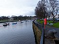
 River Clyde - geograph.org.uk - 2667757.jpg 3,748 × 2,811; 6.06 MB
-
 River Clyde - geograph.org.uk - 2667763.jpg 3,748 × 1,930; 4.39 MB
-
 River Clyde and Bowling - geograph.org.uk - 2326381.jpg 640 × 480; 126 KB
-
 River Leven and Dumbarton Rock - geograph.org.uk - 2033624.jpg 640 × 480; 135 KB
-
 River Leven at Dumbarton - geograph.org.uk - 2033631.jpg 640 × 480; 145 KB
-
 River Leven at Dumbarton - geograph.org.uk - 2033635.jpg 640 × 480; 144 KB
-
 River Leven at Dumbarton - geograph.org.uk - 2033637.jpg 640 × 400; 143 KB
-
 River Leven at Dumbarton - geograph.org.uk - 2033640.jpg 640 × 421; 150 KB
-
 River Leven bridge - geograph.org.uk - 3992705.jpg 640 × 438; 36 KB
-
 River Leven, Dumbarton - geograph.org.uk - 2726976.jpg 3,748 × 2,811; 7.13 MB
-
 River Leven, Dumbarton - geograph.org.uk - 2726979.jpg 3,748 × 2,811; 4.53 MB
-
 Riverside path - geograph.org.uk - 5592781.jpg 1,024 × 768; 335 KB
-
 Riverside path at Dumbarton - geograph.org.uk - 6386482.jpg 1,024 × 768; 221 KB
-
 Road - panoramio (108).jpg 3,000 × 4,000; 3.28 MB
-
 Road crossing the Cameron Burn - geograph.org.uk - 6165852.jpg 1,024 × 768; 287 KB
-
 Road to Blairlusk - geograph.org.uk - 6146971.jpg 640 × 481; 86 KB
-
 Road to Gartocharn - geograph.org.uk - 6181137.jpg 1,024 × 768; 221 KB
-
 Road to the caravan park - geograph.org.uk - 6146983.jpg 640 × 481; 130 KB
-
 Road to Wester Cameron - geograph.org.uk - 6165848.jpg 1,024 × 768; 198 KB
-
-
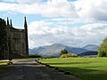
 Ross Priory by Loch Lomond - geograph.org.uk - 6406320.jpg 1,797 × 1,198; 531 KB
-
 Sandy bay at south east end of Loch Lomond - geograph.org.uk - 4973309.jpg 3,504 × 2,336; 3.54 MB
-

.jpg)

_Bridge_-_geograph.org.uk_-_6375655.jpg)


.jpg)
.jpg)
_-_geograph.org.uk_-_6375649.jpg)


.jpg)


.jpg)


