Category:West Horsley
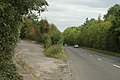
English: West Horsley is a small village between Guildford and Leatherhead in Surrey, England. Neighbouring villages include East Horsley, Ockham, West Clandon and East Clandon. It lies on the A246, and south of the A3. The Sheepleas Woods are located in the extreme south of the village.
village and civil parish in Surrey, UK  | |||||
| Upload media | |||||
| Instance of | |||||
|---|---|---|---|---|---|
| Location | Guildford, Surrey, South East England, England | ||||
| Area |
| ||||
 | |||||
Subcategories
This category has the following 8 subcategories, out of 8 total.
Media in category "West Horsley"
The following 200 files are in this category, out of 352 total.
(previous page) (next page)-
 A 246 near West Horsley - geograph.org.uk - 69602.jpg 640 × 481; 158 KB
-
 A Cross to Bear - geograph.org.uk - 2288292.jpg 2,560 × 1,920; 1.9 MB
-
 A246 at West Horsley, Surrey - geograph.org.uk - 1495465.jpg 640 × 428; 74 KB
-
 Access road off Shere Road - geograph.org.uk - 4429582.jpg 2,048 × 1,536; 2.8 MB
-

-

-
 Arable Farmland - geograph.org.uk - 6024508.jpg 5,120 × 3,840; 5.53 MB
-
 Arable fields, North Downs backslope - geograph.org.uk - 4255840.jpg 2,048 × 1,536; 2.53 MB
-
 Attractive row of trees between fields - geograph.org.uk - 4383657.jpg 800 × 533; 122 KB
-
 Autumn colours near Fuller's Farm - geograph.org.uk - 4254866.jpg 2,048 × 1,536; 2.83 MB
-
 Autumn colours, Hatchlands Park - geograph.org.uk - 4230462.jpg 2,048 × 1,536; 2.92 MB
-
 Bell & Colvill, West Horsley (geograph 2727491).jpg 2,560 × 1,920; 1.68 MB
-
 Bell and Colville car dealership, West Horsley - geograph.org.uk - 2582775.jpg 4,320 × 3,240; 4.39 MB
-
 Bell ^ Colvill - geograph.org.uk - 6162899.jpg 1,024 × 681; 761 KB
-
 Bend on byway - geograph.org.uk - 4383917.jpg 800 × 533; 165 KB
-
 Berries of the wayfaring tree, early August - geograph.org.uk - 6242914.jpg 801 × 1,024; 177 KB
-
 Berries of the wayfaring tree, mid-August - geograph.org.uk - 6242917.jpg 845 × 1,024; 180 KB
-
 Blake's Lane by Woolgars Farm - geograph.org.uk - 2999611.jpg 640 × 428; 102 KB
-
 Blakes Lane, East Clandon - geograph.org.uk - 4842196.jpg 2,048 × 1,536; 1.51 MB
-
 Blakes Lane, West Horsley - geograph.org.uk - 4827805.jpg 2,048 × 1,536; 1.47 MB
-
 Bluebells at Hatchlands - geograph.org.uk - 4944359.jpg 2,281 × 1,064; 983 KB
-
 Bluebells in Mountain Wood - geograph.org.uk - 108732.jpg 640 × 432; 148 KB
-
 Box Walk, Green Dene - geograph.org.uk - 550654.jpg 640 × 480; 192 KB
-
 Bridleway and farmhouse at Place Farm - geograph.org.uk - 4382972.jpg 800 × 533; 132 KB
-

-
 Broom House - geograph.org.uk - 1115865.jpg 640 × 480; 89 KB
-
 By Wix Hill Stud - geograph.org.uk - 907898.jpg 480 × 640; 81 KB
-

-
 Byway towards Fullers Farm - geograph.org.uk - 5789087.jpg 768 × 1,024; 285 KB
-

-
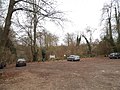 Car park in the woods, Sheepleas - geograph.org.uk - 4285383.jpg 4,608 × 3,456; 5.08 MB
-
 Caravans, Pebble Hill Farm - geograph.org.uk - 4431272.jpg 2,048 × 1,536; 3.4 MB
-
 Centenary Wood, Hatchlands Park - geograph.org.uk - 3626537.jpg 1,600 × 1,200; 871 KB
-

-

-

-

-
 Chestnut blossoms on The Street, West Horsley - geograph.org.uk - 5362343.jpg 2,304 × 1,728; 807 KB
-
 Clearing in Weston Wood - geograph.org.uk - 2963709.jpg 4,288 × 3,216; 3.86 MB
-
 Countryside near West Horsley Place - geograph.org.uk - 6238449.jpg 1,024 × 768; 186 KB
-
 Countryside north of West Horsley church - geograph.org.uk - 6237906.jpg 1,024 × 768; 194 KB
-
 Cowslip Meadow - geograph.org.uk - 2963854.jpg 4,288 × 3,216; 3.57 MB
-
 Cranmore School - geograph.org.uk - 2727496.jpg 2,560 × 1,920; 1.71 MB
-
 Cranmore School - geograph.org.uk - 494510.jpg 640 × 480; 118 KB
-
 Cranmore School, West Horsley - geograph.org.uk - 2727502.jpg 2,560 × 1,920; 1.74 MB
-
 Dawes Dene, West Horsley.jpg 3,000 × 2,250; 2.42 MB
-
 Daws Dene (geograph 3692885).jpg 640 × 427; 183 KB
-
 Daws Dene - geograph.org.uk - 3690167.jpg 640 × 427; 184 KB
-
 Daws Dene - geograph.org.uk - 4429542.jpg 2,048 × 1,536; 3.01 MB
-
 Daws Dene - geograph.org.uk - 4431263.jpg 2,048 × 1,536; 2.78 MB
-
 Daws Dene - geograph.org.uk - 4432382.jpg 2,048 × 1,536; 3.21 MB
-
 Daws Dene Farm - geograph.org.uk - 4255067.jpg 2,048 × 1,536; 2.87 MB
-
 Daws Dene Farm - geograph.org.uk - 4255163.jpg 2,048 × 1,536; 2.55 MB
-
 Daws Dene Farm - geograph.org.uk - 4255843.jpg 2,048 × 1,536; 2.51 MB
-
 Daws Dene near West Horsley - geograph.org.uk - 4429532.jpg 2,048 × 1,536; 3.03 MB
-
 Decoy bridleway, Hillside Manor - geograph.org.uk - 4429864.jpg 2,048 × 1,536; 3.09 MB
-
 Detached Properties on Shere Road West Horsley - geograph.org.uk - 6025312.jpg 5,120 × 3,840; 7.04 MB
-
 Disinfectant Foot Bath, West Horsley - geograph.org.uk - 564205.jpg 640 × 480; 146 KB
-
 Downland Above High Clandon Farm - geograph.org.uk - 2706368.jpg 2,560 × 1,920; 1.82 MB
-
 Downland arable, Fullers Farm - geograph.org.uk - 5789056.jpg 1,024 × 768; 212 KB
-
 Downland by Slade Farm - geograph.org.uk - 1115951.jpg 640 × 480; 107 KB
-
 Drinking trough - geograph.org.uk - 6162896.jpg 1,024 × 681; 1.05 MB
-
 Dwelling at Oakland Farm - geograph.org.uk - 4383975.jpg 800 × 533; 124 KB
-
 Dwellings east of Long Reach - geograph.org.uk - 4383950.jpg 800 × 533; 160 KB
-
 Early autumn, The Sheepleas - geograph.org.uk - 4181073.jpg 2,048 × 1,536; 3.68 MB
-
 East Lane, West Horsley - geograph.org.uk - 2729128.jpg 1,600 × 1,200; 521 KB
-
 East Lane, West Horsley - geograph.org.uk - 3904134.jpg 1,280 × 851; 395 KB
-
 Edwin Road, West Horsley - geograph.org.uk - 2728871.jpg 1,600 × 1,200; 607 KB
-
 Enclosure, Shere Road - geograph.org.uk - 4432424.jpg 2,048 × 1,536; 3.83 MB
-
 Entering West Horsley - geograph.org.uk - 3904160.jpg 851 × 1,280; 369 KB
-
 Entrance to Ripley gas pumping station - geograph.org.uk - 2728858.jpg 1,600 × 1,200; 558 KB
-
 Epsom Road at the exit to Cranmore School - geograph.org.uk - 4285373.jpg 4,608 × 3,456; 4.72 MB
-
 Epsom Road, West Horsley - geograph.org.uk - 2582776.jpg 4,320 × 3,240; 4.3 MB
-
 Epsom Road, West Horsley - geograph.org.uk - 4285939.jpg 4,608 × 3,456; 5.12 MB
-
 Epsom Road, West Horsley - geograph.org.uk - 4285943.jpg 4,608 × 3,456; 4.89 MB
-
 Epsom Road, West Horsley - geograph.org.uk - 4285988.jpg 4,608 × 3,456; 5.11 MB
-
 Farm access road, Daws Dene Farm - geograph.org.uk - 4255848.jpg 1,952 × 1,464; 2.82 MB
-
 Farm access track from Blake's Lane - geograph.org.uk - 4255157.jpg 2,048 × 1,536; 3.12 MB
-
 Farm Track - geograph.org.uk - 3788763.jpg 1,280 × 960; 920 KB
-
 Farm track off Blakes Lane - geograph.org.uk - 4827801.jpg 2,048 × 1,536; 1.52 MB
-
 Farm track off Shere Road - geograph.org.uk - 4285918.jpg 4,608 × 3,456; 5.03 MB
-
 Farmhouse, Place Farm - geograph.org.uk - 2704229.jpg 640 × 480; 103 KB
-
 Farmland near Woolgar's farm - geograph.org.uk - 4255076.jpg 2,048 × 1,536; 2.58 MB
-
 Farmland towards Woodcote Farm - geograph.org.uk - 6025164.jpg 3,648 × 2,736; 3.8 MB
-
 Field beside Green Lane - geograph.org.uk - 4383969.jpg 800 × 533; 128 KB
-
 Field Boundary - geograph.org.uk - 3788759.jpg 1,600 × 1,186; 613 KB
-
 Field by Blakes Lane, East Clandon - geograph.org.uk - 4842198.jpg 2,048 × 1,536; 1.22 MB
-
 Field East of St Mary's Church - geograph.org.uk - 2705715.jpg 2,560 × 1,920; 1.77 MB
-
 Field edge near the Sheepleas - geograph.org.uk - 4180932.jpg 2,048 × 1,536; 3.67 MB
-
 Field edge near West Horsley - geograph.org.uk - 4431276.jpg 2,048 × 1,536; 3.14 MB
-
 Field near The Sheepleas - geograph.org.uk - 4183466.jpg 2,048 × 1,536; 2.9 MB
-
 Field near West Horsley - geograph.org.uk - 4180928.jpg 2,048 × 1,536; 2.95 MB
-
 Field near West Horsley - geograph.org.uk - 4230419.jpg 2,048 × 1,536; 2.86 MB
-
 Field next to Long Reach - geograph.org.uk - 6025348.jpg 3,648 × 2,736; 3.95 MB
-
 Field next to St Mary's Church - geograph.org.uk - 6025316.jpg 3,648 × 2,736; 3.54 MB
-
 Field south of the A246 - geograph.org.uk - 4180938.jpg 2,048 × 1,536; 2.8 MB
-
 Fields by Long Reach, West Horsley - geograph.org.uk - 2728869.jpg 1,600 × 1,200; 572 KB
-
 Fields by Long Reach, West Horsley - geograph.org.uk - 2728896.jpg 1,600 × 1,200; 578 KB
-
 Fields by Long Reach, West Horsley - geograph.org.uk - 2729156.jpg 1,600 × 1,200; 583 KB
-
 Fields by Ripley Lane, West Horsley - geograph.org.uk - 4193747.jpg 2,304 × 1,728; 854 KB
-
 Fields near Woodcote Farm - geograph.org.uk - 5981219.jpg 4,160 × 3,120; 4.52 MB
-
 Footpath from Daws Dene - geograph.org.uk - 4429867.jpg 2,048 × 1,536; 3.18 MB
-

-
 Footpath junction by woodland - geograph.org.uk - 4383600.jpg 800 × 533; 169 KB
-
 Footpath junction with bridleway - geograph.org.uk - 4383606.jpg 800 × 533; 182 KB
-
 Footpath meets Cranmore Lane - geograph.org.uk - 4383602.jpg 800 × 533; 183 KB
-
 Footpath near Fuller's Farm - geograph.org.uk - 4254872.jpg 2,048 × 1,536; 3.13 MB
-
 Footpath near Jeffries Road - geograph.org.uk - 6023450.jpg 5,120 × 3,840; 7.33 MB
-
 Footpath to Daws Dene - geograph.org.uk - 4429521.jpg 2,048 × 1,536; 3.16 MB
-
 Footpath to Daws Dene - geograph.org.uk - 4432392.jpg 1,993 × 1,495; 3.62 MB
-
 Footpath to East Horsley - geograph.org.uk - 4183481.jpg 2,048 × 1,536; 1.75 MB
-
 Footpath, Hook Wood - geograph.org.uk - 4431266.jpg 2,048 × 1,536; 3.88 MB
-

-
 Fox in the landscape - geograph.org.uk - 2999595.jpg 640 × 480; 149 KB
-
 Fuller's Lane - geograph.org.uk - 4254870.jpg 2,048 × 1,536; 3.23 MB
-
 Fullers Farm Road and Wix Lane - geograph.org.uk - 3696282.jpg 3,888 × 2,592; 6.64 MB
-
 Fullers Farm Road at Fullers Farm - geograph.org.uk - 3696247.jpg 619 × 414; 199 KB
-
 Fullers Farm Road at Hookwood Farm - geograph.org.uk - 3692900.jpg 3,888 × 2,592; 6.01 MB
-
 Gate at Sheepleas - geograph.org.uk - 2963759.jpg 4,288 × 3,216; 3.22 MB
-
 Gateway to two footpaths on Epsom Road - geograph.org.uk - 4383598.jpg 800 × 533; 207 KB
-
 Gentle slopes, Sheepleas - geograph.org.uk - 2208224.jpg 3,072 × 2,304; 2.66 MB
-
 Glade in Hatchlands Park - geograph.org.uk - 2538178.jpg 3,648 × 2,736; 6.5 MB
-
 Green Dene - geograph.org.uk - 2654498.jpg 640 × 428; 122 KB
-
 Green Dene, passing Mountain Wood - geograph.org.uk - 4441131.jpg 768 × 1,024; 361 KB
-
 Green Lane - geograph.org.uk - 2999702.jpg 640 × 480; 176 KB
-
 Green Lane junction with Long Reach - geograph.org.uk - 4383965.jpg 800 × 533; 146 KB
-
 Green Lane West - geograph.org.uk - 2999674.jpg 640 × 480; 181 KB
-
 Green Lane West - geograph.org.uk - 4418558.jpg 768 × 1,024; 326 KB
-
 Green Lane West, West Horsley - geograph.org.uk - 4193587.jpg 2,304 × 1,728; 811 KB
-
 Green Lane, West Horsley - geograph.org.uk - 4213030.jpg 2,304 × 1,728; 649 KB
-
 Guildford via Epsom Downs train^ - geograph.org.uk - 2999658.jpg 640 × 480; 153 KB
-
 Hatchlands - Centenary Circuit - geograph.org.uk - 5281386.jpg 2,576 × 3,431; 4.72 MB
-
 Hatchlands Park Bluebell Carpet 2017 - geograph.org.uk - 5358932.jpg 4,548 × 1,613; 2.87 MB
-
 Hatchlands Park Bluebell Carpet 2017 - geograph.org.uk - 5358937.jpg 8,249 × 1,804; 6.43 MB
-
 Hatchlands Park, Icehouse - geograph.org.uk - 5358926.jpg 3,055 × 2,363; 2.07 MB
-
 Hatchlands Park, Icehouse plaque - geograph.org.uk - 5358929.jpg 2,848 × 2,134; 1.21 MB
-
 High Clandon Farm from Fullers Farm Road - geograph.org.uk - 3697537.jpg 3,888 × 2,592; 4.72 MB
-
 Hillside Manor - geograph.org.uk - 4418241.jpg 1,024 × 776; 213 KB
-
 Hookwood Farm - geograph.org.uk - 3696214.jpg 427 × 640; 193 KB
-
 Horses in field near Rydings Farm - geograph.org.uk - 4383972.jpg 800 × 533; 124 KB
-
 Horsley Camping ^ Caravan Club Site - geograph.org.uk - 3788735.jpg 1,600 × 1,170; 436 KB
-
 Horsley Jubilee Trail - geograph.org.uk - 2705689.jpg 2,560 × 1,920; 1.54 MB
-
 Horsley Newsagency - geograph.org.uk - 2727484.jpg 2,560 × 1,920; 1.81 MB
-
 Horsley Snowdrops - geograph.org.uk - 2288322.jpg 2,560 × 1,920; 1.59 MB
-
 House on East Lane, West Horsley - geograph.org.uk - 2728901.jpg 1,600 × 1,200; 591 KB
-
 Houses on bend on Little Cranmore Lane - geograph.org.uk - 4383620.jpg 800 × 533; 174 KB
-
 Jefferies Road - geograph.org.uk - 3690132.jpg 640 × 427; 199 KB
-

-
 Junction of Long Reach and The Street - geograph.org.uk - 2728870.jpg 1,600 × 1,200; 553 KB
-
 Junction of ways - geograph.org.uk - 4383655.jpg 800 × 533; 147 KB
-
 Lane to Waterloo Farm - geograph.org.uk - 3788724.jpg 1,024 × 768; 709 KB
-
 Large House on Unnamed Road - geograph.org.uk - 6025327.jpg 3,648 × 2,736; 5.49 MB
-
 Layby on Epsom Road entering Horsley - geograph.org.uk - 4285934.jpg 4,608 × 3,456; 5.11 MB
-
 Little Boxes - geograph.org.uk - 1115898.jpg 640 × 480; 73 KB
-
 Little Cranmore - geograph.org.uk - 6025372.jpg 3,648 × 2,736; 4.31 MB
-
 Little Wix Wood - geograph.org.uk - 5281321.jpg 5,152 × 3,864; 6.22 MB
-
 Little Wix Wood at Hatchlands Park - geograph.org.uk - 4944368.jpg 6,533 × 1,321; 3.51 MB
-
 Little Wix Wood, Bluebells - geograph.org.uk - 4944364.jpg 3,791 × 1,821; 2.74 MB
-
 Little Wix Wood, Hatchlands - geograph.org.uk - 4230616.jpg 2,048 × 1,536; 3.41 MB
-
 Long Reach - geograph.org.uk - 2727130.jpg 2,560 × 1,920; 1.92 MB
-
 Long Reach Junction with Woodside - geograph.org.uk - 6025100.jpg 3,648 × 2,736; 3.38 MB
-
 Long Reach, West Horsley - geograph.org.uk - 2728861.jpg 1,600 × 1,200; 572 KB
-
 Long Reach, West Horsley - geograph.org.uk - 2728865.jpg 1,600 × 1,200; 575 KB
-
 Long Reach, West Horsley - geograph.org.uk - 2728867.jpg 1,600 × 1,200; 522 KB
-
 Long Reach, West Horsley - geograph.org.uk - 2728892.jpg 1,600 × 1,200; 634 KB
-
 Long Reach, West Horsley - geograph.org.uk - 4212440.jpg 2,304 × 1,728; 843 KB
-
 Long Reach, West Horsley - geograph.org.uk - 4212443.jpg 2,304 × 1,728; 802 KB
-
 Long Walk - geograph.org.uk - 5281342.jpg 4,283 × 2,039; 5.17 MB
-

-

-

-
 Looking east on railway line - geograph.org.uk - 4383630.jpg 800 × 533; 166 KB
-
 Looking into a spur of Green Lane - geograph.org.uk - 4383982.jpg 800 × 533; 102 KB
-
 Looking into Kenyons - geograph.org.uk - 4383625.jpg 800 × 533; 116 KB
-

-
 Looking west on railway line - geograph.org.uk - 4383632.jpg 800 × 533; 176 KB
-
 Looking west on Tintells Lane - geograph.org.uk - 4383626.jpg 800 × 533; 136 KB
-
 Looking west on Whitehill Lane - geograph.org.uk - 4383991.jpg 800 × 477; 150 KB
-
 Lower Hammond's Farm - geograph.org.uk - 4230234.jpg 1,968 × 1,476; 3.31 MB
-
 Man-made Landscape - geograph.org.uk - 2963697.jpg 4,288 × 3,216; 3.59 MB
-
 Meadow Way - geograph.org.uk - 1115916.jpg 640 × 480; 113 KB
-
 Meadow Way, West Horsley - geograph.org.uk - 5362335.jpg 2,304 × 1,728; 826 KB
-
 Mock Tudor in Green Dene - geograph.org.uk - 583368.jpg 640 × 480; 170 KB
-
 Oaks, Woodcote Farm - geograph.org.uk - 4253331.jpg 2,048 × 1,536; 2.81 MB
-
 Ockham Lane North, West Horsley - geograph.org.uk - 4211597.jpg 2,304 × 1,728; 832 KB
-
 Ockham Road North at the junction of East Lane - geograph.org.uk - 4193510.jpg 2,304 × 1,728; 642 KB
-
 Old Cattle Trough, West Horsley. - geograph.org.uk - 494381.jpg 640 × 480; 141 KB
-
 Old Epsom road at the ice house - geograph.org.uk - 6209334.jpg 4,032 × 3,024; 747 KB
-
 Old Epsom Road near Wix Hill Lodge - geograph.org.uk - 6209340.jpg 3,024 × 4,032; 820 KB
-
 Old Epsom Road on ascent to the ice house - geograph.org.uk - 6209319.jpg 4,032 × 3,024; 5.22 MB
-
 Old farm out-building, Woolgars Farm - geograph.org.uk - 5789116.jpg 836 × 1,024; 226 KB
-
 Ordnance Survey Sheet TQ 05 Woking, Published 1956.jpg 5,687 × 6,624; 13.53 MB
-
 Paddocks near Woolgar's Farm - geograph.org.uk - 4254880.jpg 2,048 × 1,536; 3.34 MB
-
 Paddocks, West Horsley - geograph.org.uk - 4181077.jpg 1,885 × 1,414; 1.84 MB
-
 Paddocks, West Horsley - geograph.org.uk - 4429516.jpg 2,048 × 1,536; 3.07 MB
-
 Path beside the bluebell wood - geograph.org.uk - 2538190.jpg 3,648 × 2,736; 5 MB
-
 Path from the west end of Tintells Lane - geograph.org.uk - 4383627.jpg 800 × 533; 189 KB
-
 Path in Sheepleas - geograph.org.uk - 2963723.jpg 4,288 × 3,216; 3.47 MB
-
 Path towards Hatchlands Park - geograph.org.uk - 4230238.jpg 2,048 × 1,536; 2.94 MB
-
 Path, Sheepleas - geograph.org.uk - 4429555.jpg 2,048 × 1,536; 3.32 MB


.jpg)


,_Sheepleas_-_geograph.org.uk_-_6237563.jpg)
,_Sheepleas_(1)_-_geograph.org.uk_-_6236684.jpg)
,_Sheepleas_(2)_-_geograph.org.uk_-_6236708.jpg)
,_Sheepleas_(3)_-_geograph.org.uk_-_6243486.jpg)


.jpg)


