Category:West Lomond
hill in Fife, Scotland, UK  | |||||
| Upload media | |||||
| Instance of | |||||
|---|---|---|---|---|---|
| Part of | |||||
| Location | Fife, Scotland | ||||
| Mountain range | |||||
| Topographic prominence |
| ||||
| Elevation above sea level |
| ||||
| Parent peak | |||||
 | |||||
Subcategories
This category has the following 3 subcategories, out of 3 total.
J
- John Knox's Pulpit (4 F)
W
- West Lomond cairn (4 F)
- West Lomond trig point (8 F)
Media in category "West Lomond"
The following 67 files are in this category, out of 67 total.
-
 Approaching West Lomond - geograph.org.uk - 1449452.jpg 640 × 480; 83 KB
-
 Ballo Reservoir and West Lomond - geograph.org.uk - 1731317.jpg 1,600 × 1,200; 383 KB
-
 Ballo Reservoir from Balgothrie - geograph.org.uk - 1368916.jpg 640 × 480; 64 KB
-
 Barley, Woodmill - geograph.org.uk - 1621094.jpg 640 × 480; 73 KB
-
 Bibio sp. on the Lomonds - geograph.org.uk - 536220.jpg 640 × 480; 97 KB
-
 Boundary Stone on West Lomond Path - geograph.org.uk - 1449423.jpg 640 × 480; 112 KB
-
 By Drumdreel Farm - geograph.org.uk - 175136.jpg 640 × 424; 50 KB
-
 Country lane near Dunshalt - geograph.org.uk - 605983.jpg 480 × 640; 97 KB
-
 Craigmead trees - geograph.org.uk - 880144.jpg 640 × 480; 63 KB
-

-
 Descending West Lomond - geograph.org.uk - 1449504.jpg 640 × 480; 91 KB
-
 East Lomond Summit - geograph.org.uk - 1449362.jpg 640 × 480; 66 KB
-
 Easter and Wester Upper Urquhart - geograph.org.uk - 355260.jpg 640 × 480; 87 KB
-
 Farm track towards Strathmiglo - geograph.org.uk - 111675.jpg 640 × 480; 93 KB
-
 Farm track, Glenlomond - geograph.org.uk - 1422288.jpg 640 × 480; 84 KB
-
 Farmland by East Hall - geograph.org.uk - 132279.jpg 640 × 480; 114 KB
-
 Fields near Butterwell - geograph.org.uk - 204586.jpg 640 × 480; 146 KB
-
 Gate on the West Lomond Path - geograph.org.uk - 1366300.jpg 640 × 480; 89 KB
-
 Glassart Den Woodland - geograph.org.uk - 1597342.jpg 640 × 480; 82 KB
-
 Glenvale - geograph.org.uk - 357584.jpg 640 × 405; 91 KB
-
 Glenvale and West Lomond - geograph.org.uk - 562687.jpg 640 × 485; 99 KB
-
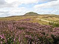
 Heather Moorland, West Lomond - geograph.org.uk - 1449433.jpg 640 × 480; 98 KB
-
 Heather rocks - geograph.org.uk - 140968.jpg 640 × 480; 91 KB
-
 Hill Track - West Lomond - geograph.org.uk - 1564322.jpg 640 × 428; 74 KB
-
 Holl Reservoir - geograph.org.uk - 1368895.jpg 640 × 480; 61 KB
-
 Holl Reservoir - geograph.org.uk - 1582407.jpg 640 × 359; 59 KB
-
 Lacesston Farm - geograph.org.uk - 355236.jpg 640 × 480; 81 KB
-

-
 Moorland Pool, West Lomond - geograph.org.uk - 1449414.jpg 640 × 480; 116 KB
-
 Near Rossie House - geograph.org.uk - 190645.jpg 640 × 424; 56 KB
-
 Northwards from Craigen Gaw - geograph.org.uk - 1734991.jpg 640 × 480; 105 KB
-
 On West Lomond - geograph.org.uk - 1449478.jpg 640 × 480; 95 KB
-
 Pasture, Auchmuir. - geograph.org.uk - 9135.jpg 640 × 430; 51 KB
-
 Path to the summit. - geograph.org.uk - 622580.jpg 480 × 640; 80 KB
-
 Pitlour Hill - geograph.org.uk - 1553927.jpg 640 × 480; 81 KB
-
 Potato field near Charlottetown - geograph.org.uk - 190592.jpg 640 × 424; 64 KB
-
 Rough grazing near Drumain Reservoir - geograph.org.uk - 1585430.jpg 640 × 359; 81 KB
-
 Sheep, Pitlour Hill - geograph.org.uk - 1553982.jpg 640 × 480; 74 KB
-
 Snow and no snow - geograph.org.uk - 1734952.jpg 640 × 480; 102 KB
-
 South-east slope of West Lomond - geograph.org.uk - 1738263.jpg 640 × 427; 59 KB
-
 Steep hillside - geograph.org.uk - 354026.jpg 640 × 480; 73 KB
-
 Stubble field at Scotstarvit. - geograph.org.uk - 605991.jpg 640 × 480; 53 KB
-
 Summit of Black Craig - geograph.org.uk - 805932.jpg 640 × 426; 94 KB
-
 The footpath towards West Lomond - geograph.org.uk - 880142.jpg 640 × 480; 82 KB
-
 The West Lomond track - geograph.org.uk - 622613.jpg 480 × 640; 65 KB
-
 Track between the Lomonds - geograph.org.uk - 1735021.jpg 640 × 480; 101 KB
-
 Track to West Lomond - geograph.org.uk - 218220.jpg 640 × 480; 74 KB
-
 Track to West Lomond - geograph.org.uk - 536188.jpg 640 × 480; 80 KB
-
 Track to West Lomond - geograph.org.uk - 536233.jpg 640 × 480; 85 KB
-
 View from Bishop Hill - geograph.org.uk - 455020.jpg 640 × 480; 77 KB
-
 View from West Lomond Hill - geograph.org.uk - 1567920.jpg 600 × 450; 269 KB
-
 View North East from West Lomond - geograph.org.uk - 622606.jpg 480 × 640; 37 KB
-
 View south from Cairn Trench - geograph.org.uk - 180526.jpg 640 × 480; 31 KB
-
 Viewpoint on East Lomond - geograph.org.uk - 1365809.jpg 640 × 480; 76 KB
-
 West Lomond - geograph.org.uk - 1421883.jpg 640 × 480; 117 KB
-
 West Lomond - geograph.org.uk - 64837.jpg 640 × 480; 97 KB
-
 West Lomond a windy february day - panoramio.jpg 6,160 × 4,080; 3.29 MB
-
 West Lomond at sunset.jpg 2,560 × 1,920; 561 KB
-
 West Lomond from the access path - geograph.org.uk - 33435.jpg 640 × 480; 75 KB
-
 West Lomond Hill - geograph.org.uk - 461604.jpg 640 × 396; 109 KB
-
 West Lomond in the distance - geograph.org.uk - 1597165.jpg 480 × 640; 118 KB
-
 West Lomond Path - geograph.org.uk - 1366288.jpg 640 × 480; 87 KB
-
 West Lomond Path - geograph.org.uk - 1366322.jpg 640 × 480; 78 KB
-
 West Lomond path - geograph.org.uk - 622599.jpg 480 × 640; 82 KB
-
 West Lomond, Fife - geograph.org.uk - 1564300.jpg 640 × 428; 60 KB
-
 West Lomond.JPG 2,304 × 1,728; 1.24 MB
-
 Woodland around Harperleas Reservoir - geograph.org.uk - 1585401.jpg 640 × 359; 76 KB


