Category:Westminster, Ellesmere Port
suburb of Ellesmere Port, Cheshire, United Kingdom .jpg) | |||||
| Upload media | |||||
| Instance of | |||||
|---|---|---|---|---|---|
| Location | Ellesmere Port, Cheshire West and Chester, Cheshire, North West England, England | ||||
 | |||||
Subcategories
This category has the following 2 subcategories, out of 2 total.
J
- Joseph Groome Towers (4 F)
Media in category "Westminster, Ellesmere Port"
The following 23 files are in this category, out of 23 total.
-
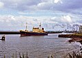 A vessel on the Manchester Ship Canal at Ellesmere Port - geograph.org.uk - 6464044.jpg 1,500 × 1,060; 1.57 MB
-
-

-
 Café 59, Ellesmere Port - geograph.org.uk - 6184748.jpg 800 × 507; 62 KB
-
 Corner Shop, Stanley Road, Ellesmere Port.JPG 4,320 × 3,240; 2.72 MB
-
 Ellesmere Port - geograph.org.uk - 6464037.jpg 1,419 × 794; 1.1 MB
-
 Ellesmere Port Boat Museum - workshops - geograph.org.uk - 6481644.jpg 1,800 × 1,200; 361 KB
-
 George V postbox on Westminster Road, Ellesmere Port - geograph.org.uk - 6185175.jpg 2,136 × 2,848; 1.06 MB
-
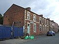
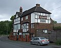
 House on Westminster Road, Ellesmere Port - geograph.org.uk - 6185179.jpg 2,848 × 2,136; 1.32 MB
-
 Junction 10 on the M53 - geograph.org.uk - 6434160.jpg 2,700 × 1,999; 266 KB
-

-
 Manchester Ship Canal Railway - geograph.org.uk - 6184746.jpg 800 × 600; 93 KB
-
 Playing field, New Grosvenor Road, Ellesmere Port.JPG 4,320 × 3,240; 3.01 MB
-
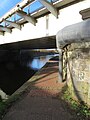 Railway bridge 145A over the Shropshire Union Canal - geograph.org.uk - 6023539.jpg 1,200 × 1,600; 394 KB
-
 Royal Ledsham Bowling Club.JPG 4,320 × 3,240; 3.29 MB
-
 Sea Waves Fish Bar, Ellesmere Port.JPG 3,240 × 4,320; 3.04 MB
-
-
 Slip road junction 9 M53 - geograph.org.uk - 5936726.jpg 640 × 427; 227 KB
-
 Terraced housing on Elm Street - geograph.org.uk - 6184749.jpg 800 × 600; 109 KB
-
-
 The M53 heading north - geograph.org.uk - 6434164.jpg 2,700 × 2,025; 317 KB
-
 The M53 heading north - geograph.org.uk - 6434166.jpg 2,700 × 2,025; 409 KB
-
 The National Waterways Museum, Ellesmere Port - geograph.org.uk - 6464060.jpg 1,682 × 1,073; 1.63 MB


