Category:Westow
village and civil parish in North Yorkshire, England, UK  | |||||
| Upload media | |||||
| Instance of | |||||
|---|---|---|---|---|---|
| Location | Ryedale, North Yorkshire, Yorkshire and the Humber, England | ||||
 | |||||
Subcategories
This category has the following 8 subcategories, out of 8 total.
B
- The Blacksmiths Arms, Westow (6 F)
F
- Firby, Ryedale (5 F)
H
- Howl Beck (3 F)
K
- Kirkham Hall (5 F)
S
- St Mary's Church, Westow (7 F)
W
- Westow Hall (5 F)
- Westow War Memorial (3 F)
Media in category "Westow"
The following 200 files are in this category, out of 291 total.
(previous page) (next page)-
 A play area at Westow - geograph.org.uk - 2326084.jpg 800 × 600; 233 KB
-
 A quiet corner of Westow - geograph.org.uk - 4353559.jpg 4,320 × 3,240; 3.75 MB
-
 Access road from Westow Low Grange - geograph.org.uk - 4530329.jpg 4,608 × 3,456; 5.65 MB
-
 An escapee from Badger Wood^ - geograph.org.uk - 2838514.jpg 1,024 × 768; 97 KB
-
 Approaching Firby from the east - geograph.org.uk - 3868863.jpg 1,600 × 1,200; 392 KB
-
 Arable farmland - geograph.org.uk - 3900747.jpg 2,000 × 1,500; 2.38 MB
-
 Arable fields and power lines - geograph.org.uk - 3907574.jpg 2,000 × 1,500; 3.3 MB
-
 Autumnal approach to The Hall - geograph.org.uk - 3227119.jpg 1,024 × 768; 349 KB
-
 Badger Hill (house) hidden in the trees - geograph.org.uk - 2326068.jpg 800 × 600; 343 KB
-
 Baron Baronness Grimthorpe.jpg 375 × 500; 99 KB
-
 Base of Cross at Kirkham Priory - geograph.org.uk - 5381054.jpg 1,024 × 768; 347 KB
-
 Beech hedge, autumn - geograph.org.uk - 3227123.jpg 1,024 × 768; 397 KB
-
 Beef cattle beside the River Derwent - geograph.org.uk - 4529188.jpg 4,578 × 3,416; 7.2 MB
-
 Beside Badger Wood - geograph.org.uk - 5489434.jpg 640 × 427; 183 KB
-
 Beside the Derwent - geograph.org.uk - 2917180.jpg 1,024 × 768; 234 KB
-
 Bird-scarer in crop field - geograph.org.uk - 2837599.jpg 1,024 × 768; 198 KB
-
 Bird-scarers on Primrose Hill - geograph.org.uk - 2837632.jpg 1,024 × 768; 126 KB
-
 Blacksmith's Arms, Westow - geograph.org.uk - 5880549.jpg 1,024 × 768; 125 KB
-
 Bluebells below a beech tree, Westow churchyard - geograph.org.uk - 5372749.jpg 1,024 × 768; 300 KB
-
 Boundary between different crops - geograph.org.uk - 2837611.jpg 1,024 × 768; 128 KB
-
 Bridge over the River Derwent - geograph.org.uk - 3405689.jpg 640 × 480; 154 KB
-
 Bridleway at Grange Farm - geograph.org.uk - 5772101.jpg 2,048 × 1,536; 1.53 MB
-
 Bridleway near Westow. - geograph.org.uk - 5772095.jpg 2,048 × 1,536; 1.32 MB
-
 Bridleway sign - geograph.org.uk - 2917460.jpg 1,024 × 705; 171 KB
-
 Bridleway to Grange Farm - geograph.org.uk - 4353578.jpg 4,320 × 3,240; 2.59 MB
-
 Bridleway to Grange Farm - geograph.org.uk - 6064583.jpg 3,240 × 4,319; 4.83 MB
-
 Cattle across the river - geograph.org.uk - 5381201.jpg 1,024 × 768; 263 KB
-
 Centenary Way - geograph.org.uk - 5772105.jpg 2,048 × 1,536; 1.39 MB
-
 Centenary way approaching Coldwell Plantation - geograph.org.uk - 3868857.jpg 1,600 × 1,200; 568 KB
-
 Church Farm - geograph.org.uk - 5494299.jpg 5,184 × 3,456; 6.46 MB
-
 Church Farm Kennels - geograph.org.uk - 1295111.jpg 640 × 384; 293 KB
-
 Church Lane Low Lane Junction - geograph.org.uk - 2094051.jpg 4,000 × 3,000; 3.17 MB
-
 Church Lane, Westow - geograph.org.uk - 5372726.jpg 1,024 × 768; 198 KB
-
 Coldwell Plantation - geograph.org.uk - 261073.jpg 640 × 480; 75 KB
-
 Comfrey plants - geograph.org.uk - 2916616.jpg 668 × 1,024; 243 KB
-
 Crambeck, aerial 2018 - geograph.org.uk - 5767531.jpg 800 × 533; 79 KB
-
 Crop field south of Penhowe Lane - geograph.org.uk - 2837437.jpg 1,024 × 768; 172 KB
-
 Dark Lane - geograph.org.uk - 3900944.jpg 2,000 × 1,500; 2.95 MB
-
 Dark Lane between Firby and Westow - geograph.org.uk - 2969487.jpg 2,248 × 4,000; 2.17 MB
-
 Derwentside priory - Kirkham, North Yorkshire - geograph.org.uk - 5991200.jpg 1,024 × 672; 174 KB
-
 Deserted paddock - geograph.org.uk - 3907456.jpg 2,000 × 1,500; 2.33 MB
-
 Digger near Howlbeck Bridge - geograph.org.uk - 3405745.jpg 640 × 427; 79 KB
-
 Dilapidated sheds in a field off Henlow Lane - geograph.org.uk - 5372837.jpg 1,024 × 768; 182 KB
-
 Don't kill the villagers - geograph.org.uk - 3907414.jpg 2,000 × 1,500; 2.63 MB
-
 Down the Derwent - geograph.org.uk - 2917170.jpg 1,024 × 768; 155 KB
-
 Downhill to Westow - geograph.org.uk - 3907427.jpg 2,000 × 1,500; 2.47 MB
-
 Edge of a large field - geograph.org.uk - 2837787.jpg 1,024 × 768; 145 KB
-
 Entering Westow village from the west - geograph.org.uk - 3900763.jpg 2,000 × 1,500; 2.17 MB
-
 Entering Westow, North Yorkshire - geograph.org.uk - 2326074.jpg 800 × 600; 231 KB
-
 Entrance to Kirkham Priory - geograph.org.uk - 6227361.jpg 2,000 × 1,340; 3.66 MB
-
 F15 Low Over Westow.jpg 964 × 707; 46 KB
-
 Farm track to Penhowe Lane - geograph.org.uk - 5595797.jpg 1,600 × 1,064; 791 KB
-
 Farmland at Four Lane Ends - geograph.org.uk - 3482736.jpg 640 × 427; 111 KB
-
 Farmland near Badger Bank - geograph.org.uk - 2011942.jpg 640 × 480; 95 KB
-
 Farmland near Church Farm - geograph.org.uk - 2011929.jpg 640 × 480; 117 KB
-
 Farmland near Westow - geograph.org.uk - 2011948.jpg 640 × 480; 62 KB
-
 Farmland near Westow Low Grange - geograph.org.uk - 2012029.jpg 640 × 480; 61 KB
-
 Farmland north of Penhowe Lane - geograph.org.uk - 2837569.jpg 1,024 × 768; 163 KB
-
 Farmland west of the track to Low Penhowe - geograph.org.uk - 2837618.jpg 1,024 × 768; 174 KB
-
 Farmland, The Brakes - geograph.org.uk - 2012016.jpg 640 × 480; 72 KB
-
 Farmland, The Leys - geograph.org.uk - 2012035.jpg 640 × 480; 65 KB
-
 Field beside the Road to Kirkham - geograph.org.uk - 5493901.jpg 5,184 × 3,456; 6.53 MB
-
 Field boundary near Stud Farm - geograph.org.uk - 5372722.jpg 1,024 × 768; 193 KB
-
 Fields near Badger Wood - geograph.org.uk - 5489445.jpg 640 × 427; 194 KB
-
 Filling the gaps in the hedge - geograph.org.uk - 2838508.jpg 1,024 × 768; 141 KB
-
 Firby - geograph.org.uk - 6271389.jpg 640 × 360; 101 KB
-
 Floating debris lodged on the weir - geograph.org.uk - 2917205.jpg 1,024 × 768; 292 KB
-
 Footpath through Wheat Field - geograph.org.uk - 2489003.jpg 3,264 × 2,448; 1.61 MB
-
 Footpath to River Derwent and Jeffry Bog - geograph.org.uk - 2094012.jpg 4,000 × 3,000; 3.18 MB
-
 Footpath to the Jeffry Bog Plantation - geograph.org.uk - 1292238.jpg 640 × 427; 404 KB
-
 Footpath towards Firby - geograph.org.uk - 2011931.jpg 640 × 480; 123 KB
-
-
 Four Lane Ends - geograph.org.uk - 2012013.jpg 640 × 480; 71 KB
-
 Fox and Hounds House, Westow - geograph.org.uk - 3900851.jpg 2,000 × 1,500; 1.99 MB
-
 Fungus on fallen branch - geograph.org.uk - 3908691.jpg 2,000 × 1,635; 2.71 MB
-
 Gate on the path from Leavening to Penhowe Lane - geograph.org.uk - 4625241.jpg 1,024 × 768; 191 KB
-
 Gatehouse, Kirkham Priory - geograph.org.uk - 5493742.jpg 5,184 × 3,456; 6.36 MB
-
 Gatehouse, Kirkham Priory - geograph.org.uk - 5547967.jpg 640 × 480; 192 KB
-
 Grass field and Church Farm, Westow - geograph.org.uk - 5372754.jpg 1,024 × 768; 227 KB
-
 Grass triangle, north of Westow - geograph.org.uk - 2917446.jpg 1,024 × 768; 255 KB
-
 Grazing land, Church Farm - geograph.org.uk - 2011927.jpg 640 × 480; 81 KB
-
 Grazing land, Stud Farm, Westow - geograph.org.uk - 2012006.jpg 640 × 480; 52 KB
-
 Green Lane - geograph.org.uk - 133193.jpg 640 × 480; 196 KB
-
 Hanging Hill Lane (track) - geograph.org.uk - 4530314.jpg 4,608 × 3,456; 5.65 MB
-
 Hanging Hill Lane - geograph.org.uk - 3908673.jpg 2,000 × 1,500; 2.14 MB
-
 Hanging Hill Lane - geograph.org.uk - 6065041.jpg 4,319 × 2,901; 2.64 MB
-
 Hanging Hill Lane 2 - geograph.org.uk - 5772089.jpg 2,048 × 1,536; 1.14 MB
-
 Hazy day over Westow - geograph.org.uk - 3907439.jpg 2,000 × 1,500; 3 MB
-
 Heading for home - geograph.org.uk - 3222115.jpg 1,024 × 768; 347 KB
-
 Hedgerow near Westow Low Grange - geograph.org.uk - 3405635.jpg 640 × 427; 72 KB
-
 Henlow Lane - geograph.org.uk - 3405773.jpg 427 × 640; 83 KB
-
 Henlow Lane - geograph.org.uk - 3907419.jpg 2,000 × 1,499; 2.77 MB
-
 Henlow Lane - geograph.org.uk - 5427617.jpg 640 × 427; 226 KB
-
 High Lane - geograph.org.uk - 3908684.jpg 2,000 × 1,500; 3.31 MB
-
 High Lane - geograph.org.uk - 5772091.jpg 2,048 × 1,536; 1.63 MB
-
 High Lane - geograph.org.uk - 6065049.jpg 3,239 × 4,319; 4.3 MB
-
 Howardian Hills, AONB - geograph.org.uk - 3900756.jpg 2,000 × 1,500; 2.28 MB
-
 Howl Beck - geograph.org.uk - 4353583.jpg 3,240 × 4,320; 4.79 MB
-
 Howl Beck passing through woodland - geograph.org.uk - 2837649.jpg 1,024 × 768; 267 KB
-
 Howlbeck Bridge - geograph.org.uk - 3868829.jpg 1,600 × 1,200; 902 KB
-
 Howsham Wood - geograph.org.uk - 2011962.jpg 640 × 480; 104 KB
-
 Howsham Woods - geograph.org.uk - 2094089.jpg 4,000 × 3,000; 2.51 MB
-
 Jeffry Bog Plantation - geograph.org.uk - 2489065.jpg 3,264 × 2,448; 1.91 MB
-
 Jeffry Bog Plantation from Huttons Bank Wood - geograph.org.uk - 2806893.jpg 3,264 × 2,448; 2.39 MB
-
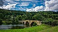 Kirkham Bridge - geograph.org.uk - 5138633.jpg 1,800 × 1,012; 1.95 MB
-
 Kirkham Bridge - geograph.org.uk - 5379379.jpg 1,024 × 768; 253 KB
-
 Kirkham Bridge - geograph.org.uk - 5493747.jpg 5,184 × 3,456; 6.29 MB
-
 Kirkham Bridge as seen from Kirkham Priory - geograph.org.uk - 6461091.jpg 1,200 × 1,800; 246 KB
-
 Kirkham Bridge awaits repair - geograph.org.uk - 4529200.jpg 4,608 × 3,456; 4.09 MB
-
 Kirkham Bridge, Kirkham - geograph.org.uk - 5762423.jpg 640 × 480; 96 KB
-
 Kirkham Priory - geograph.org.uk - 4778128.jpg 800 × 600; 86 KB
-
 Kirkham Priory - geograph.org.uk - 4993319.jpg 4,000 × 3,000; 4.28 MB
-
 Kirkham Priory - geograph.org.uk - 4993322.jpg 4,000 × 3,000; 3.9 MB
-
 Kirkham Priory - geograph.org.uk - 4993327.jpg 3,000 × 4,000; 4.55 MB
-
 Kirkham Priory - geograph.org.uk - 4993329.jpg 4,000 × 3,000; 4.94 MB
-
 Kirkham Priory - geograph.org.uk - 5493707.jpg 5,184 × 3,456; 6.88 MB
-
 Kirkham Priory - geograph.org.uk - 5521259.jpg 1,024 × 683; 205 KB
-
 Kirkham Priory - geograph.org.uk - 5521316.jpg 1,024 × 653; 182 KB
-
 Kirkham Priory - geograph.org.uk - 5762520.jpg 640 × 480; 95 KB
-
 Kirkham Priory - geograph.org.uk - 5786455.jpg 800 × 600; 90 KB
-
 Kirkham Priory - geograph.org.uk - 6227360.jpg 2,000 × 978; 1.79 MB
-
 Kirkham Priory - geograph.org.uk - 6264595.jpg 640 × 360; 94 KB
-
 Kirkham Priory from Kirkham Bridge - geograph.org.uk - 5379408.jpg 1,024 × 768; 137 KB
-
 Kirkham Priory Gatehouse - geograph.org.uk - 5521224.jpg 1,024 × 683; 231 KB
-
 Kirkham priory gatehouse. - geograph.org.uk - 4548530.jpg 640 × 404; 74 KB
-
 Kirkham Priory, Laver - geograph.org.uk - 5521269.jpg 1,024 × 683; 326 KB
-
 Kirkham Priory, Refectory doorway - geograph.org.uk - 5521278.jpg 1,024 × 683; 368 KB
-
 Kirkham Priory, West Range - geograph.org.uk - 5547962.jpg 640 × 426; 195 KB
-
 Kirkham Valley - geograph.org.uk - 2838519.jpg 1,024 × 768; 109 KB
-
 Lane SE Of Westow - geograph.org.uk - 389890.jpg 640 × 480; 98 KB
-
 Large Field Large Herd - geograph.org.uk - 2489024.jpg 3,264 × 2,448; 1.5 MB
-
 Leaning oak in a sloping field - geograph.org.uk - 6271388.jpg 640 × 360; 62 KB
-
 Left turn to Menethorpe - geograph.org.uk - 2917477.jpg 1,024 × 768; 275 KB
-
 Lone pine on the Centenary Way footpath - geograph.org.uk - 3900975.jpg 1,500 × 2,000; 1.78 MB
-
 Lone pine tree on the road to Eddlethorpe - geograph.org.uk - 2917330.jpg 1,024 × 768; 171 KB
-

-
 Low cliff north of Low Lane - geograph.org.uk - 2837715.jpg 1,024 × 768; 253 KB
-

-
 Low Lane's bridge over Howl Beck - geograph.org.uk - 2837705.jpg 1,024 × 768; 243 KB
-
 Low Lane, heading towards Westow - geograph.org.uk - 1330355.jpg 480 × 640; 110 KB
-
 Low Penhowe Farm - geograph.org.uk - 2837628.jpg 1,024 × 768; 125 KB
-
 Main Street, Westow - geograph.org.uk - 2837767.jpg 1,024 × 768; 156 KB
-
 Male blackbird - geograph.org.uk - 3900883.jpg 1,024 × 713; 647 KB
-
 Minor road near Blade's Plantation - geograph.org.uk - 3900907.jpg 1,500 × 2,000; 2.28 MB
-
 Minor road towards Kirkham - geograph.org.uk - 2011933.jpg 640 × 480; 71 KB
-
 Minor road towards Westow - geograph.org.uk - 2011945.jpg 640 × 480; 79 KB
-
 Mobile butcher's premises, Westow - geograph.org.uk - 2837772.jpg 1,024 × 768; 120 KB
-
 More like a footpath than a track - geograph.org.uk - 4530348.jpg 4,608 × 3,456; 5.43 MB
-
 Narrow pasture by Kirkham Park Wood - geograph.org.uk - 2917436.jpg 640 × 435; 107 KB
-
 New hedgerow - geograph.org.uk - 2917441.jpg 1,024 × 740; 230 KB
-
 New hedgerow - geograph.org.uk - 3900926.jpg 1,024 × 749; 819 KB
-
 New hedgerows - geograph.org.uk - 2917453.jpg 1,024 × 654; 211 KB
-
 Newly mown hay field - geograph.org.uk - 4530344.jpg 4,608 × 3,456; 5.02 MB
-
 Newly planted saplings - geograph.org.uk - 2917448.jpg 1,024 × 768; 320 KB
-
 Oak Cliff Wood - geograph.org.uk - 2916607.jpg 1,024 × 768; 318 KB
-
 Old water pump, Westow - geograph.org.uk - 3900817.jpg 2,000 × 2,000; 4.07 MB
-
 Parked at a bend in the road - geograph.org.uk - 2838505.jpg 1,024 × 768; 95 KB
-
 Part of priory church, Kirkham - geograph.org.uk - 5547965.jpg 473 × 640; 183 KB
-
 Passing place - geograph.org.uk - 3900751.jpg 2,000 × 1,500; 1.9 MB
-
 Passing place on the road to Kirkham - geograph.org.uk - 2838511.jpg 1,024 × 768; 115 KB
-
 Path to Howsham Wood - geograph.org.uk - 5880537.jpg 1,024 × 768; 221 KB
-
 Peacefully grazing - geograph.org.uk - 2917484.jpg 1,024 × 768; 421 KB
-
 Penhowe Lane - geograph.org.uk - 2837414.jpg 1,024 × 768; 139 KB
-
 Penhowe Lane - geograph.org.uk - 2837559.jpg 1,024 × 768; 174 KB
-
 Penhowe Lane towards Burythorpe - geograph.org.uk - 5595803.jpg 1,600 × 1,064; 1.15 MB
-
 Pond, Coldwell Plantation - geograph.org.uk - 6272131.jpg 640 × 427; 135 KB
-
 Power lines along Beck Dale - geograph.org.uk - 3908717.jpg 1,024 × 768; 230 KB
-
 Power lines crossing Low Lane - geograph.org.uk - 2837640.jpg 1,024 × 768; 184 KB
-
 Primrose Cottage near Burythorpe - geograph.org.uk - 5595792.jpg 1,600 × 1,064; 662 KB
-
 Priory ruins, Kirkham - geograph.org.uk - 2916630.jpg 1,024 × 768; 261 KB
-
 Puddle-filled layby - geograph.org.uk - 3907579.jpg 2,000 × 1,500; 2.02 MB
-
 Re-routed footpath - geograph.org.uk - 3900956.jpg 2,000 × 1,500; 2.41 MB
-
 Ready for a Cruise - geograph.org.uk - 2670188.jpg 3,648 × 2,736; 4.27 MB
-
 Remains of Kirkham Priory - geograph.org.uk - 3222120.jpg 1,024 × 768; 331 KB
-
 Right turn to Firby - geograph.org.uk - 3900935.jpg 1,024 × 773; 849 KB
-
 Ripening rape crop - geograph.org.uk - 3907572.jpg 2,000 × 1,500; 2.69 MB
-
 Ripening rapeseed crop near Firby - geograph.org.uk - 3900918.jpg 2,000 × 1,500; 2.47 MB
-
 Rising land near Blade's Plantation - geograph.org.uk - 3900901.jpg 2,000 × 1,500; 2.21 MB
-
 River Derwent - geograph.org.uk - 6272133.jpg 640 × 427; 100 KB
-
 River Derwent - geograph.org.uk - 6272158.jpg 640 × 427; 120 KB
-
 River Derwent and Kirkham Bridge - geograph.org.uk - 6227362.jpg 2,000 × 1,246; 3.28 MB
-
 River Derwent at Jeffry Bog Nature Reserve - geograph.org.uk - 3868835.jpg 1,600 × 1,200; 527 KB
-
 River Derwent at Kirkham - geograph.org.uk - 5548120.jpg 640 × 559; 190 KB
-
 River Derwent flowing through Kirkham - geograph.org.uk - 3222119.jpg 1,024 × 768; 382 KB
-
 River Derwent Kirkham Priory and a herd of beef cattle (1) - geograph.org.uk - 4529170.jpg 4,512 × 3,326; 4.86 MB
-
 River Derwent Kirkham Priory and a herd of beef cattle (2) - geograph.org.uk - 4529179.jpg 3,411 × 2,557; 3.15 MB
-
 River Derwent west of Jeffry Bog Plantation - geograph.org.uk - 3868851.jpg 1,600 × 1,200; 386 KB
-
 River Derwent, Kirkham - geograph.org.uk - 1882794.jpg 640 × 480; 110 KB
-
 Road Junction and War Memorial - geograph.org.uk - 2094069.jpg 4,000 × 3,000; 2.17 MB
-
 Road junction near Howlbeck Bridge - geograph.org.uk - 3405740.jpg 640 × 427; 95 KB
-
 Road near Westow Low Grange - geograph.org.uk - 3405630.jpg 640 × 427; 59 KB
-
 Road to Kirkham beside Black Plantation - geograph.org.uk - 5493907.jpg 5,184 × 3,456; 5.92 MB
-
 Road to Norton at the High Lane (Track) junction - geograph.org.uk - 4530319.jpg 4,608 × 3,456; 4.8 MB
-
 Road to Westow - geograph.org.uk - 5493913.jpg 5,184 × 3,456; 5.26 MB
-
 Ruffin Lane - geograph.org.uk - 5427615.jpg 640 × 427; 212 KB
-
 Ruin at Kirkham Priory - geograph.org.uk - 6461071.jpg 1,200 × 1,800; 429 KB
-
 Ruins of Kirkham Priory - geograph.org.uk - 2916622.jpg 1,024 × 773; 320 KB
-
 Ruins reflected - geograph.org.uk - 2917297.jpg 1,024 × 768; 275 KB
-
 Shop window - geograph.org.uk - 3907403.jpg 2,000 × 1,500; 2.56 MB
-
 Signpost at Four Lanes End - geograph.org.uk - 4144866.jpg 4,608 × 3,456; 3.76 MB


_hidden_in_the_trees_-_geograph.org.uk_-_2326068.jpg)


_-_geograph.org.uk_-_4530314.jpg)


_-_geograph.org.uk_-_4529170.jpg)
_-_geograph.org.uk_-_4529179.jpg)


_junction_-_geograph.org.uk_-_4530319.jpg)


