Category:Whalley Range
English: Whalley Range is situated in the Manchester City Council ward of Whalley Range in the City of Manchester
area of Manchester, England  | |||||
| Upload media | |||||
| Instance of | |||||
|---|---|---|---|---|---|
| Location | Manchester, Greater Manchester, North West England, England | ||||
| Different from | |||||
 | |||||
Subcategories
This category has the following 8 subcategories, out of 8 total.
Media in category "Whalley Range"
The following 67 files are in this category, out of 67 total.
-

-
 Alexandra Park, Moss Side, Manchester - geograph.org.uk - 633158.jpg 640 × 415; 68 KB
-
 Alexandra Road South - geograph.org.uk - 4518591.jpg 6,000 × 4,000; 5.35 MB
-
 Alexandra Road South - geograph.org.uk - 5353020.jpg 5,183 × 3,177; 1.98 MB
-
 Betting shop at Brooks Bar - geograph.org.uk - 3245786.jpg 3,872 × 2,592; 3.25 MB
-

-

-
 Brooks Bar - Shrewsbury Street - geograph.org.uk - 1231213.jpg 640 × 480; 149 KB
-

-

-

-
 Chorlton - Bin Day on Kings Road - geograph.org.uk - 1231199.jpg 640 × 480; 148 KB
-
 Chorlton - Kingsbrook Road - geograph.org.uk - 1231204.jpg 640 × 480; 211 KB
-
 Chorlton - Nettleford Road - geograph.org.uk - 1231202.jpg 640 × 480; 150 KB
-
 Chorlton - Offices and Hindu Temple - geograph.org.uk - 1231206.jpg 640 × 480; 178 KB
-
 Chorlton - Wilbraham Road - geograph.org.uk - 1231205.jpg 640 × 480; 220 KB
-
 Chorlton - Wilbraham Road - geograph.org.uk - 1231207.jpg 640 × 480; 230 KB
-
 Chorlton - Withington Road - geograph.org.uk - 1231200.jpg 640 × 480; 167 KB
-
 Chorlton Lodge - geograph.org.uk - 5892952.jpg 678 × 1,024; 171 KB
-
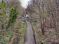 Cycleway - geograph.org.uk - 2757105.jpg 640 × 480; 624 KB
-

-
 Early morning Autum morning at Alexandra Park Manchester UK.jpg 4,000 × 5,000; 12.55 MB
-
 Fallowfield Loop old woman sculpture (8199415725).jpg 3,648 × 2,736; 5.94 MB
-
 Fallowfield Loop old woman sculpture (8200528772).jpg 3,648 × 2,736; 5.47 MB
-
 Fuel Filling Station - Alexandra Park - geograph.org.uk - 2848149.jpg 2,796 × 2,138; 2.35 MB
-

-
 Gita Bhavan Hindu Temple - geograph.org.uk - 4447864.jpg 640 × 426; 103 KB
-
 Gita Bhavan Hindu Temple - geograph.org.uk - 4518608.jpg 5,477 × 3,651; 3.31 MB
-

-
 Manchester Chinese Christian Church - geograph.org.uk - 1963890.jpg 900 × 600; 145 KB
-
 Manley Road - geograph.org.uk - 4313247.jpg 1,920 × 735; 230 KB
-
 Manley Road - geograph.org.uk - 4313249.jpg 1,920 × 1,152; 535 KB
-

-

-
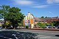
 Południowy Manchester - panoramio - dzidek.jpg 3,250 × 2,438; 1.33 MB
-
 Russley Lodge - geograph.org.uk - 3163867.jpg 640 × 480; 210 KB
-

-
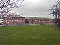
 St Bede's College Playing Field, Withington Road - geograph.org.uk - 5147128.jpg 1,600 × 1,200; 460 KB
-

-
 St Margaret's Church, Whalley Range.jpg 2,097 × 4,167; 5.63 MB
-

-

-

-
 The Brooks Bar road junction - geograph.org.uk - 3245796.jpg 3,872 × 2,592; 3.22 MB
-
 The Pavilion in Alexandra Park - geograph.org.uk - 5892960.jpg 1,024 × 678; 230 KB
-
 Tufted Duck On Alexandria Park Lake - geograph.org.uk - 5892962.jpg 1,019 × 654; 81 KB
-
 Wellington Road, Whalley Range - geograph.org.uk - 629066.jpg 640 × 640; 87 KB
-
 Wellington Road, Whalley Range - geograph.org.uk - 633418.jpg 640 × 423; 82 KB
-
 Wellington Road, Whalley Range, Autumn - geograph.org.uk - 710635.jpg 625 × 640; 137 KB
-
 Whalley Range Community Centre (Nello James Centre) - geograph.org.uk - 5353015.jpg 5,183 × 2,981; 1.66 MB
-
 Whalley Range Cricket Club - Entrance - geograph.org.uk - 3386949.jpg 1,600 × 1,200; 426 KB
-
 Whalley Range Cricket Club - Ground - geograph.org.uk - 3386942.jpg 1,600 × 1,200; 290 KB
-
 Whalley Range Cricket Club - Pavilion - geograph.org.uk - 3386955.jpg 1,600 × 1,200; 280 KB
-
 Whalley Range Girls High School - geograph.org.uk - 716778.jpg 640 × 480; 81 KB
-
 Whalley Range High School - geograph.org.uk - 2757372.jpg 640 × 480; 437 KB
-
 Whalley Range High School Sports Field - geograph.org.uk - 2757358.jpg 640 × 480; 531 KB
-
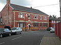
 Whalley Range, Army Reserve Centre - geograph.org.uk - 4625662.jpg 1,024 × 766; 139 KB
-
 Whalley Range, delivery office - geograph.org.uk - 1470056.jpg 640 × 480; 75 KB
-
 Whalley Range, ginnel - geograph.org.uk - 4625675.jpg 768 × 1,024; 208 KB
-
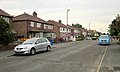
 Whalley Range, Norton Street - geograph.org.uk - 1470060.jpg 640 × 480; 62 KB
-
 Whalley Road - geograph.org.uk - 5353003.jpg 5,183 × 2,847; 1.43 MB
-
 William Hulme Junior School Whalley Range - geograph.org.uk - 716772.jpg 640 × 480; 110 KB
-

-
 Withington Road Shops, Whalley Range - geograph.org.uk - 1963913.jpg 800 × 600; 120 KB
-
 Woodlands Road - geograph.org.uk - 4518599.jpg 6,000 × 4,000; 6.35 MB
-
 Wyverne Road - geograph.org.uk - 4518627.jpg 6,000 × 4,000; 3.62 MB
-
 Alexandra Road South, Whalley Range - geograph.org.uk - 633143.jpg 640 × 421; 76 KB


.jpg)
.jpg)


_-_geograph.org.uk_-_5353015.jpg)


